
Experience the Vibrant Tapestry of Singapore’s Central Area
Explore round-the-clock recreation and an abundance of possibilities for locals and tourists alike in the Central Area.
Last updated 24 June 2026
With a range of world-class attractions, experiences, and architecture on offer, you can explore our historic, arts and civic districts and learn about the rich stories, buildings, personalities and events that had taken place there. Unwind, and explore at your own pace along a tapestry of green and blue networks.
Discover Recreational Gems of Central Area
Click each photo to find out more about new and upcoming highlights in the Central Area!

Join us in re-imagining these places
Recreational & lifestyle opportunities at Marina Bay
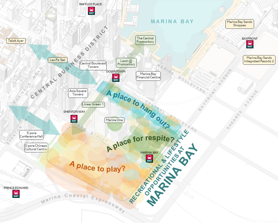
Tracts of available land south of Marina Bay present opportunities to introduce recreational and lifestyle concepts on shorter leases, while providing flexibility to meet evolving needs. We welcome all ideas on what you would like to see here!
A Place to Hang Out?
The area could play host to unique lifestyle and dining concepts, with lively events, pop-ups and public spaces.
A Place for Respite?
The open spaces around Marina Bay MRT Station could offer community and family-friendly experiences in an urban park setting.
A Place to Play?
Possible ideas could include an expansive space housing attractions, sports & recreation, and even places for a short retreat.
Imagine the possibilities - What new experiences would you like to see here?
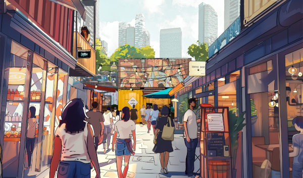
A vibrant district with busy alleys of shops and eateries to grab a meal or hang out with friends?
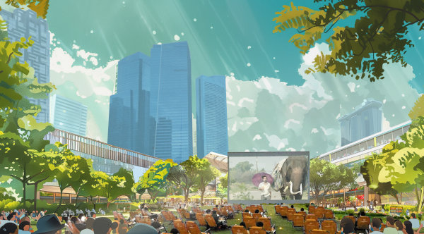
Immerse yourself in the exciting festivals and live concerts at this vibrant space?
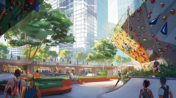
Novel experiences, recreation zones and places to practise your sport of choice?
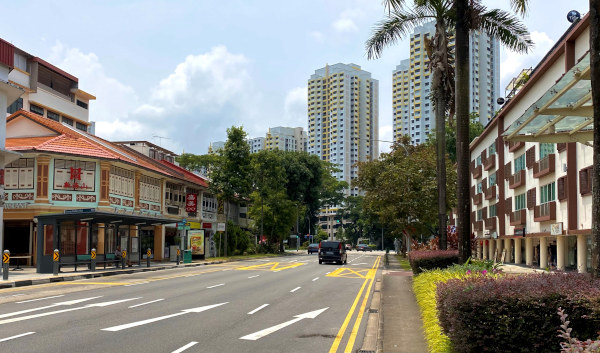
Enhancing the Inner Ring Corridor
Stretching 12 km-long, the Inner Ring Corridor is made up of historic roads, such as Cantonment Road, Outram Road, Scotts Road, Balestier Road and Lavender Street, fringing the city centre. Over time, many unique and charming neighbourhoods like Tiong Bahru, Jalan Besar, and Balestier have evolved along these roads.
In future, the corridor will continue to serve as a key vibrant conduit, linking existing and future housing areas, key attractions, and recreational options. We would like to seek ideas on how we can further enhance the identity and walk-cycle connectivity along it!
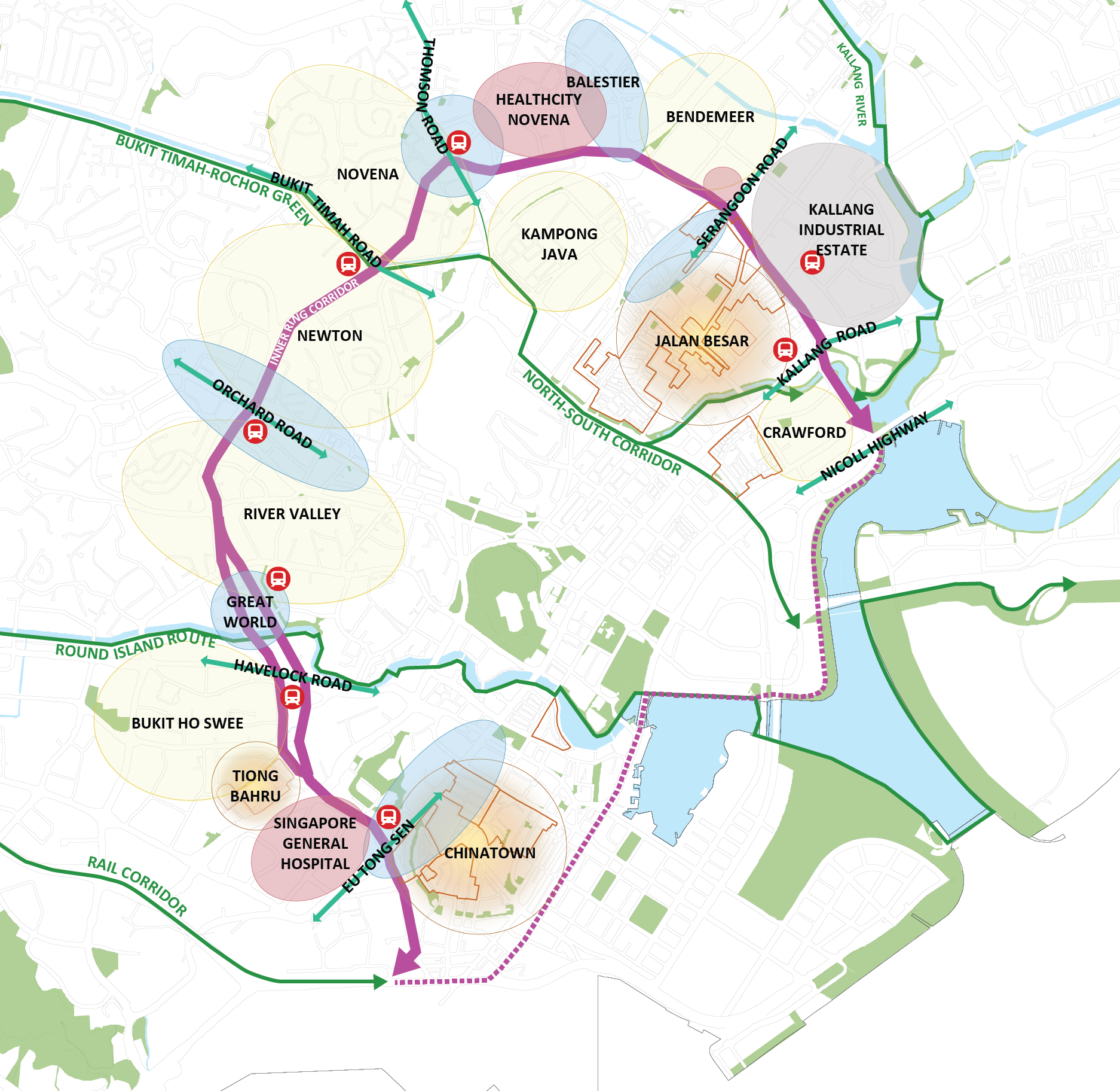
Zion-Outram spine
This spine is flanked by unique local areas with ‘old world’ charm, from Tiong Bahru estate, Bukit Ho Swee neighbourhood, to Zion Food Centre. There are opportunities to enhance connectivity both along the Zion-Outram spine and to adjacent neighbourhoods, including the upcoming Pearl’s Hill neighbourhood.
Newton Circus
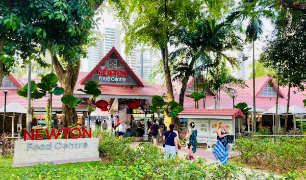
The Newton Circus area is endearing to many, from the famous Newton Food Centre to the pre- and post-war Singapore Municipal Commission (SMC) and Singapore Improvement Trust (SIT) apartments at Monk’s Hill. There are plans to introduce new housing and amenities, more delightful public spaces, and improved connectivity within a neighbourhood rich in heritage charm.
Tyrwhitt Cluster
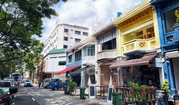
The Tyrwhitt area is thriving with eclectic uses, from cafes to eateries and boutique hotels. There are opportunities for ground-up placemaking initiatives, to turn back alleys and pockets of public spaces into fun places to explore.
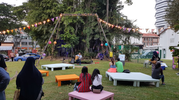
Communal Space at Sultan Gate
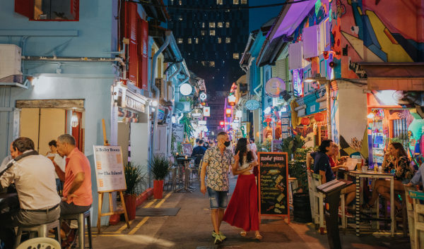
Located in the heart of Kampong Gelam and close to landmarks such as the Malay Heritage Centre and Gedung Kuning, the open space at Sultan Gate serves as a popular community space and a green lung today.
As part of the Kampong Gelam Historic Area Place Plan, Kampong Gelam Alliance plans to improve the attractiveness of this community space to support small events and pop-up initiatives. There is also opportunity to improve walkability within Kampong Gelam, as it is close to Bussorah mall, the car-free zones of Baghdad Street, Bussorah Street, Haji Lane and Bali Lane, and the future open space along the North-South Corridor.

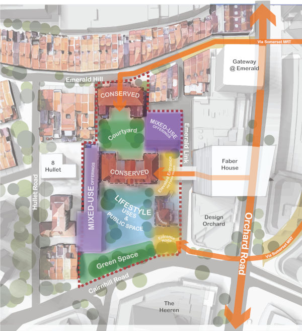
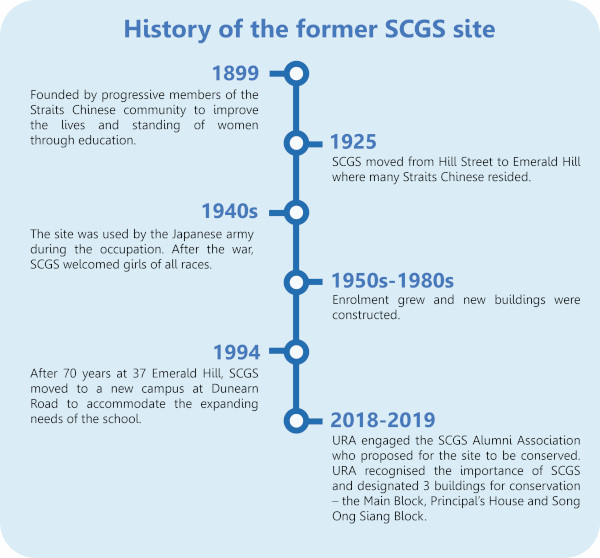
Uncover a Lifestyle Hub at Emerald Hill
The former Singapore Chinese Girls’ School (SCGS) at 37 Emerald Hill is a hidden gem at Orchard Road, located between Design Orchard and the Emerald Hill Conservation Area. With the first building completed in the 1920s, the site went on to house SCGS for almost 70 years, playing a key role in the history of women’s education in Singapore.
This charming cluster of heritage buildings can be given a new lease of life as a mixed-use lifestyle destination featuring unique accommodation concepts, retail, dining, arts and cultural uses around intimate courtyard spaces.
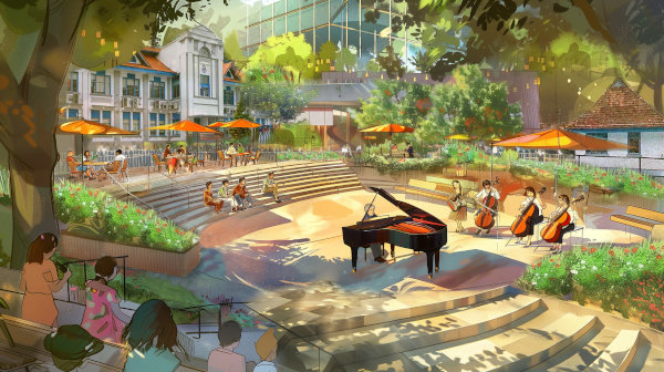
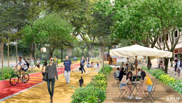
AI generated impressions of a differentiated experience at Orchard Road with activated public spaces
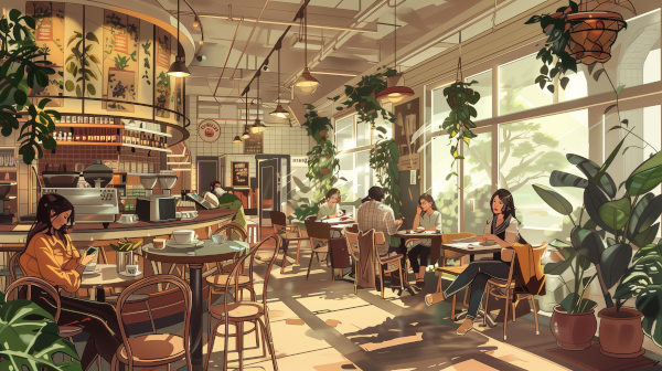
AI generated impressions of the adaptive reuse of heritage buildings for new lifestyle offerings