
Kallang River
Kallang River will be sensitively revitalised with new community nodes and public spaces to serve a growing population living and working along the river.
Last updated 24 June 2026
A lush riverine escape in the city
It is Singapore’s longest river, with clean waters and verdant riverbanks home to wildlife. Running through diverse housing estates and employment areas, with 800,000 people living near the river, the Kallang River forms part of many Singaporeans’ collective memories.
The waterway will continue to be sensitively revitalised with new community nodes and public spaces. There will be enhanced connectivity and recreational offerings too. They will serve a growing population living and working along the river.
This is our main river, like the ‘Amazon of Singapore’. Singapore, the city and the settlements, started here along the river.— Kua Kay Yaw, Nature Society Singapore
Bringing life and vitality to the river
Open recreational opportunities along the water
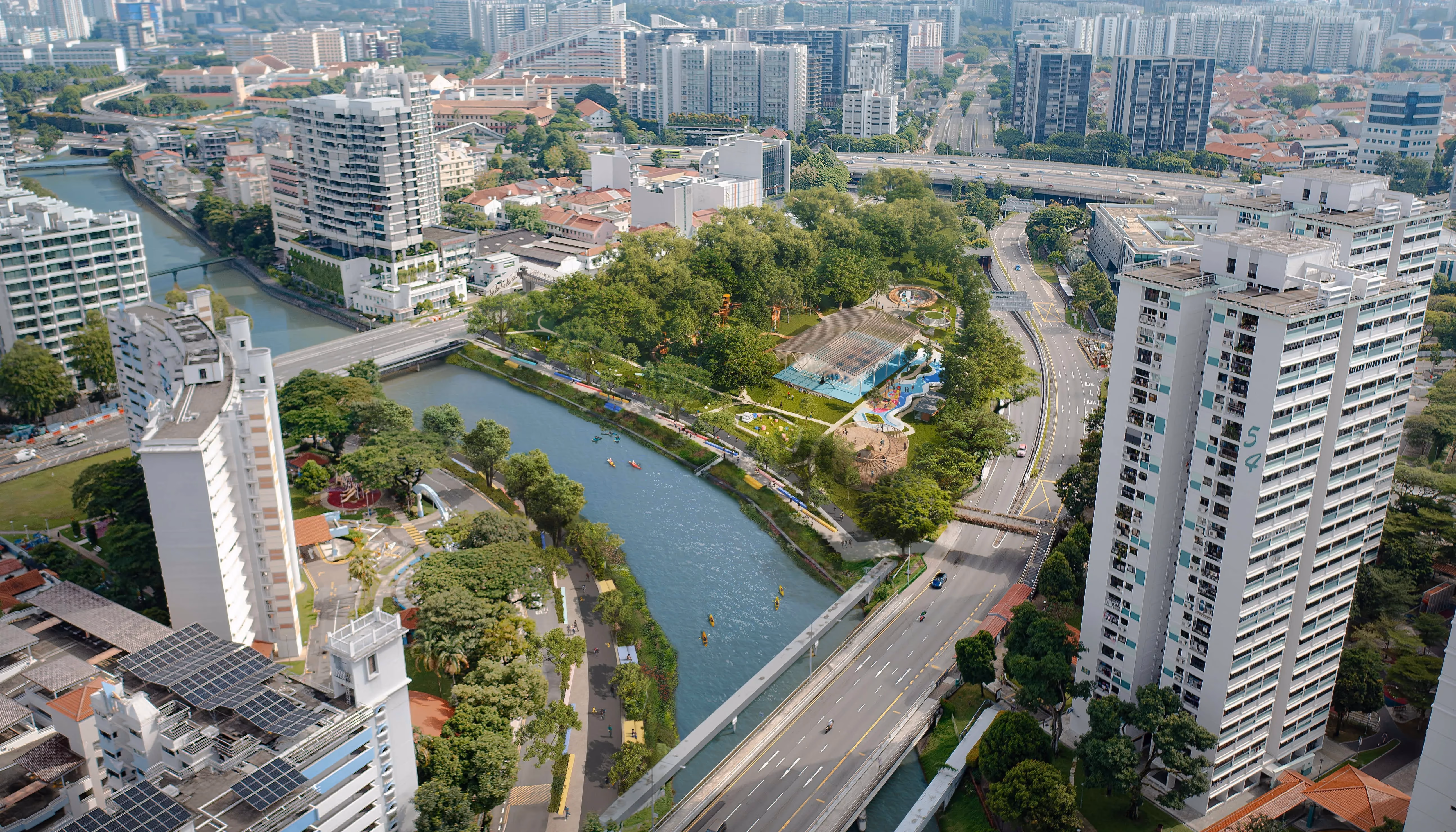
Enhancing the waterways for leisure and recreation allows more to enjoy the presence of water in our everyday lives. A network of facilities can be developed over time to facilitate waterfront sports and recreation, or even opportunities to engage with the water.
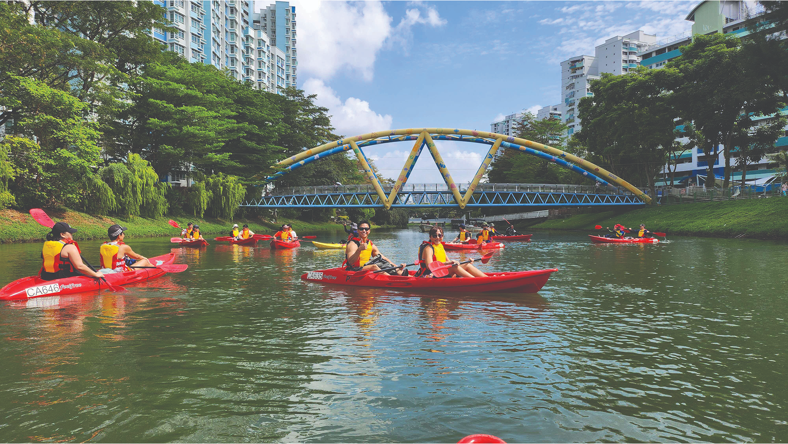
Kayaking on Kallang River.
Enhance connectivity – a joy to walk, cycle and explore
Active mobility along Kallang River is now easier with the recent completion of Phase 1 of the Bishan-to-City (B2C) Links.
The next phase will see completion of a cycling bridge over the Pan-Island Expressway (PIE) by 2027, which will make the 10-kilometre ride even more seamless, taking only 30 minutes or less!
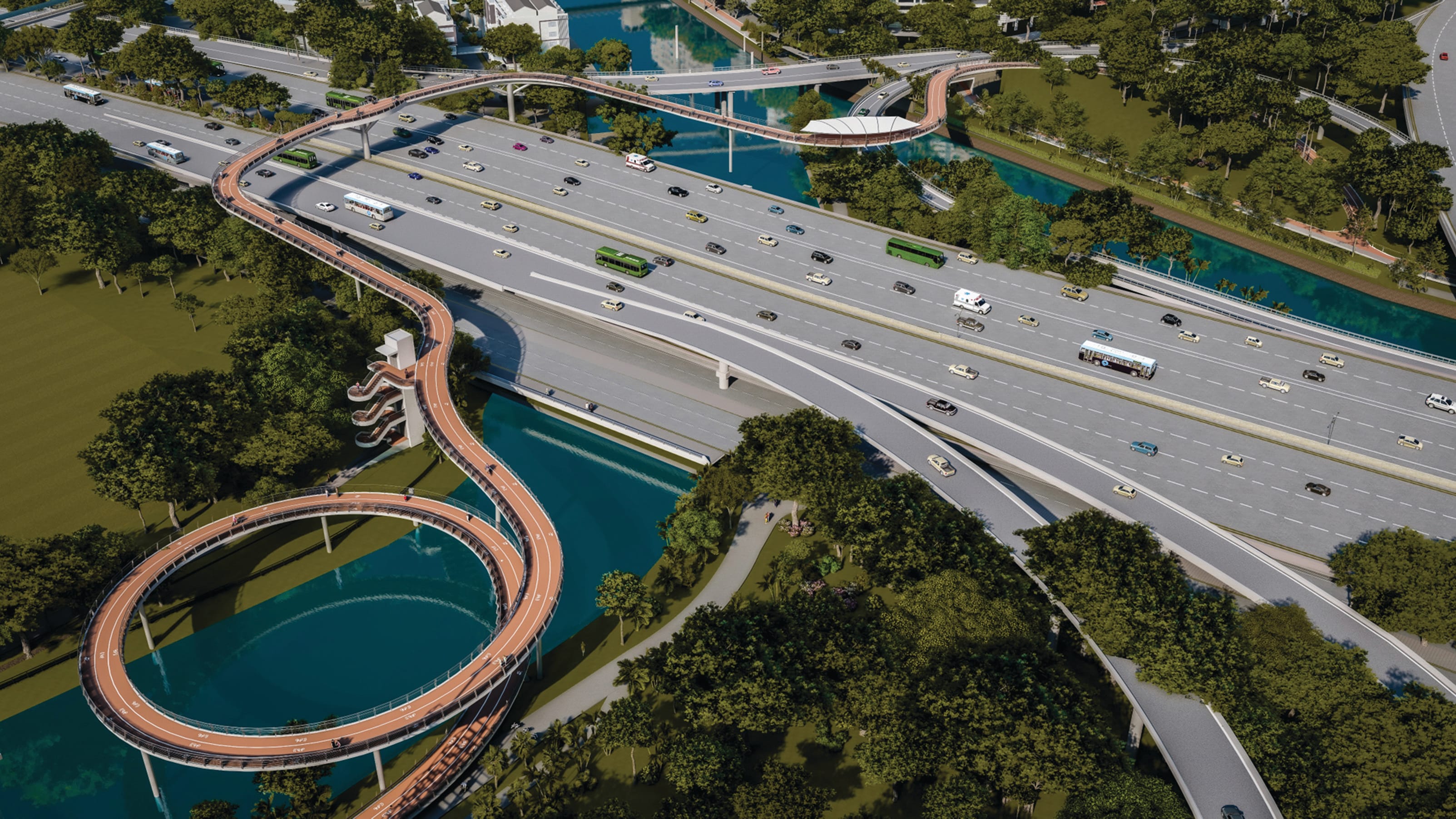
The upcoming B2C-PIE cycling bridge.
Introduce more amenities, activities and spaces to connect
More amenities will be provided along the river as part of new developments, such as shelters, rest points and toilets.
New linkages and bridges will also make it easier to reach, cross over or stroll along the waterway, linking the various neighbourhoods together.
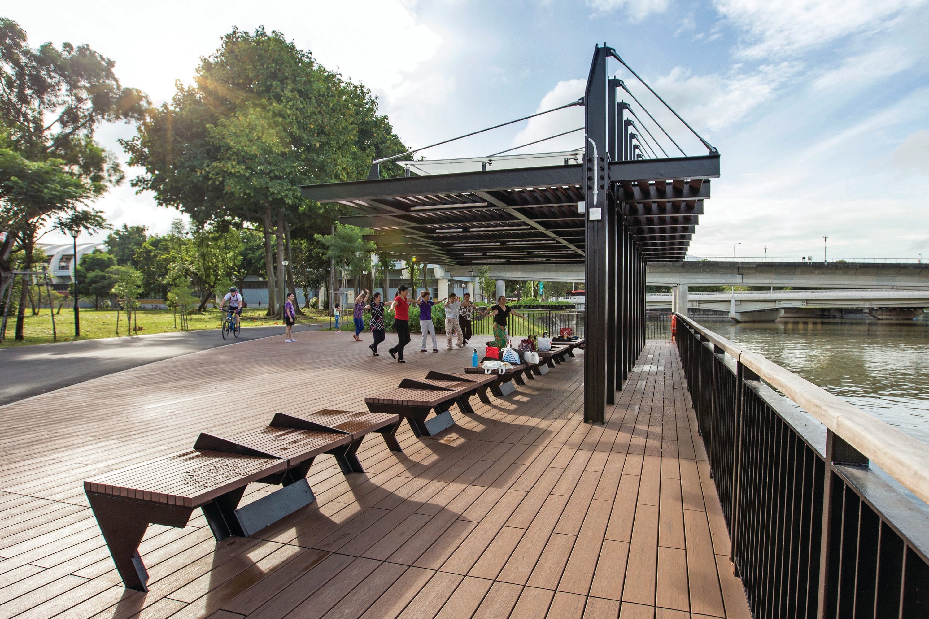
Community deck along ABC Waters @ Kallang River (Upp Boon Keng - Sims Ave). Source: PUB
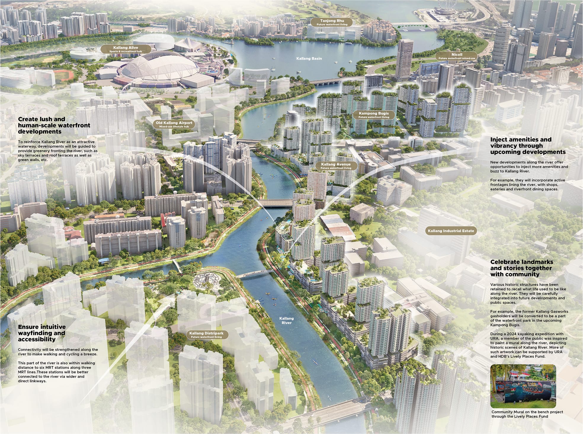
Shaping successful waterfront spaces
Environmental modelling tools can help to shape urban form for better outdoor comfort levels. For example, wind corridors will be created to increase wind capture into each neighbourhood, while building forms will be sculpted to maximise shade over parts of the river where people gather.
New developments will incorporate shops and eateries as well as attractive frontages and landscaping along the river, making the waterfront come alive with activities.
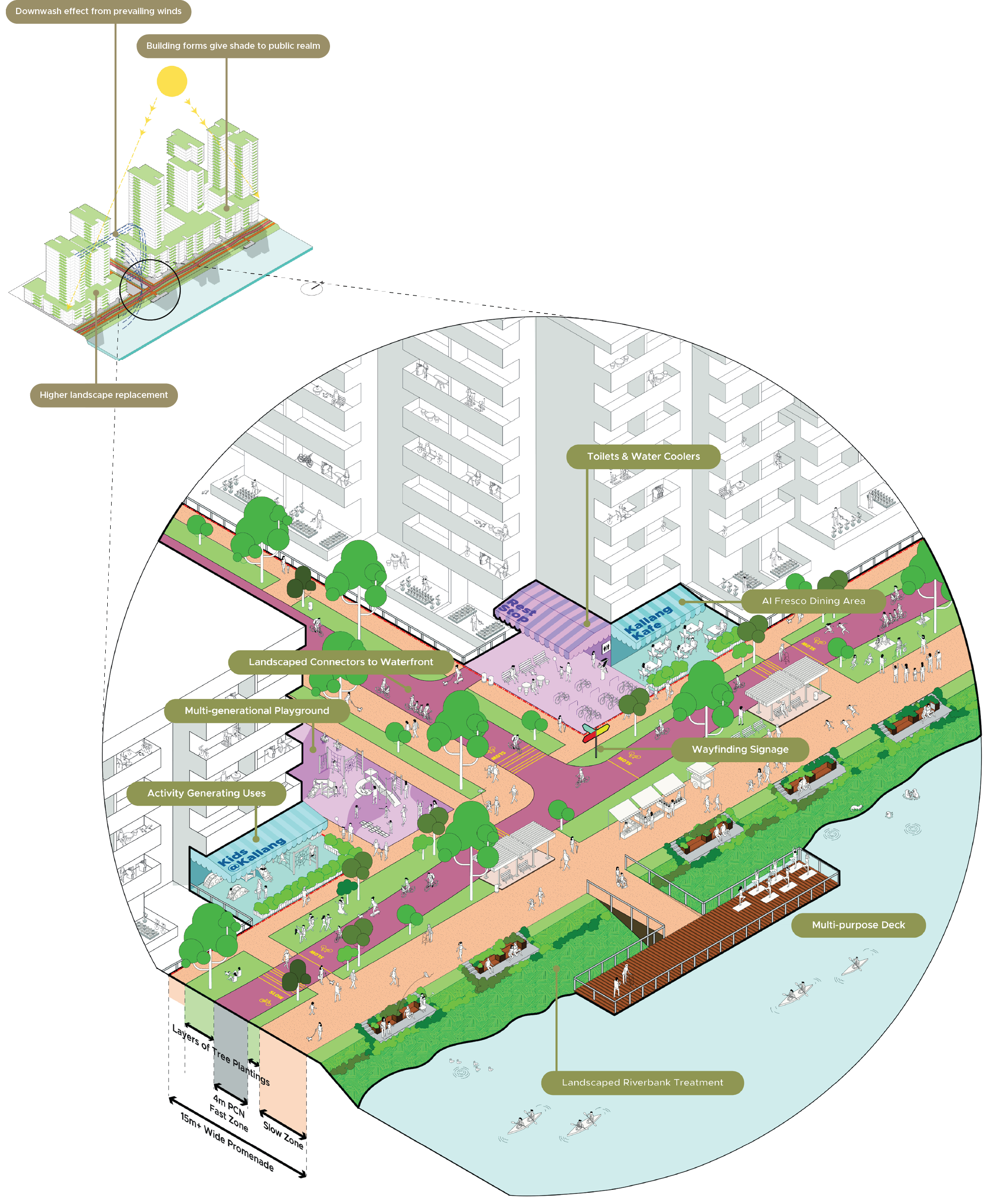
Strategies for active frontages and vibrant promenade along Kallang River.
We heard you! These are your ideas for Kallang River.
Over a ten-month period from August 2024 to May 2025, URA engaged over 2,300 residents and stakeholders along the Identity Corridors to develop the vision and strategies for each corridor. These are some key ideas collected for Kallang River:
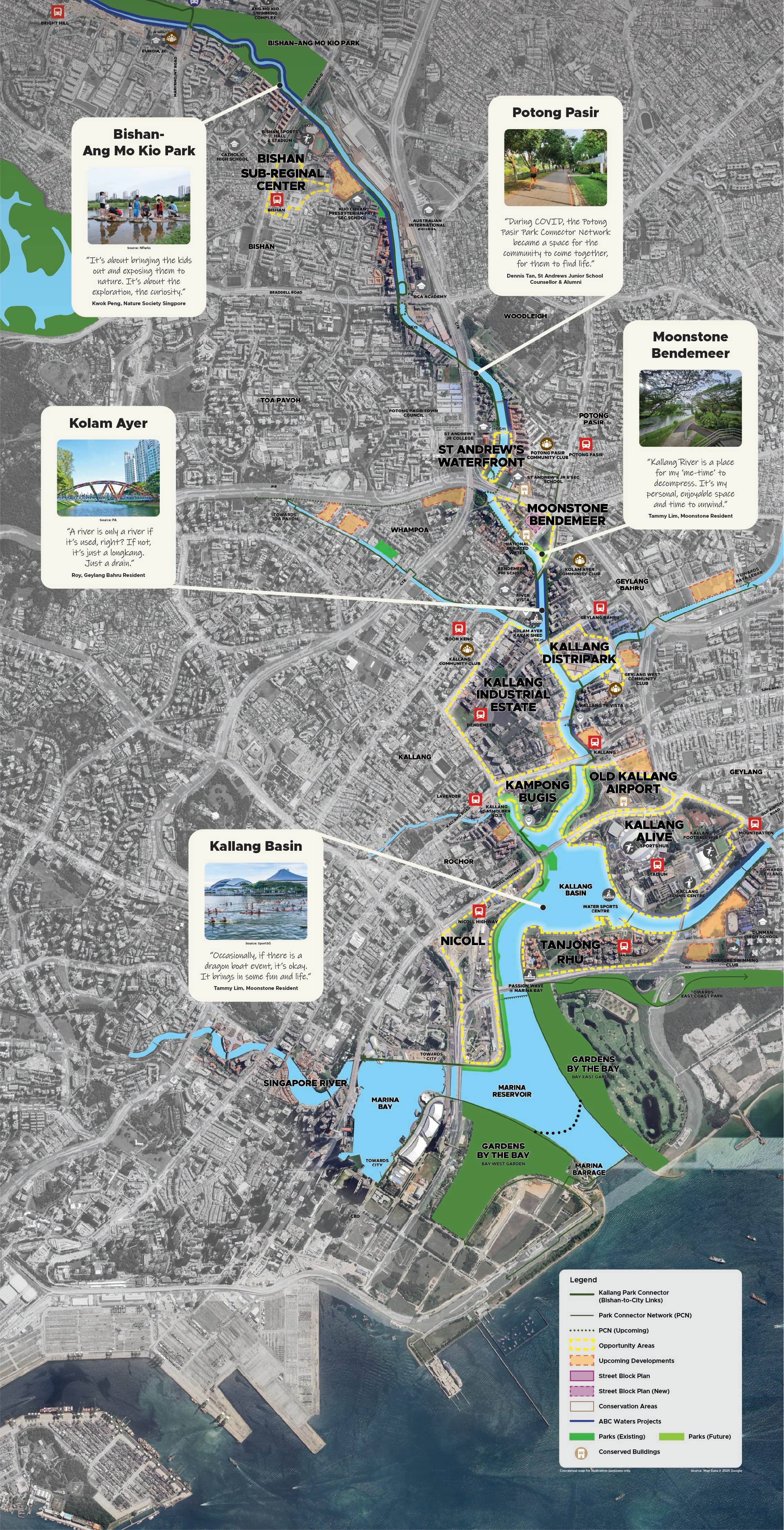
Downriver Kallang
An active three-kilometre waterfront with exciting upcoming neighbourhoods.
Moonstone and Bendemeer
Enhancing a special gem along the river
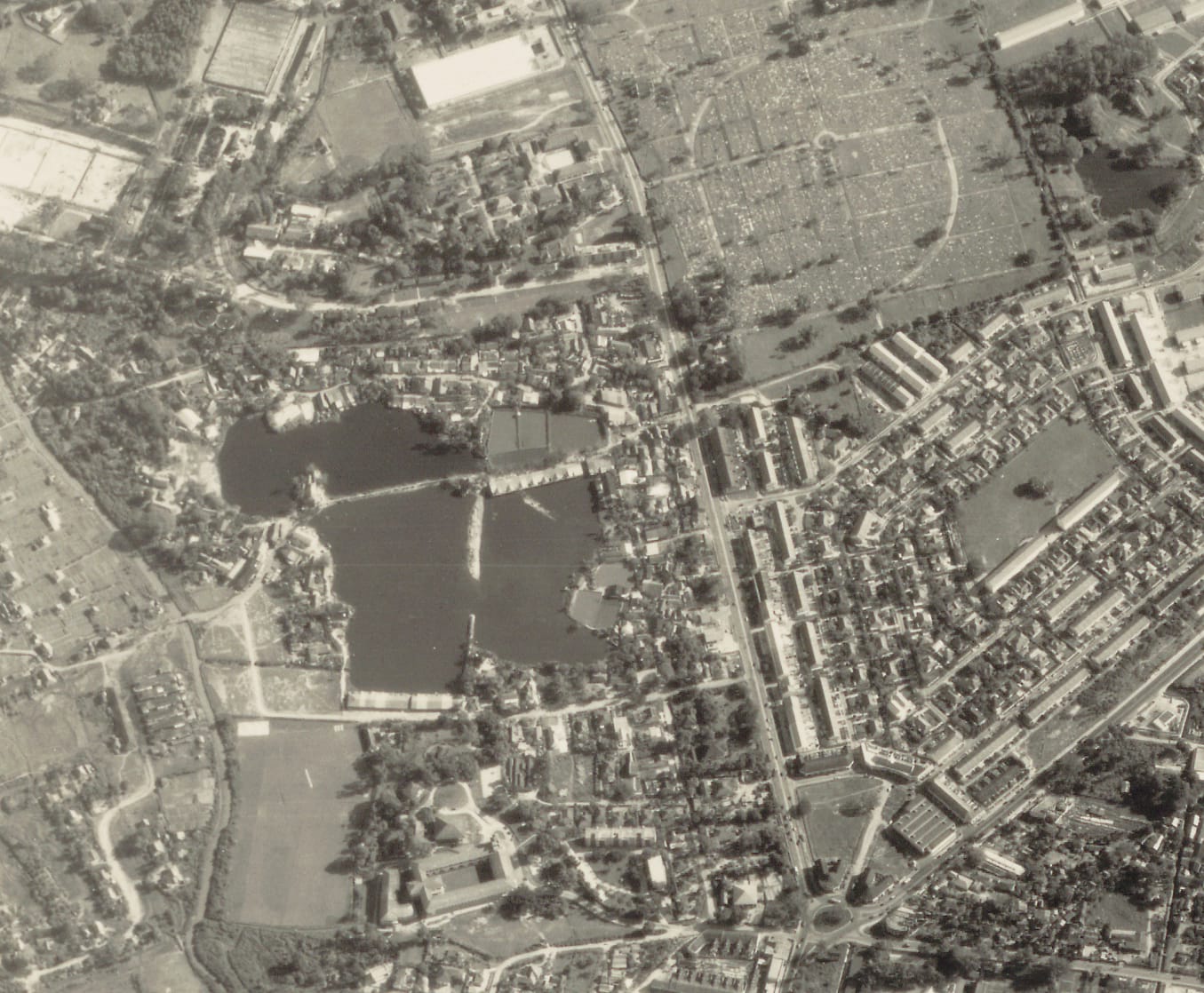
Moonstone Lane Estate stands out with its unique urban village typology and rich multi-cultural history. It was initially known as Woodsville Estate and later Kampong Marican. The community of Chinese, Malays, Indians and Eurasians left their mark in the place names and cultural spaces of the area.
In recognition of its unique qualities, the precinct has been earmarked as an Identity Node in DMP2025.
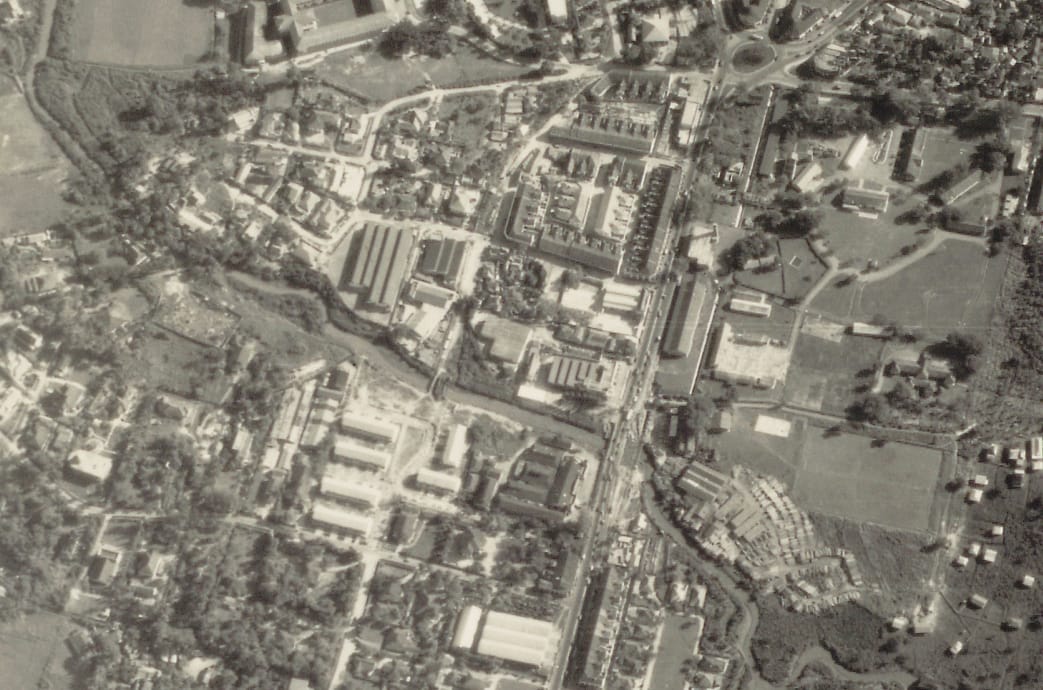
The former Kampong Marican. Source: National Archives
Improve accessibility and create a meeting point along the river
Sitting at the midpoint of the upcoming B2C Links, this Identity Node can be a convenient pitstop along Kallang River.
Waterfront park at Bendemeer.
A new waterfront park integrated with a new Sport-in-Precinct facility will be created next to Moonstone Lane Estate. With new benches, lighting and pavilions, this space will serve as a vibrant connector to the adjacent Geylang Bahru estate.
A new waterfront park and Sport-in-Precinct @ Bendemeer Road.
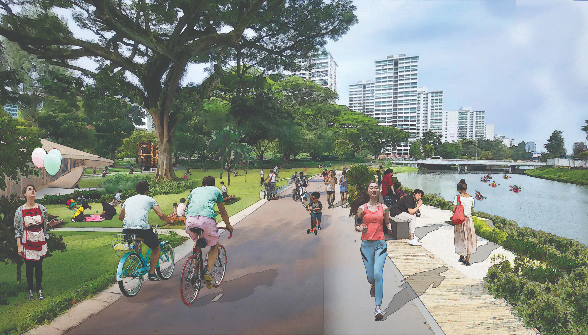
Protect the scale of the urban village
To enhance the existing intimate and low-rise character, buildings will be guided to maintain a two-storey edge along the narrow streets, while the main building can build up to prevailing height of six storeys.

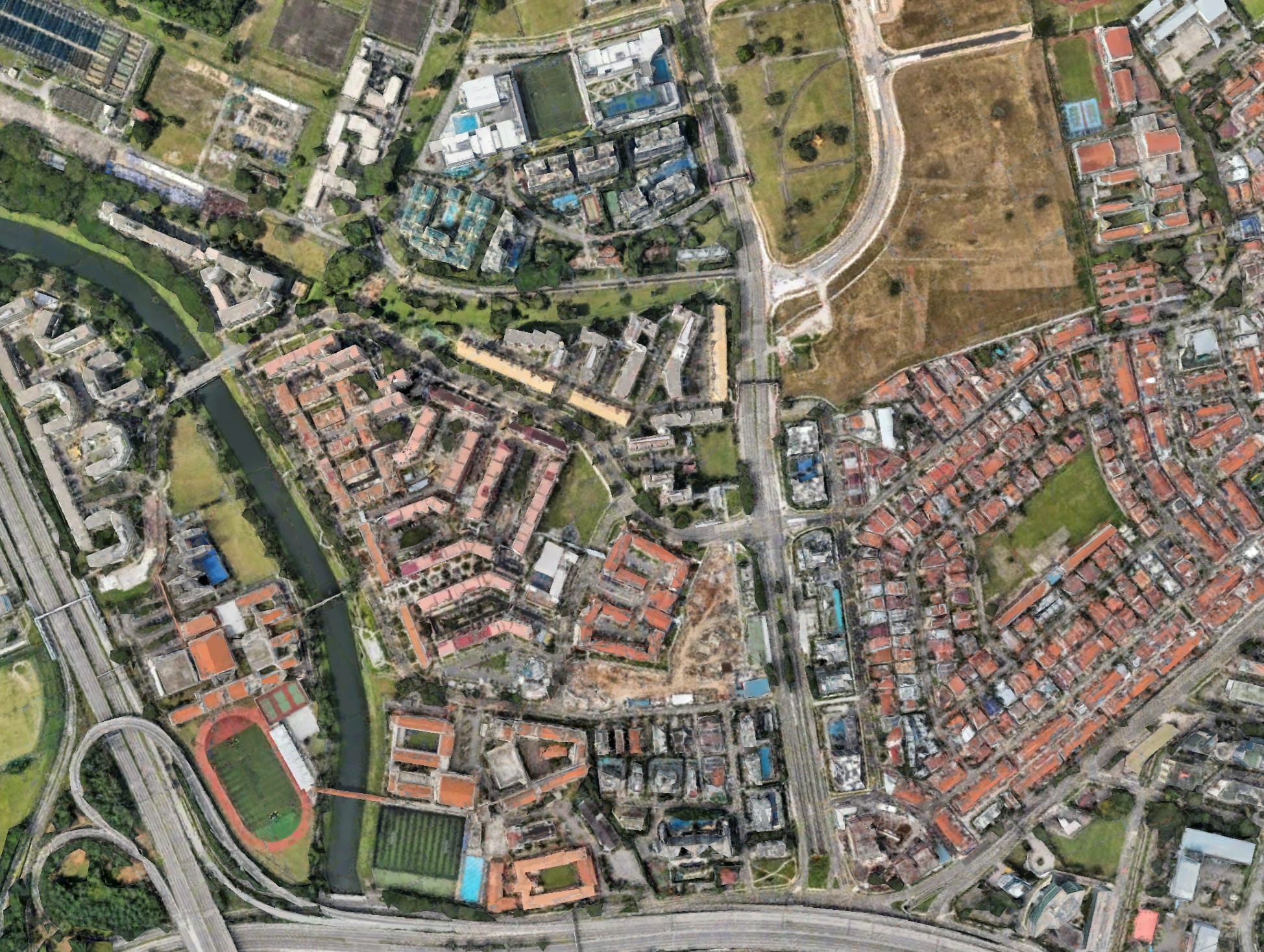
Human-scale streetscapes and better connectivity at Moonstone Lane Estate.
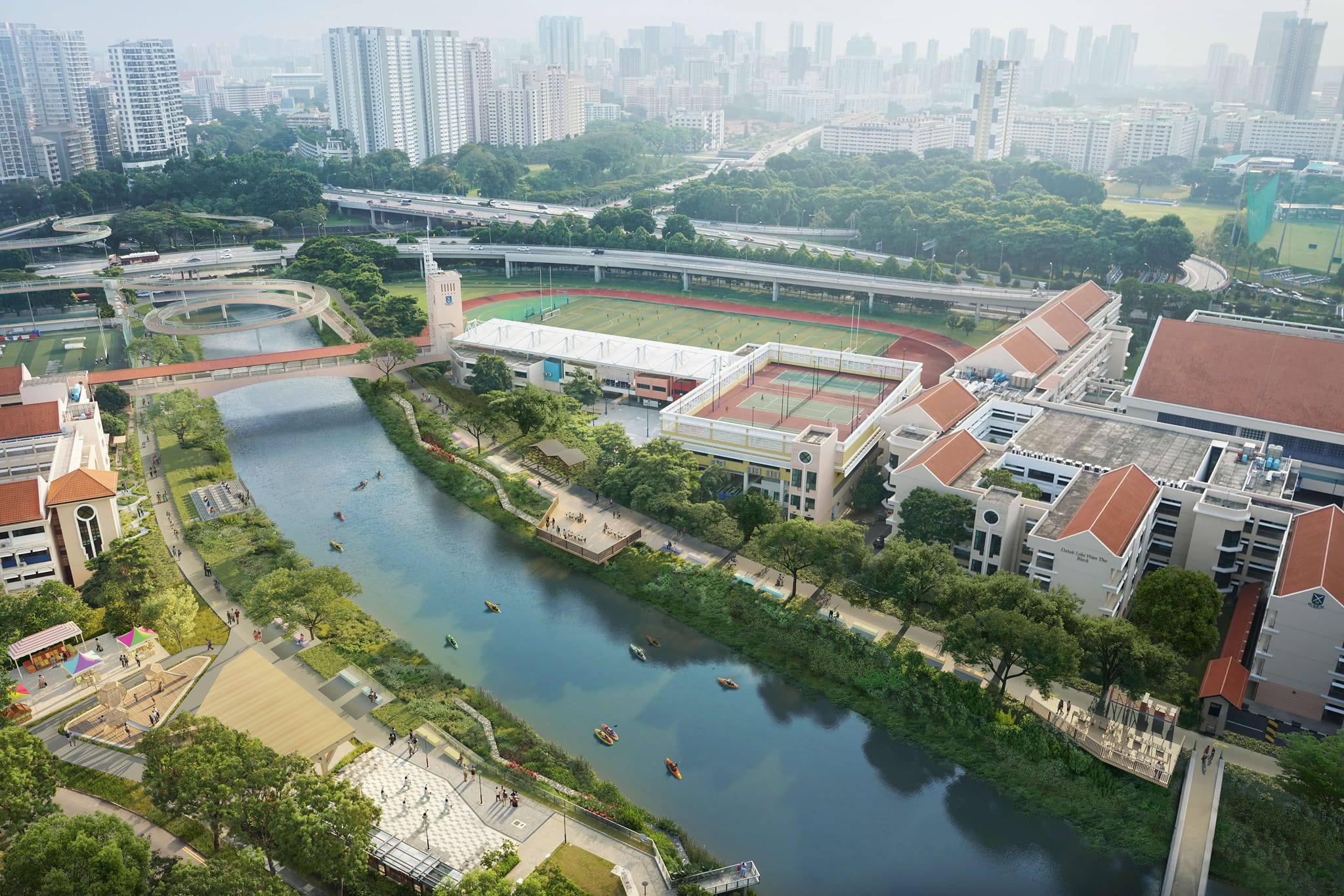
Potong Pasir and St. Andrew’s Village
Bridging communities by the water
.jpg)
ABC Waters @ Kallang River (Potong Pasir).
A long tradition of community bonding and support
Kampong Potong Pasir used to experience frequent floods, when residents sought shelter at the nearby Church of the Ascension located on higher ground.
This spirit of mutual support continues to thrive today, with students of St. Andrew’s Village engaging the community and bringing hospice residents out along the riverfront.
Involving school and community in visioning
URA engaged nearby residents as well as alumni and administrators of St. Andrew’s Village to develop the plans for Kallang River together. Many of the discussions were animated by rich stories of growing up along the river. There was also a desire to create more community spaces and opportunities for bonding and interactions.
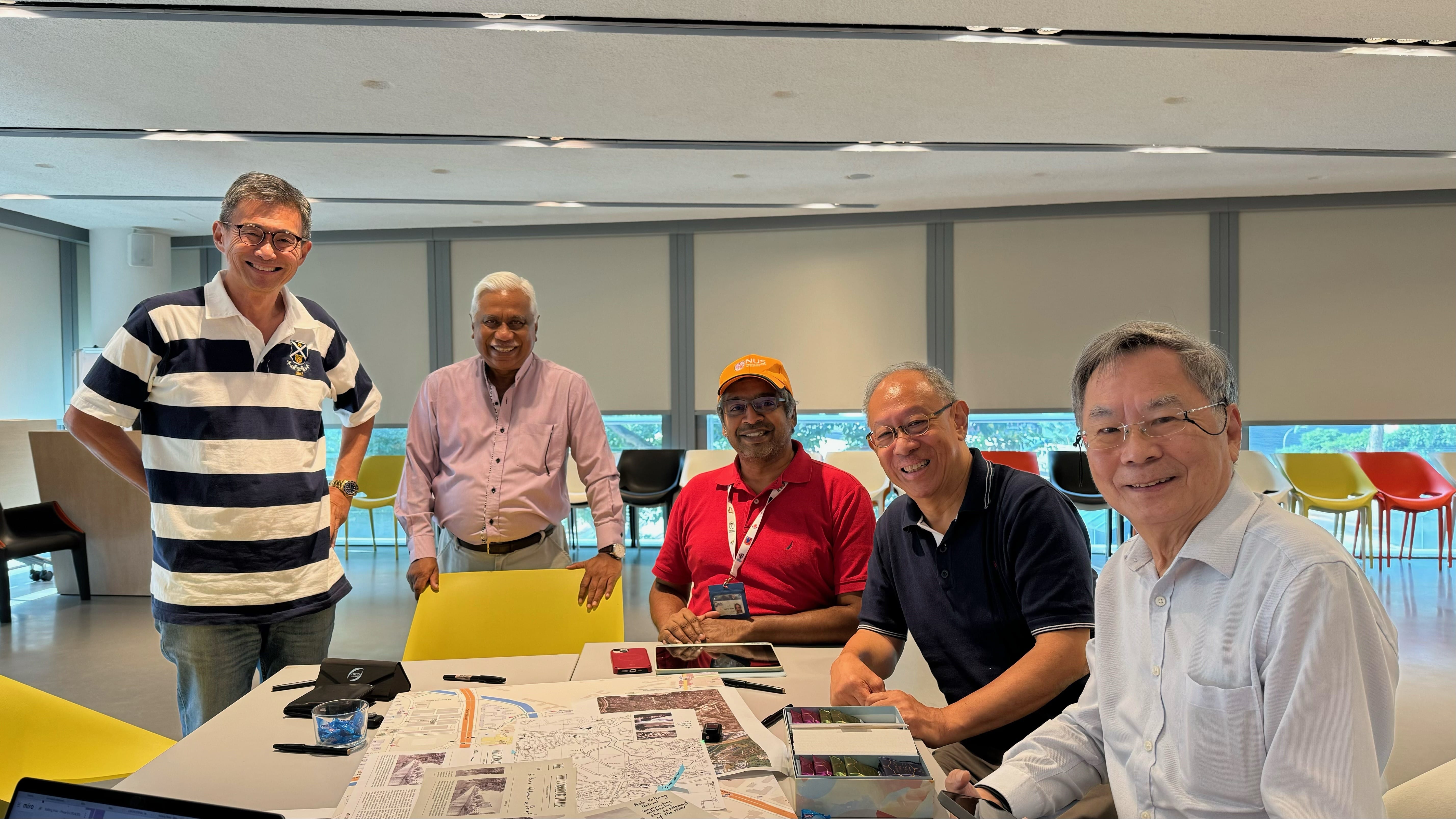
An engagement session with the St. Andrew’s community.
A rejuvenated waterfront for Potong Pasir
Building on the completed ABC (Active, Beautiful, Clean) Waters @ Kallang River (Potong Pasir) in 2015, the stretch fronting St. Andrew’s Village can be enhanced to serve the local community. Some ideas included more seating and gathering spaces, landscaping and ‘outdoor classrooms’ to learn about riverine biodiversity.
Enhanced Potong Pasir waterfront.