
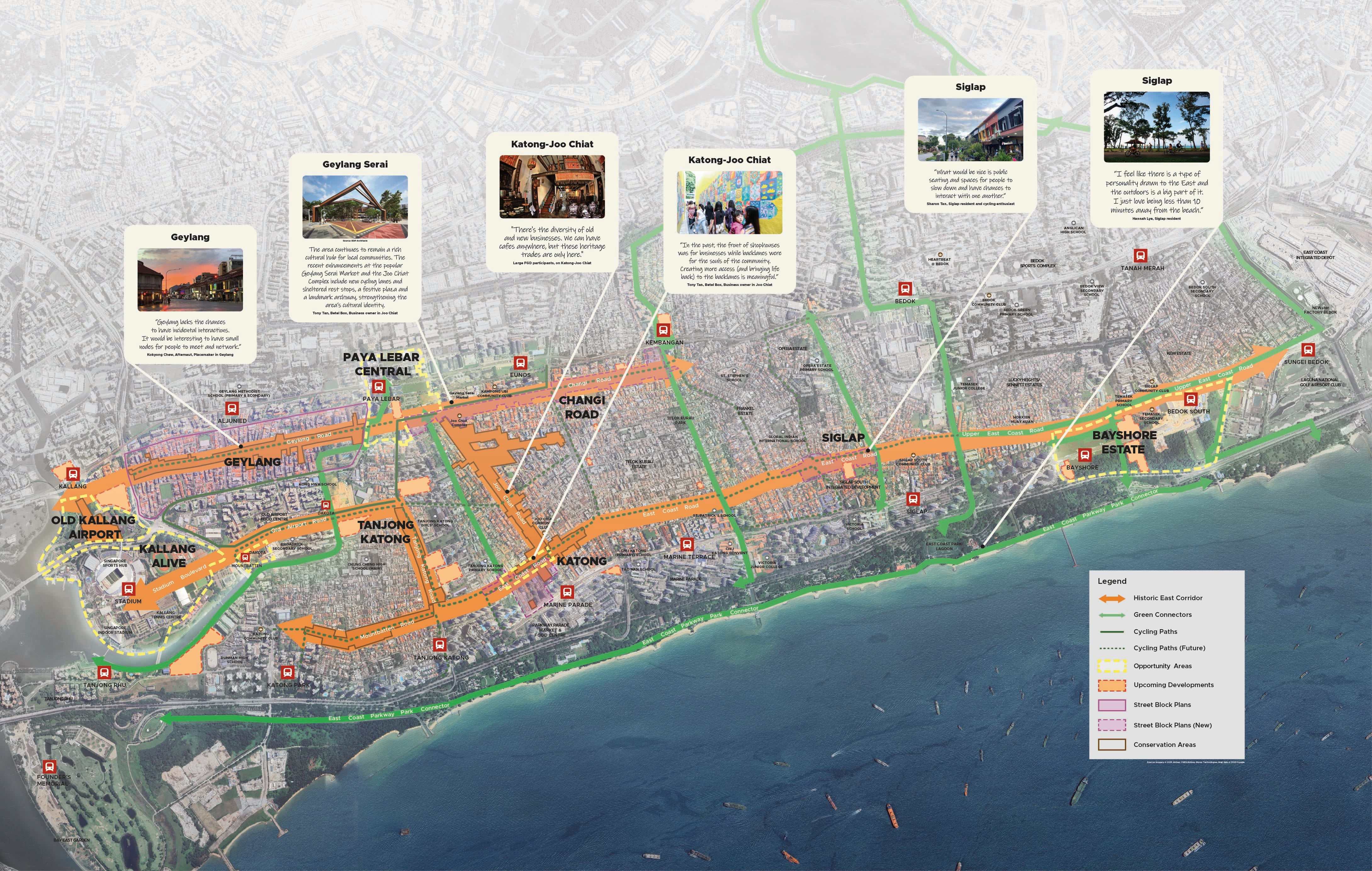
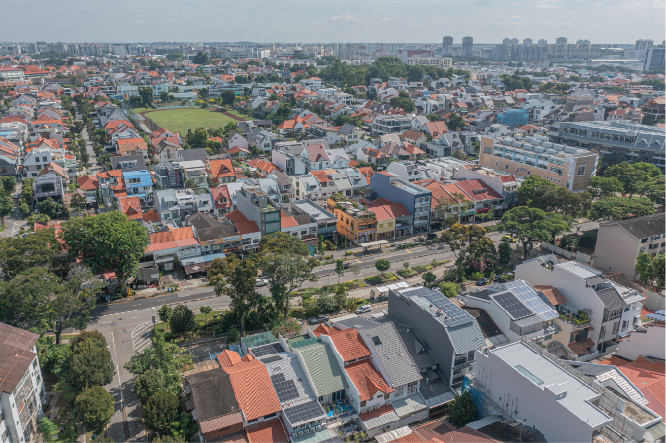
Historic East
The Historic East Corridor is a special blend of old and new that locals and visitors have come to love and cherish.
Last updated 24 June 2026
A communal cultural tapestry
Comprising familiar nodes such as Katong and Siglap as well as vibrant streets like Geylang Road and Joo Chiat Road, the corridor is a special blend of the old and the new that locals and visitors have come to love and cherish.
This network of streets and precincts is one of the most recognisable areas in Singapore, a result of various street block plans as well as conservation and urban design efforts over the years. Its designation as an Identity Corridor in 2022 represents the latest effort to shape it alongside residents and stakeholders for more authentic and sustainable outcomes as we continue to develop!
Weaving Connections in the East
Enhance walking and cycling along historic streets
The area draws large numbers of visitors to explore its popular food and culture haunts, resulting in heavy pedestrian and vehicular traffic. Improvements for walking and cycling will encourage greater use of public transit and active mobility. Initiatives to reduce vehicular traffic, such as temporary street closures, may be possible to support events and activities by stakeholders.
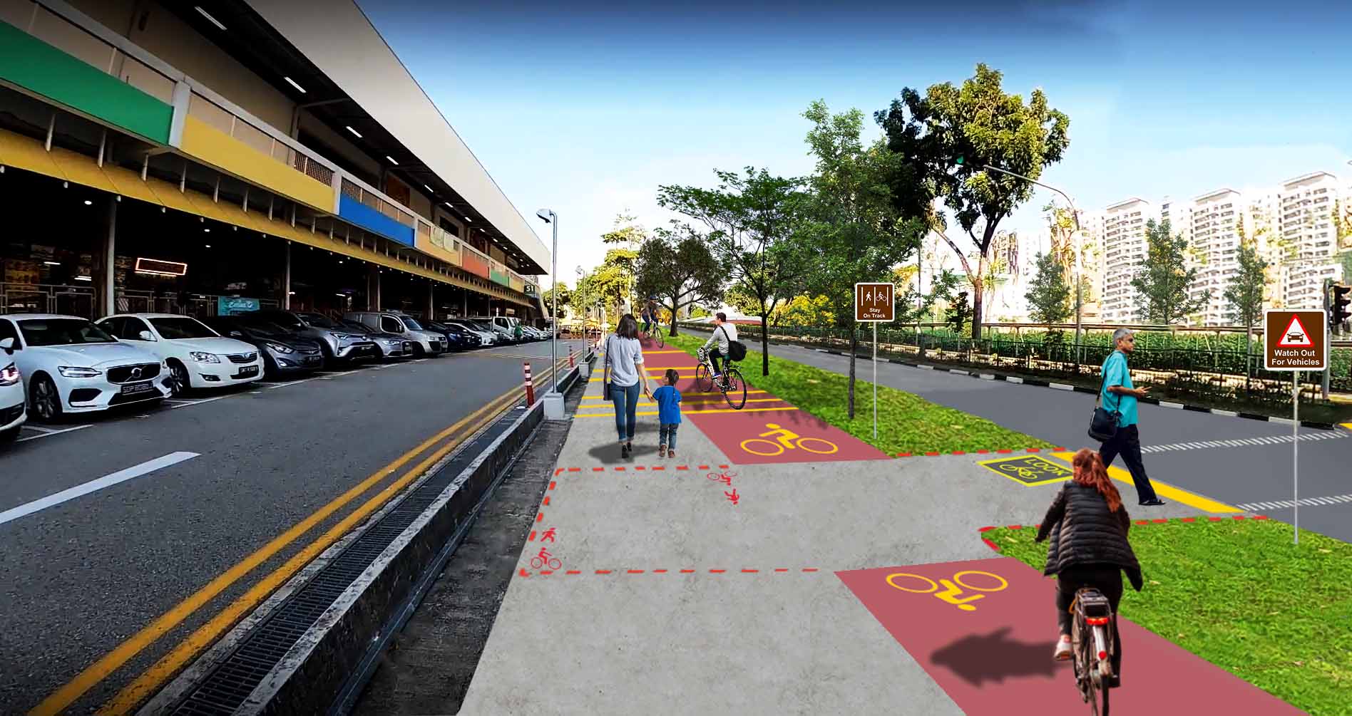
Upcoming enhancements for walking and cycling along Old Airport Road. Source: LTA.
Build on past efforts to strengthen the sense of place
We have developed guidelines for nodes such as Katong, Siglap and Changi Road in the Historic East to enhance their characters as we continue to develop them.
Support public space creation and placemaking efforts
The area is layered with formal and informal public spaces, such as traditional five-foot ways and back alleys. They can come alive with more activities and art, created with the support of residents and businesses.
New public spaces will also be created under the Urban Redevelopment Authority’s (URA) Privately-owned Public Spaces (POPS) Guidelines. They will offer focal points for gathering in the neighbourhoods.
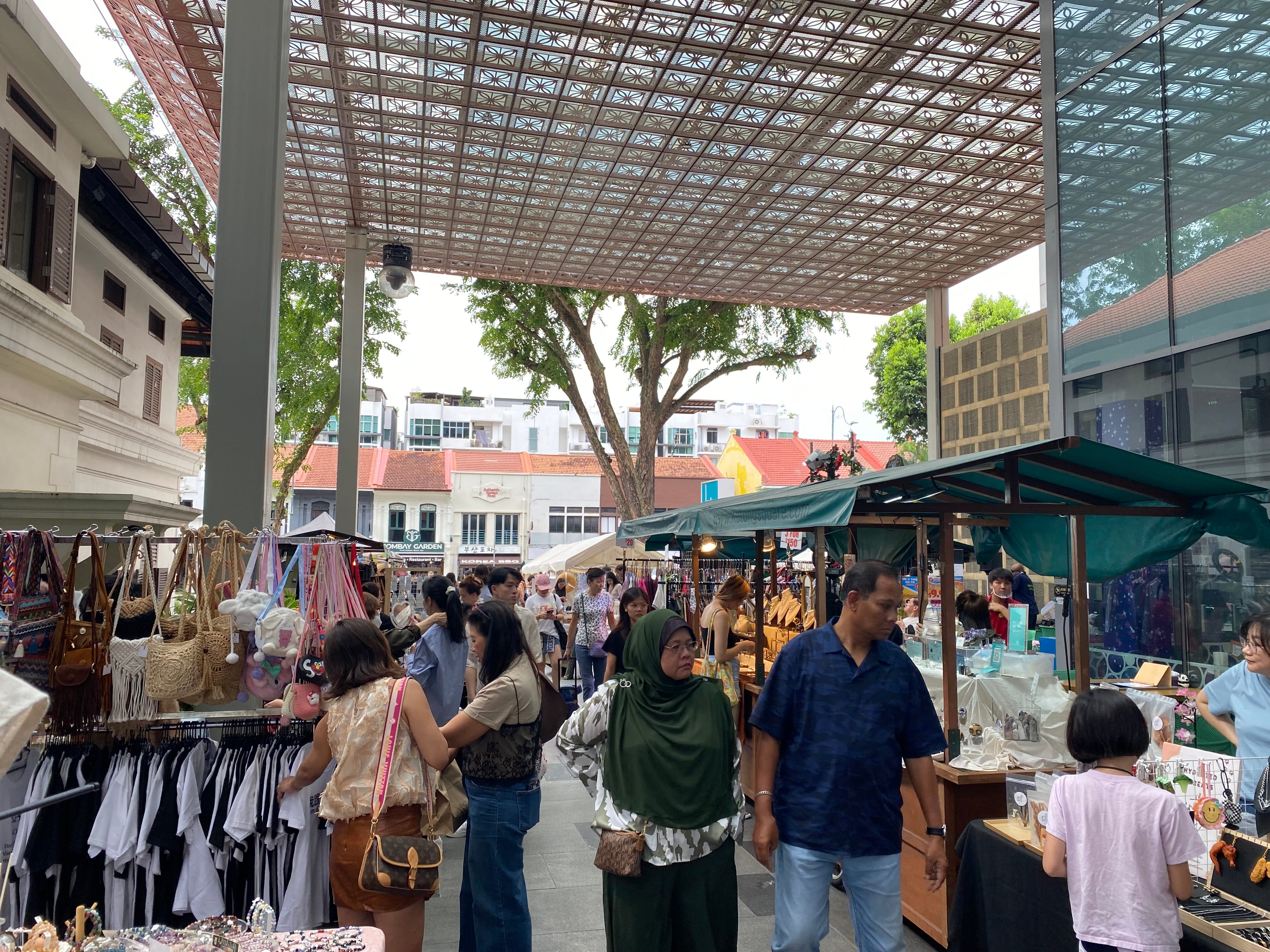
Placemaking activities in Katong.
We heard you!
Over a ten-month period from August 2024 to May 2025, URA engaged over 2,300 residents and stakeholders along the Identity Corridors to develop the vision and strategies for each corridor. These are some key ideas collected for the Historic East:
Siglap - Celebrating the charms of a laid-back east coast node
A former fishing village with a unique origin story
According to some, this area was originally named “Si Gelap” (the dark one) by a prince from Kalimantan who landed on its shores during a solar eclipse. While the fishing villages in the area have been transformed into residential estates after reclamation works were completed, Siglap maintains a relaxed atmosphere with outdoor dining and greenery, and the area has been earmarked as an Identity Node in DMP2025.
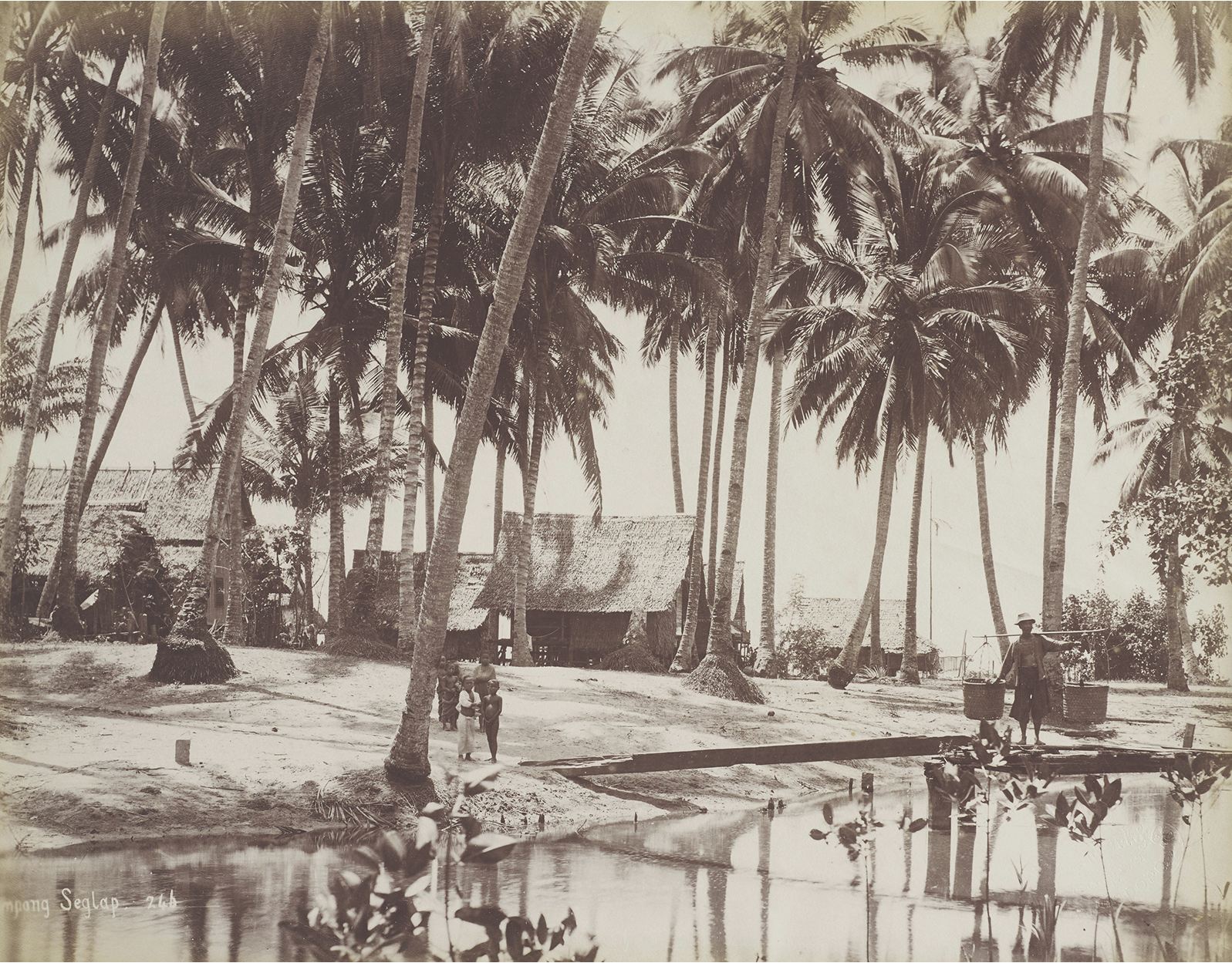
Siglap in the 1890s. Source: Collection of NMS, NHB
Enhance sense of scale and intimacy
Building height requirements are in place to retain the area’s street-based character and overall scale of the area. Improved sheltered connections will also make the area more walkable.
Siglap today.
Improved streetscapes at Siglap and Changi Road. Conceptual diagram for illustration purposes only.
Introduce community spaces for gatherings and events
A new public space will be introduced within the upcoming Siglap South Integrated Development (SSID) serving as a new focal point along the main street that is easily accessible and can host various community events and activities.
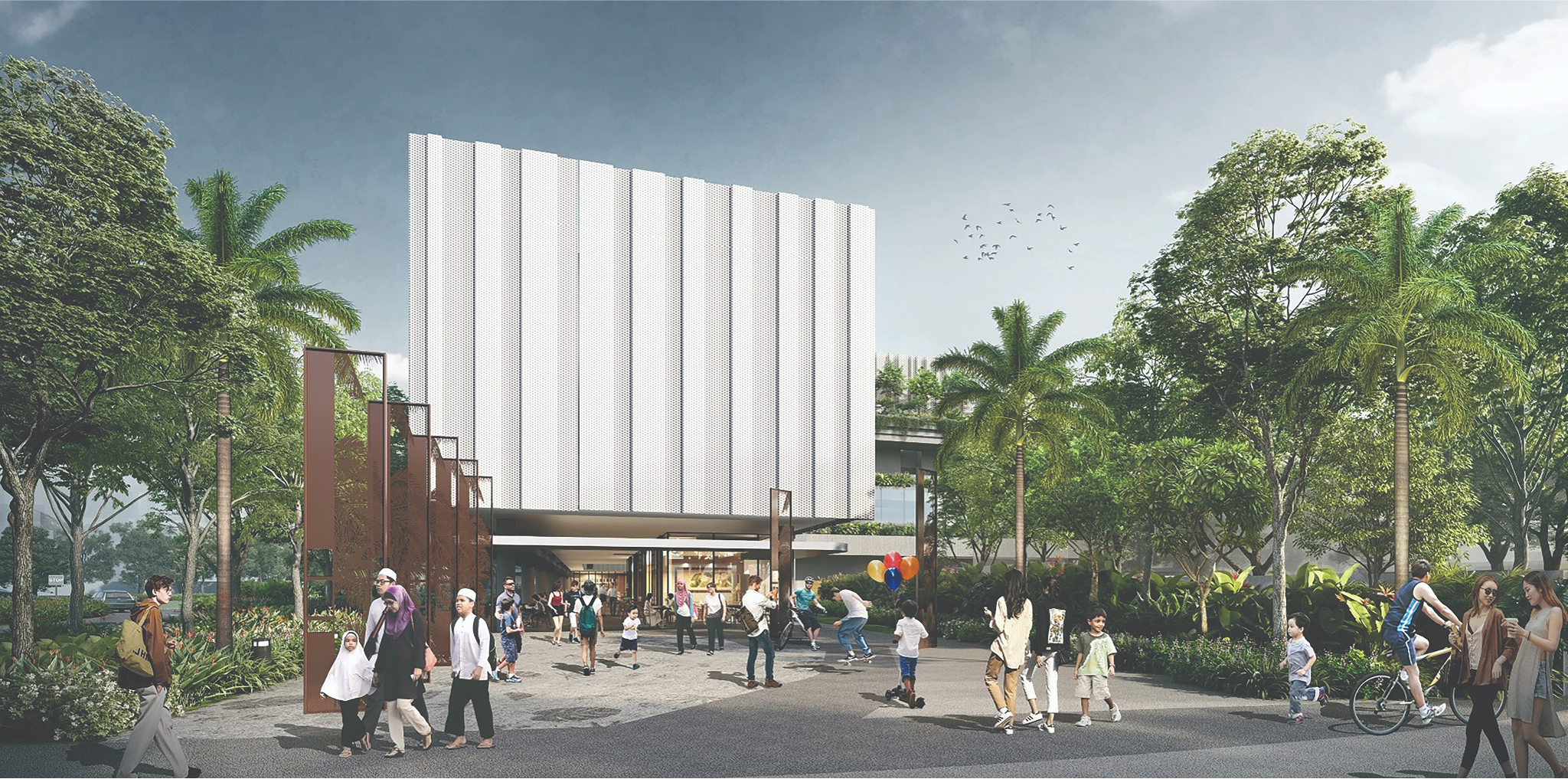
The upcoming public space in Siglap South Integrated Development. Source: SLA in partnership with PA.
Katong - Refreshing a lively activity belt
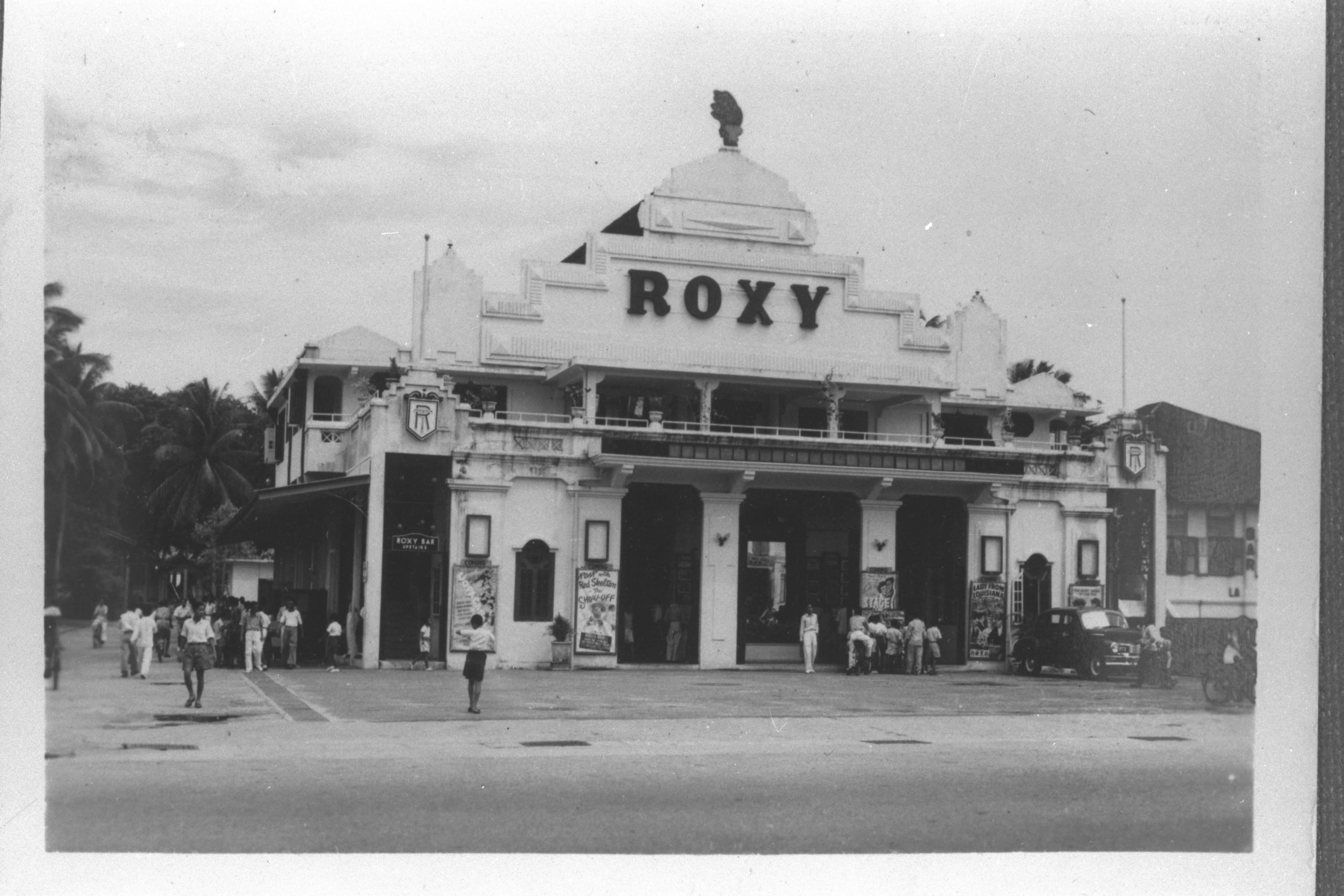
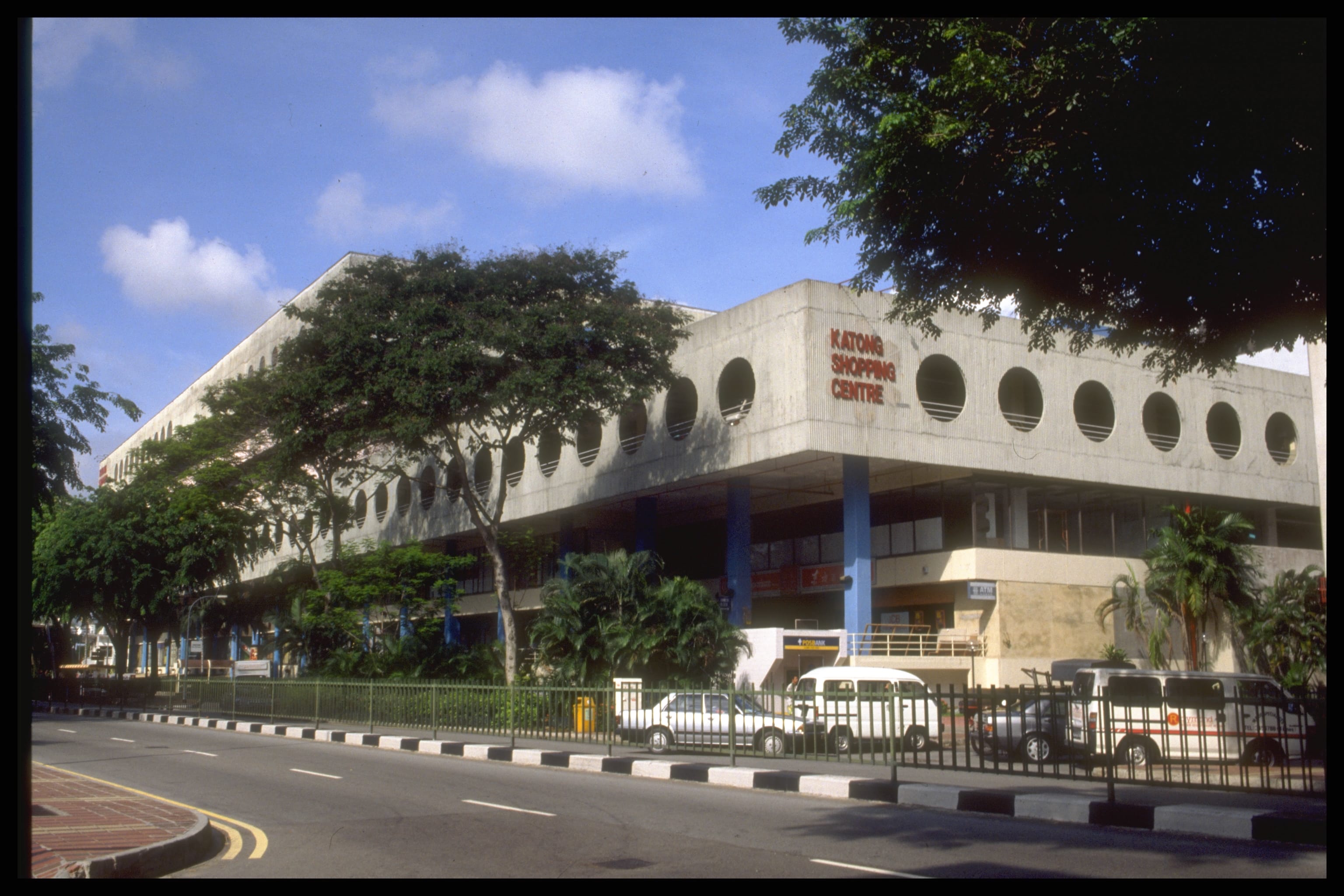
Remembering the happening Katong Roxy area
Since the 1950s and 1960s, Katong has been a major leisure and shopping hub. It was home to theatres like Roxy and Odeon, as well as Katong Shopping Centre, Singapore’s first air-conditioned mall.
Today, the node remains ever popular, with modern malls, heritage businesses and boutique hotels that draw locals and overseas visitors alike.
Shape new developments to be sensitive to the historic context
The street block comprises modern developments in long, narrow lots that used to front the sea.
Guidelines will be introduced to ensure new developments are compatible in scale with nearby shophouses and contribute to the area’s vibrancy through activity-generating uses, such as shops and eateries, at street level.
Introduce new public spaces and focal points for the community
The public spaces in Katong will be enhanced to support frequent events and the large crowds in the area. The proposal for a pedestrian mall from i12 Katong to Katong V was conceived during URA’s public engagement. Feedback from the stakeholders included providing generous public seating, enhancing the landscaping and paving, and designing unique street lighting.
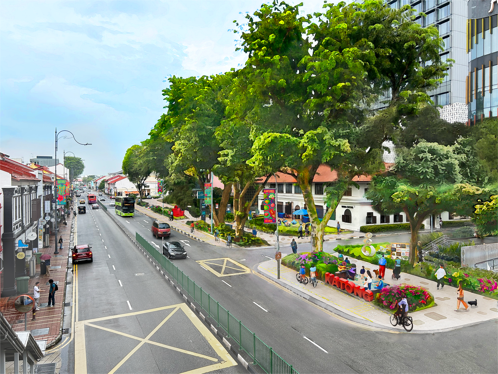
Possible enhancement works for a new pedestrian mall in Katong.
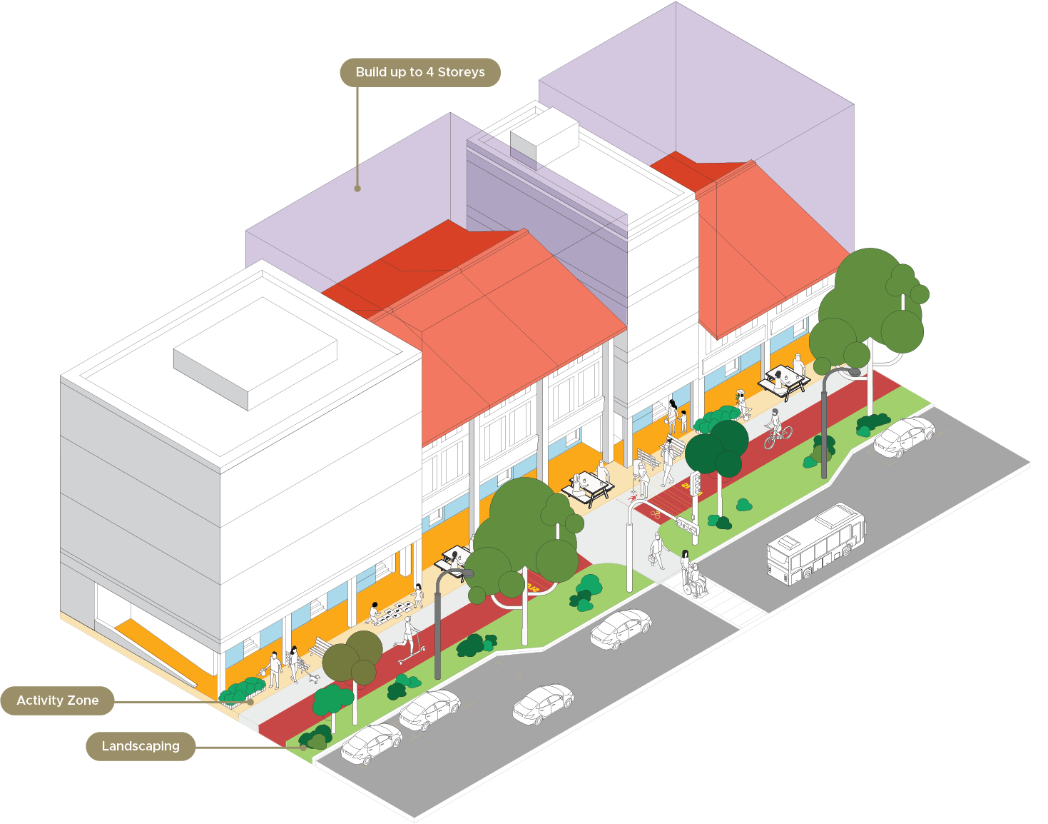
Improve street block porosity and active mobility
New through-block links have been safeguarded in the street block to enhance visual porosity and serve as shortcuts from East Coast Road to the recently completed Marine Parade MRT Station. The covered walkways of adjacent developments will link up seamlessly too. The buildings in Katong will be designed to incorporate open spaces and connections.
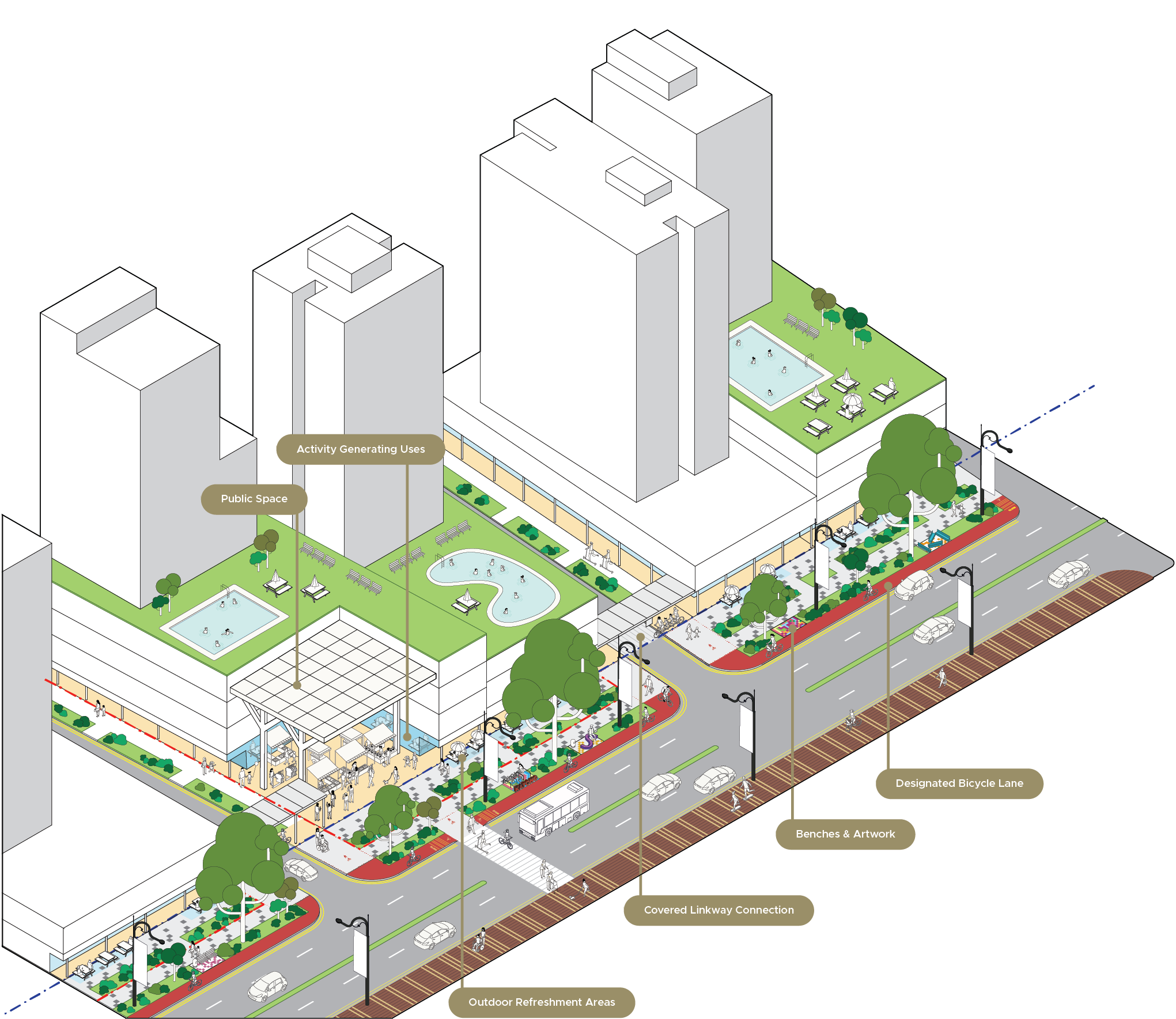
New pedestrian mall at Katong-Joo Chiat with space for activities, walking and cycling. Conceptual diagram for illustration purposes only.
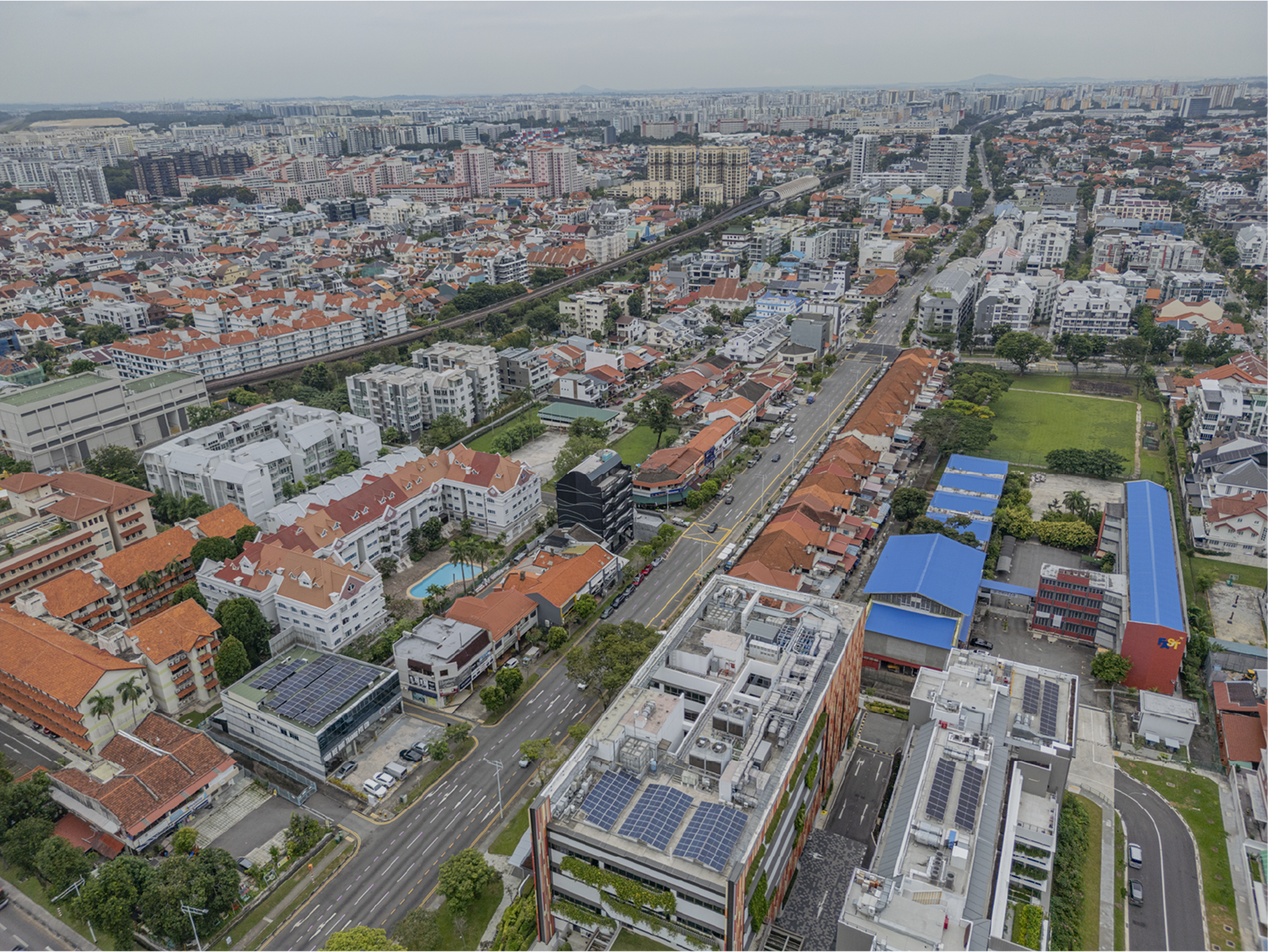
Changi Road - Guiding the evolution of an eclectic, fine-grained street
Remembering the gotong royong spirit
By the mid-1900s, multiple kampongs had been founded along this street, including Kampong Eunos, Kampong Kembangan and Kampong Pachitan.
Former residents of the area still remember the gotong royong spirit when villagers worked together for the common good. Today, these community ties remain strong and people still gather to worship, shop and dine along the street.
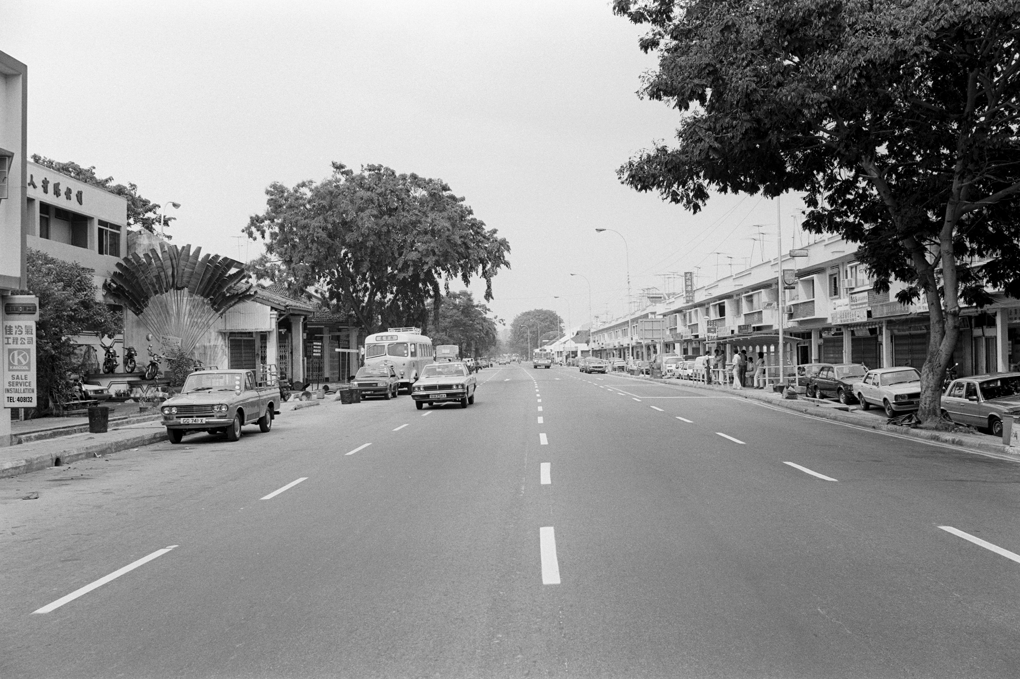
Changi Road, between Kampong Eunos and Jalan Eunos, 1983. Source: Lee Kip Lin and NLB
Enhance walking and cycling experience over time
We will make the streets more suitable for walking and cycling, such as through minimising vehicular access from the main road and setting aside more space for planting and pedestrian walkways along the streets.
Changi Road today.
Ensure developments contribute active, accessible frontages
Building height requirements will guide the existing scale of the street to be maintained while developments will be guided to provide covered walkways and shops that are easily accessible from the street.
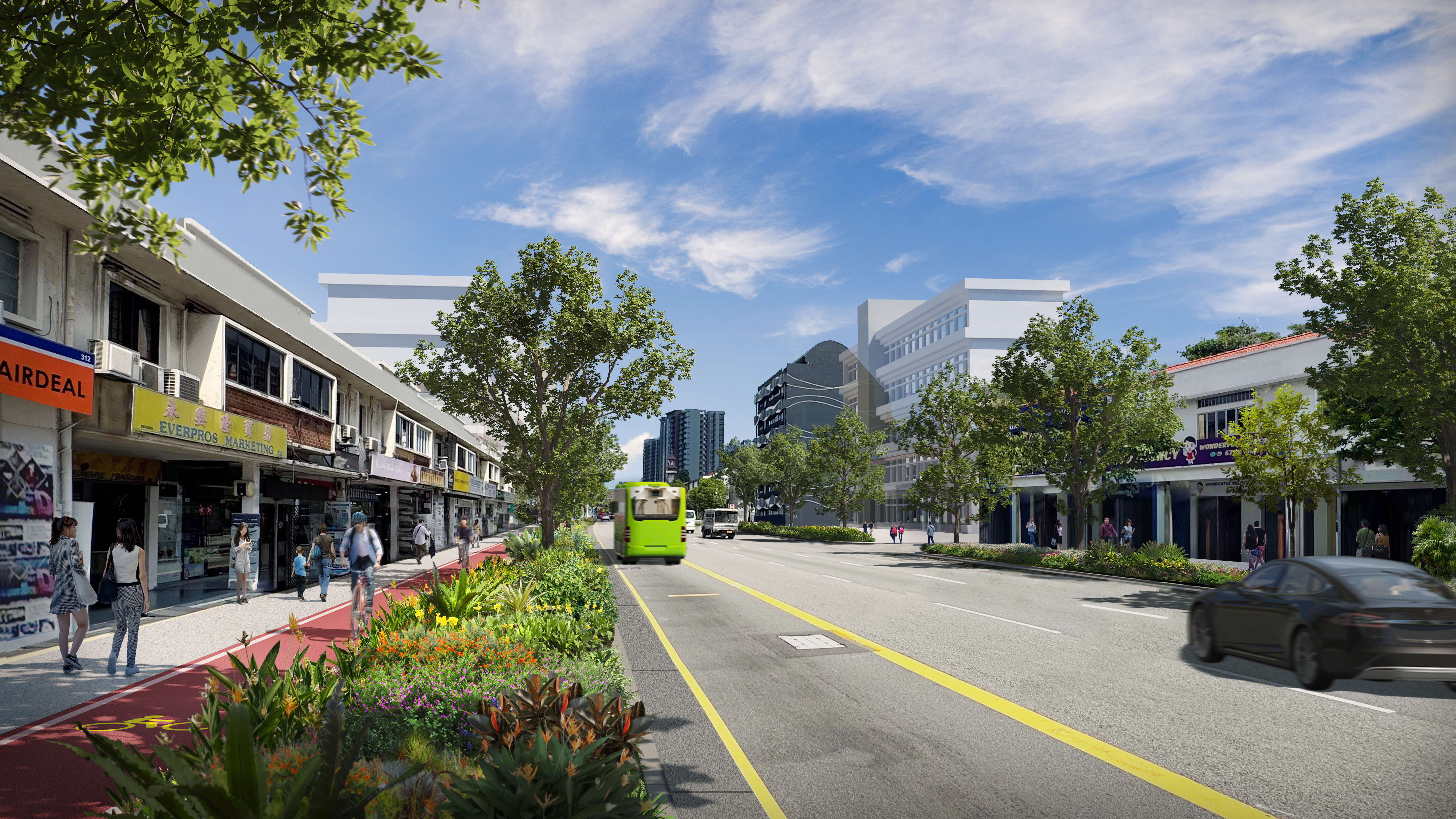
Possibilities for enhanced streetscape at Changi Road.