
Identity Corridors
Learn how Singapore's Identity Corridors will enhance key heritage routes, integrate public spaces and improve connectivity.
Last updated 25 June 2026
Shaping places we cherish
Across Singapore there are places that are meaningful to us, and these spaces are enhanced to give us a sense of belonging and identity. Some stand out because of their distinct setting or character, while others house trades and activities that are special.
Identity Plan
18 such areas were earmarked as Identity Nodes since the introduction of the Identity Plan in 2002. Holistic strategies were introduced to strengthen their form and character over time.
In 2022, the Long-Term Plan Review expanded this concept to include longer stretches with unique urban or natural quality as Identity Corridors. These run along major roads, rivers and rail lines, and are lined with charming neighbourhoods and vibrant streetscapes.
A holistic approach to guide evolution
A holistic approach to planning and urban design has been developed for each corridor to strengthen its identity, in tandem with new developments in the area.
The following principles guide our planning, urban design and placemaking efforts for Identity Nodes and Identity Corridors:
Character & Charm
To holistically guide the evolution of places along the corridors, ensuring that their character and charm can be enjoyed by future generations.
Connectivity
To enhance accessibility—prioritising walking and cycling to enable exploration at a slower pace.
Community
To work with local communities to shape the evolution of these corridors and co-create lasting outcomes together.
The Identity Plan - View Larger Map
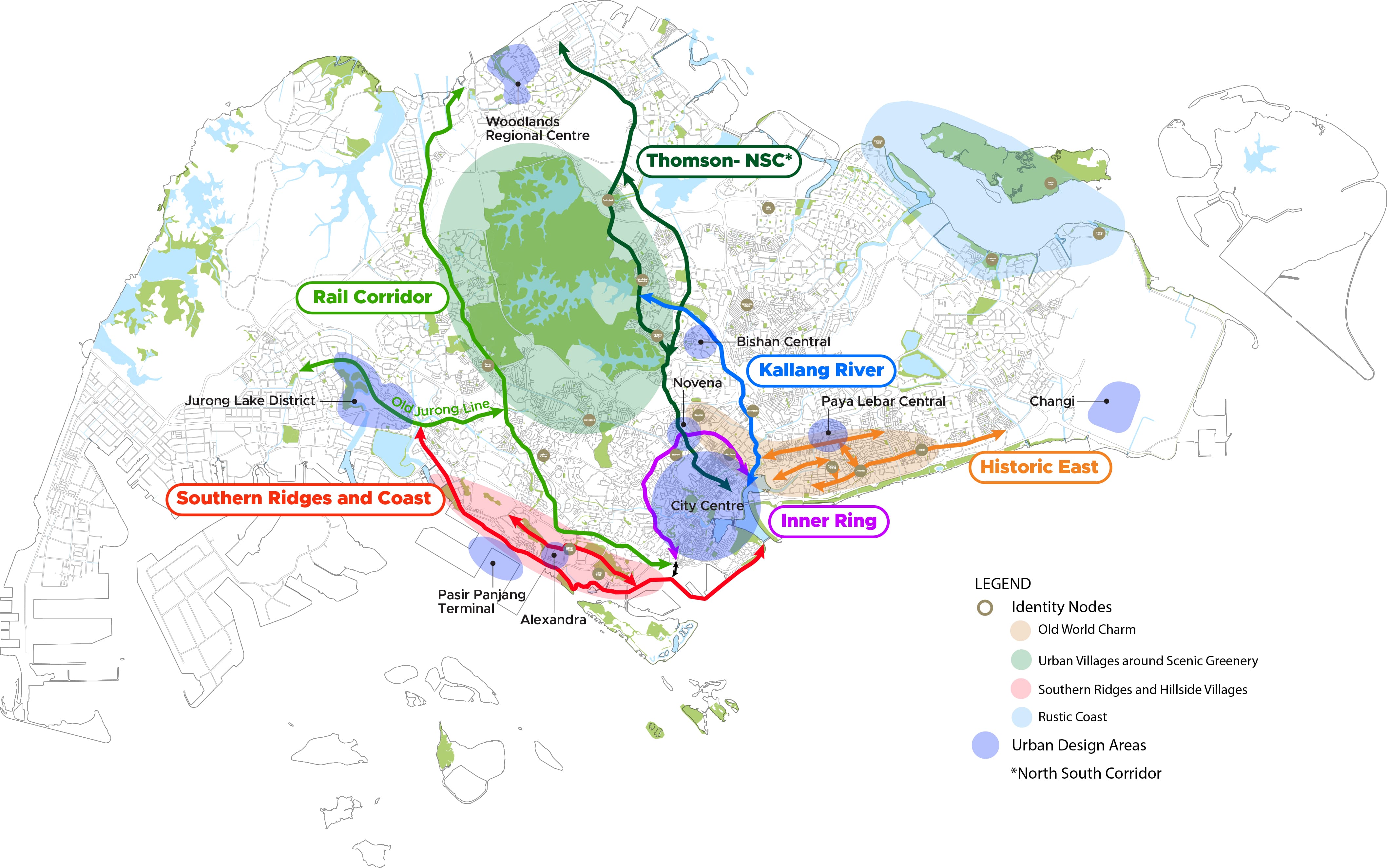
The Identity Corridors
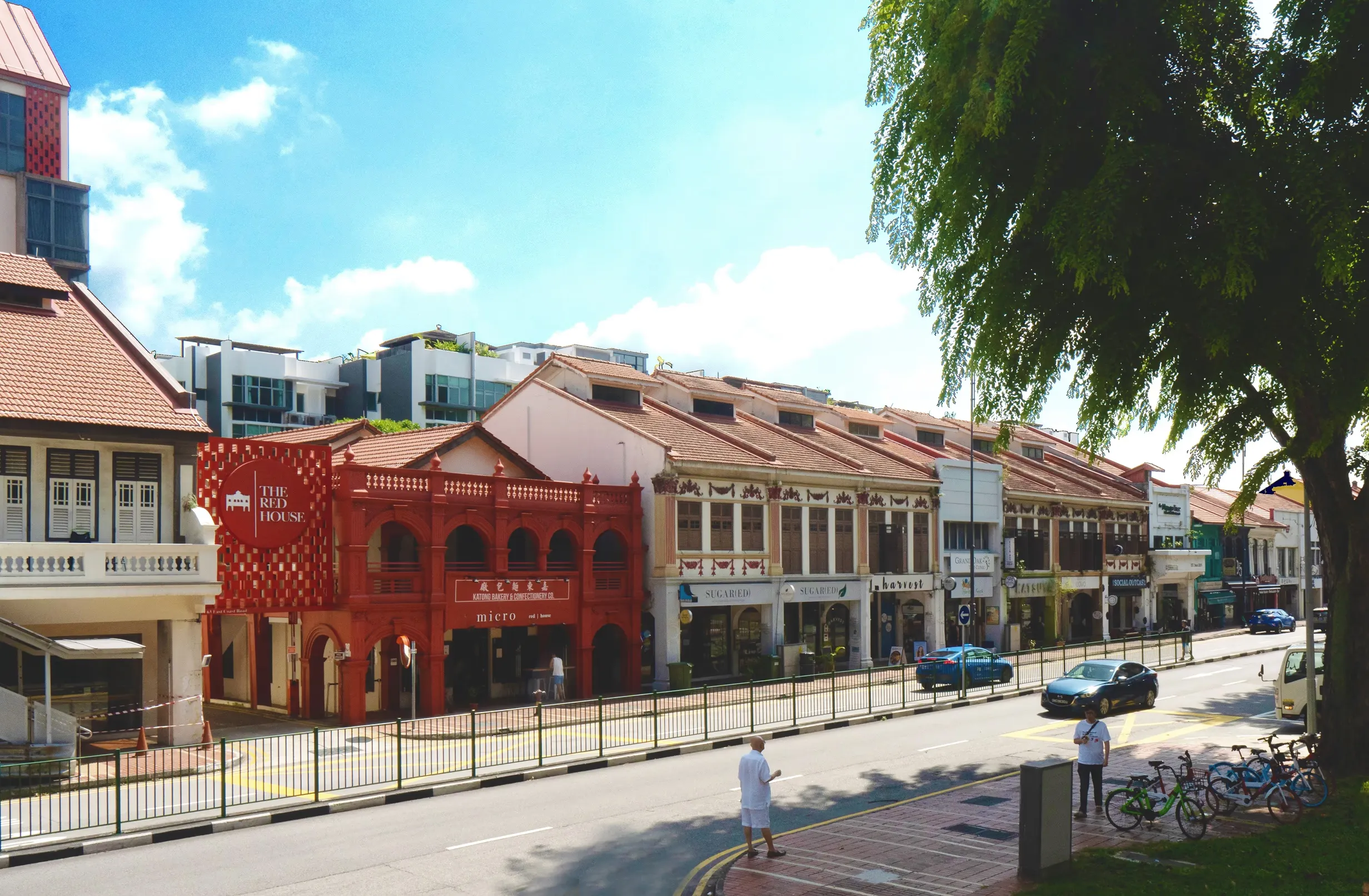
Historic East
Historic East consists of stretches along and around Geylang and Changi Roads, East Coast Road, the Old Airport Road and Stadium Boulevard, as well as Siglap, Marine Parade and Bayshore. The rich multi-ethnic character gives the area a distinctive identity and culture that continues to thrive today.
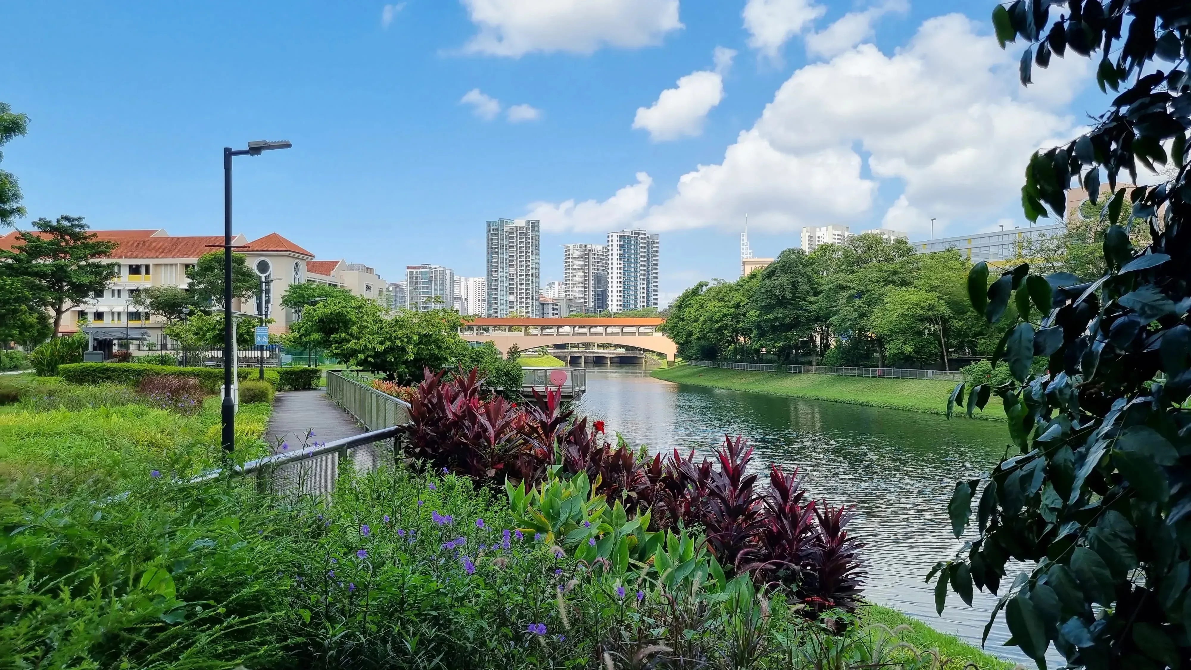
Kallang River
Kallang River connects the Lower Peirce Reservoir with the Marina Reservoir. Running through housing estates and community nodes, the river is also home to our wildlife. Over the years, improvements have been made to enhance Kallang River's landscape and connectivity such as the Bishan-to-City cycling and pedestrian route.
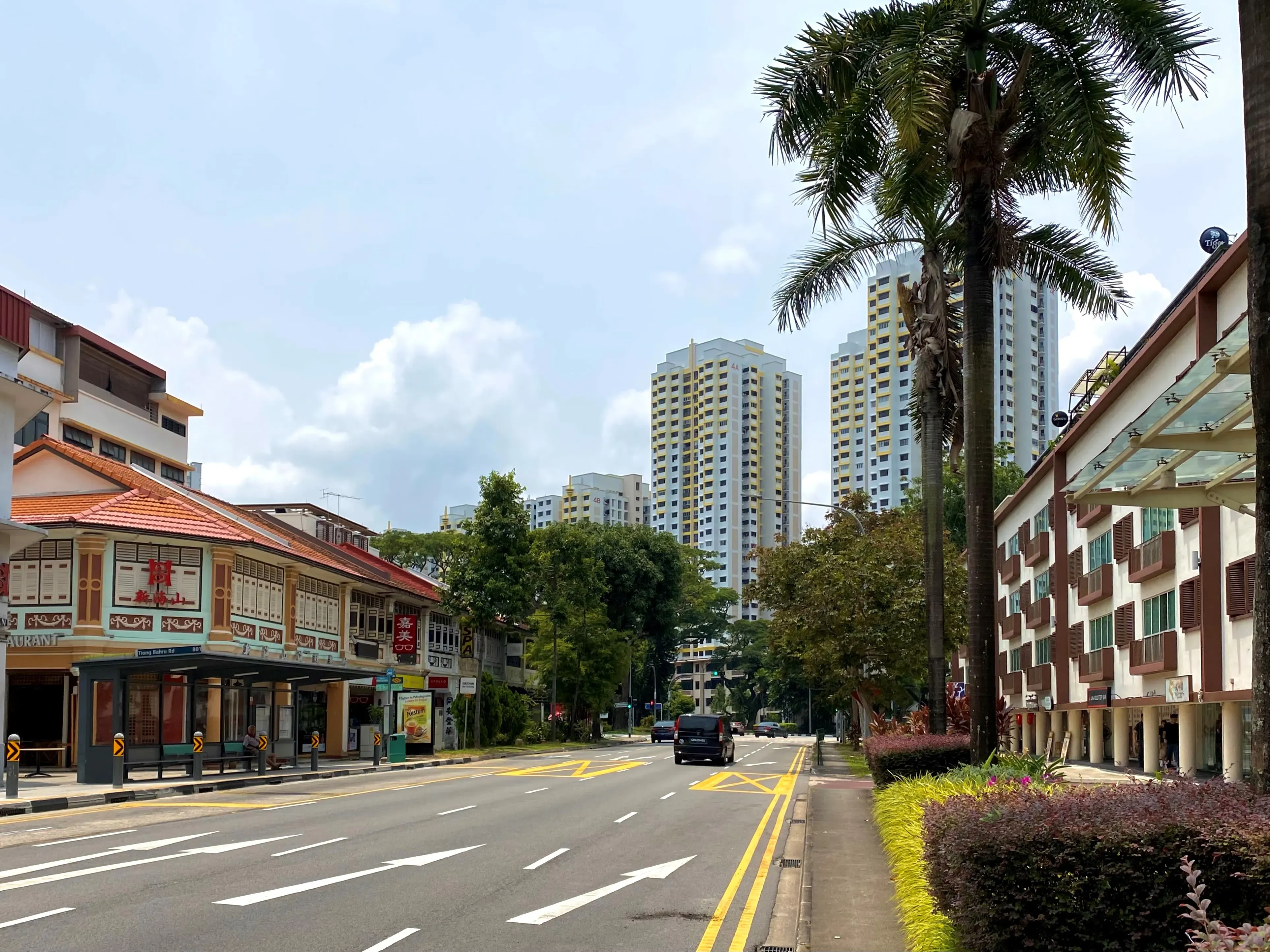
Inner Ring
Inner Ring encircles the city fringe along roads such as Tiong Bahru Road, Scotts Road, Balestier Road and Lavender Street. It connects many city fringe neighbourhoods and key active mobility and recreational corridors such as Singapore River, Rail Corridor, North South Corridor and Kallang River.
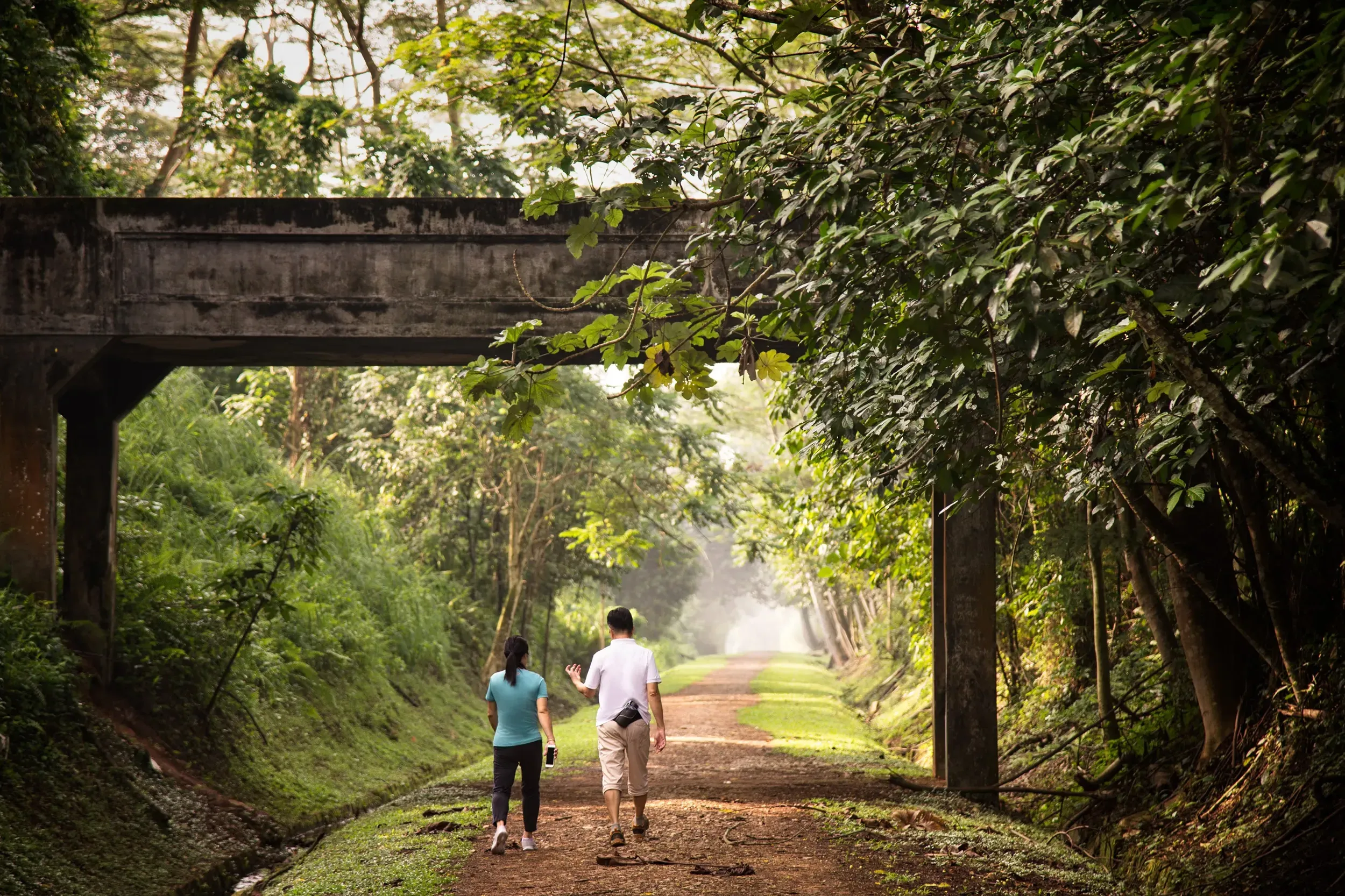
Rail Corridor
The Rail Corridor is a recreational corridor stretching from the former Tanjong Pagar Railway Station in the south to Woodlands in the north. It threads through diverse communities, connecting around 1 million residents within a 1km radius. Over the years, there has been continued efforts to shape the Rail Corridor into an inclusive green space for all.
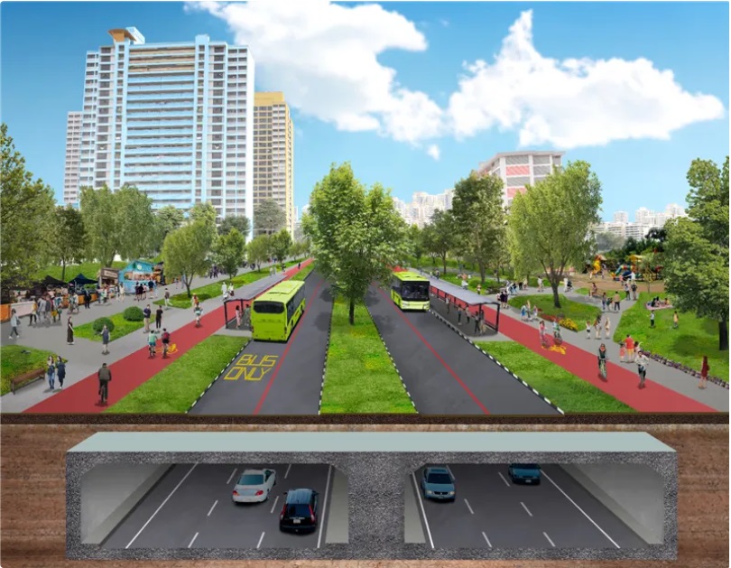
Thomson & NSC
Beyond enhancing connectivity from the north to the city, NSC transforms the surface streets to prioritise walking, cycling and public transport riding. Journeys along the NSC can support a more active and healthier lifestyle. More than just a corridor for commuting, the NSC will feature public spaces that serve as gateways to adjacent developments, and provide areas for activities, events, gatherings or to just relax and watch the world go by!
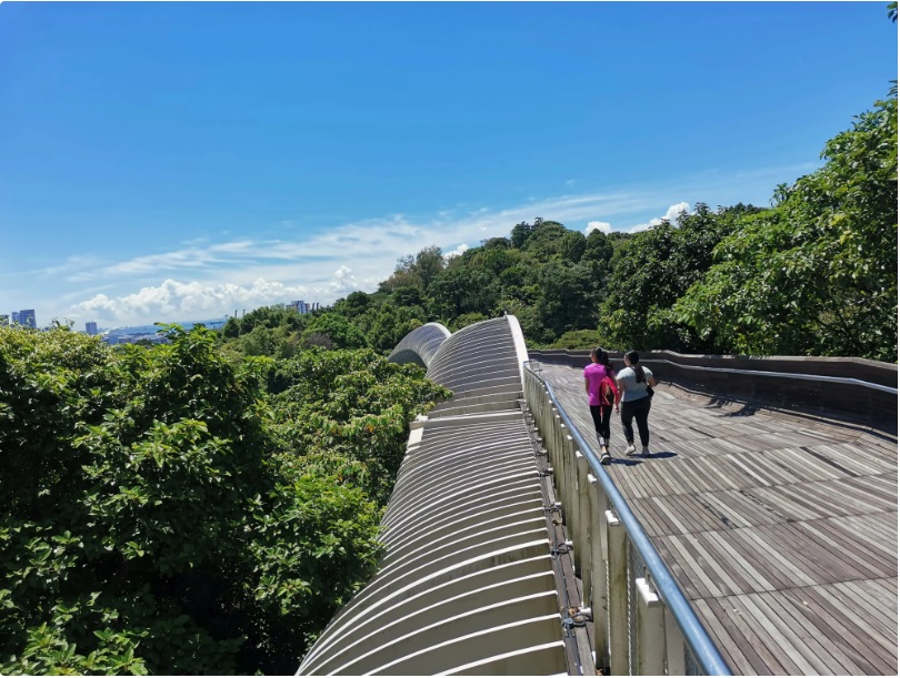
Southern Ridges & Coast
This Corridor covers the southern coastal waterfront area, with plans to create a continuous coastal waterfront promenade to seamlessly connect various places, from Marina Barrage and Southern Ridges to the Greater Southern Waterfront. More plans will be shared in the future when we develop the area.
Co-creating outcomes together
Over 2,300 residents and stakeholders have been engaged in person to share their aspirations and feedback on three Identity Corridors – Historic East, Kallang River and Inner Ring. Let’s work together to enhance the unique characters and develop endearing public spaces, so that the Identity Corridors will remain well-used and loved by future generations. Click here to view the communities' aspirations.
Local Identity guides
A set of local identity guides has been developed to document the history and lived experiences of the communities for each corridor. These stories serve to connect us to these places and provide inspirations for placemaking.
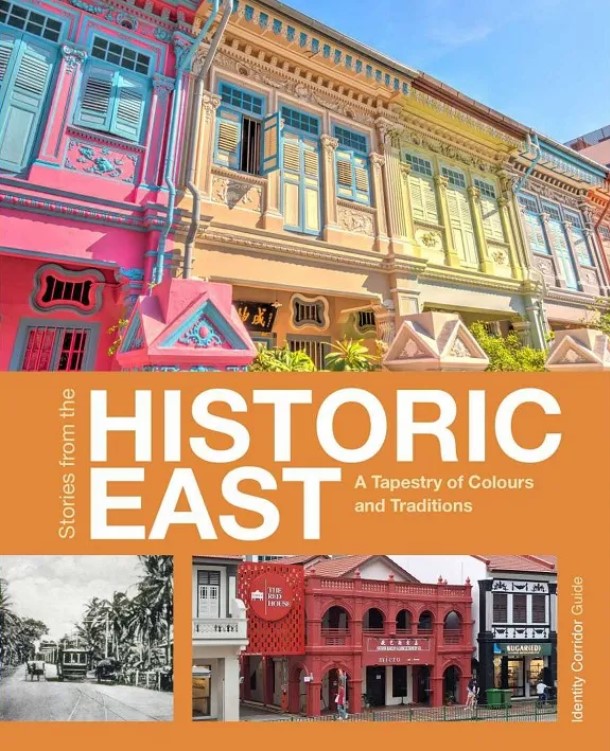
Historic East
From Katong-Joo Chiat to Siglap and East Coast, dive into the history, evolution, and magic behind the Historic East Corridor in this local identity guide.
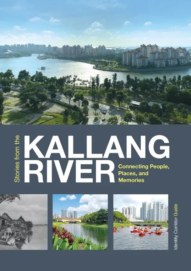
Kallang River
Uncover the stories and insider insights behind Singapore’s longest river in this local identity guide for the Kallang River Identity Corridor. Learn more about how the river has evolved, its many landmarks and charms as we shape it for the future.
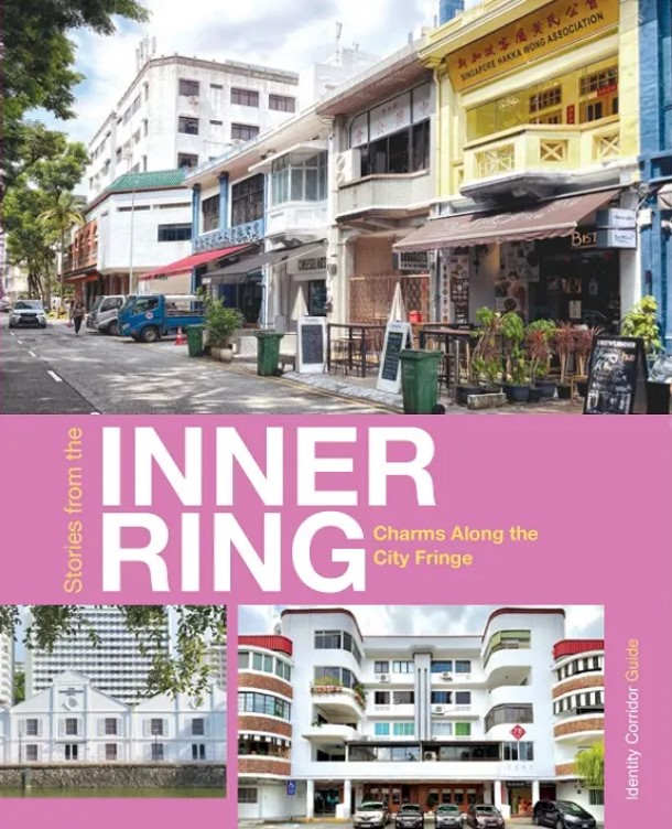
Inner Ring
Discover the stories and tales behind charming neighbourhoods that evolved on the fringe city in this local identity guide for the Inner Ring Identity Corridor.
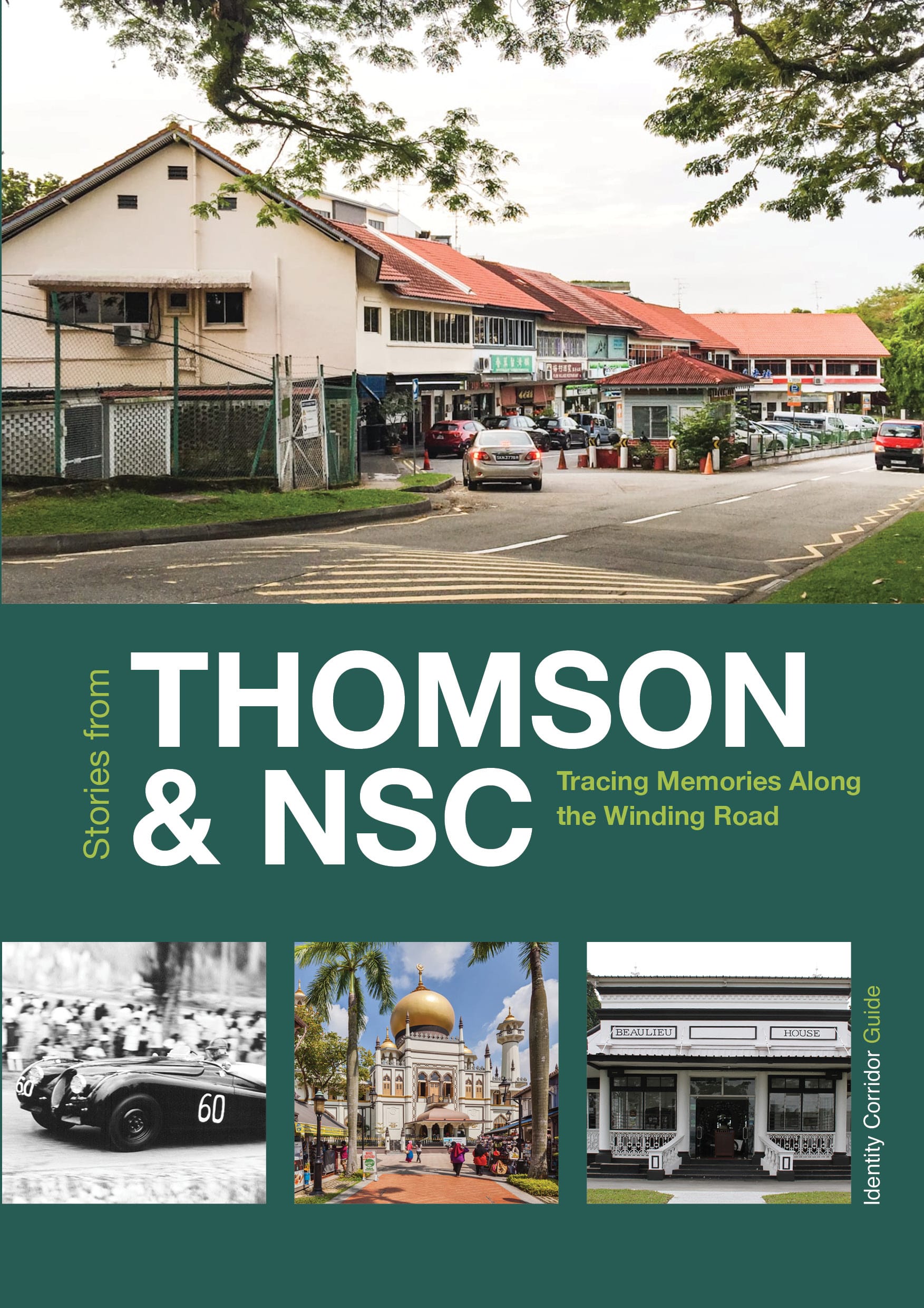
Thomson & NSC
Trace the journey through time along one of Singapore's oldest trunk roads in this local identity guide for the Thomson-NSC Identity Corridor.