
Gateway to the World, Vibrant Nodes for All
The East Region is powered by key economic nodes such as Changi Airport, Changi Aviation Park, Changi Business Park and Tampines Regional Centre.
Last updated 2 June 2026
Our Eastern Gateway and business nodes
Connecting us globally and strengthening vibrant business ecosystems
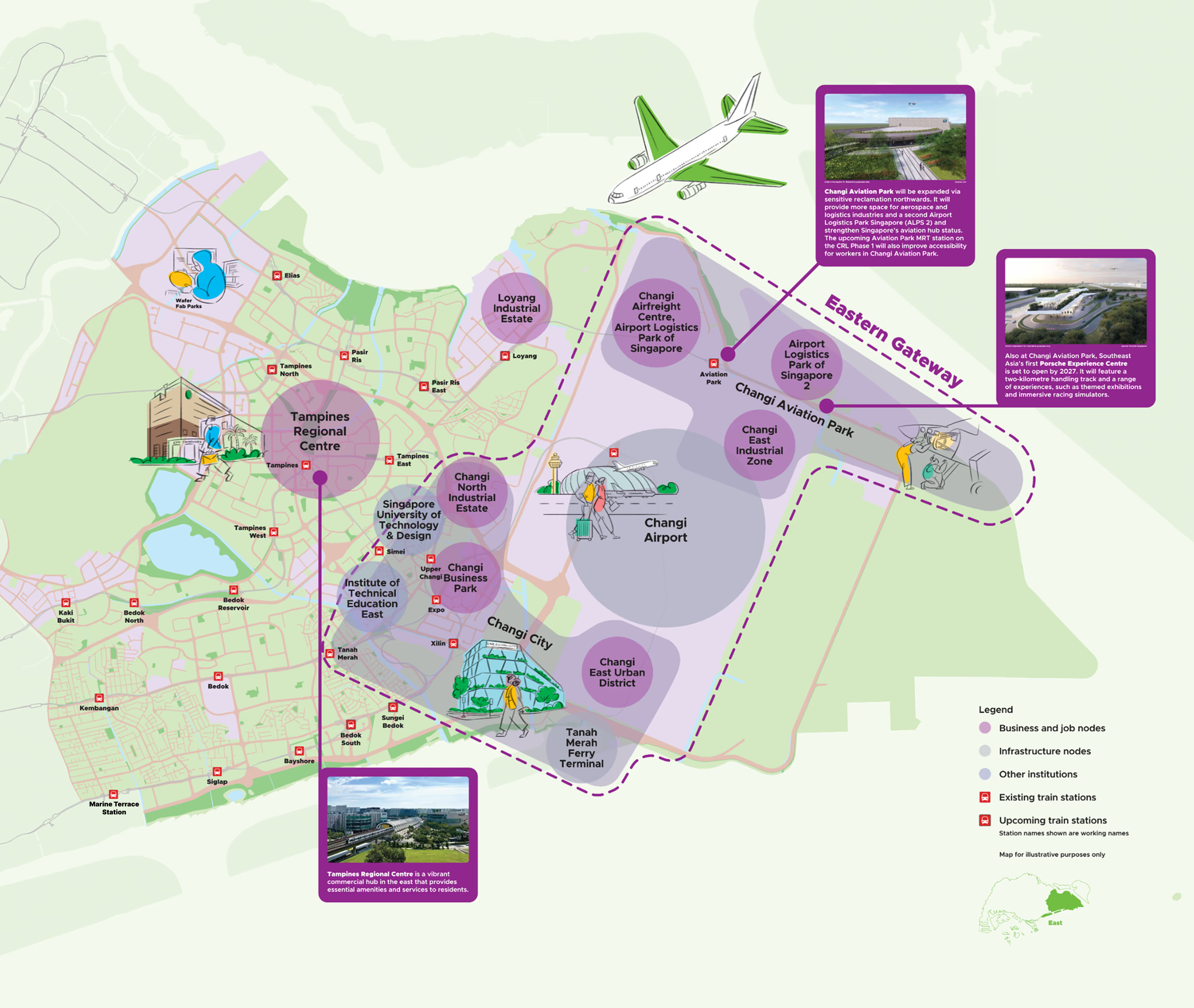
Boosting our aviation hub
The East Region is Singapore's business gateway to the world. Key economic nodes such as Changi Airport, Changi Aviation Park, Changi East Urban District, Expo, Changi Business Park and Tampines Regional Centre will be further developed to support vibrant workspaces close to home.
Changi Area will become more accessible with the improvements to the transport infrastructure, which includes the upcoming MRT Stations, road, commuter and active mobility infrastructure enhancements.
Changi Airport
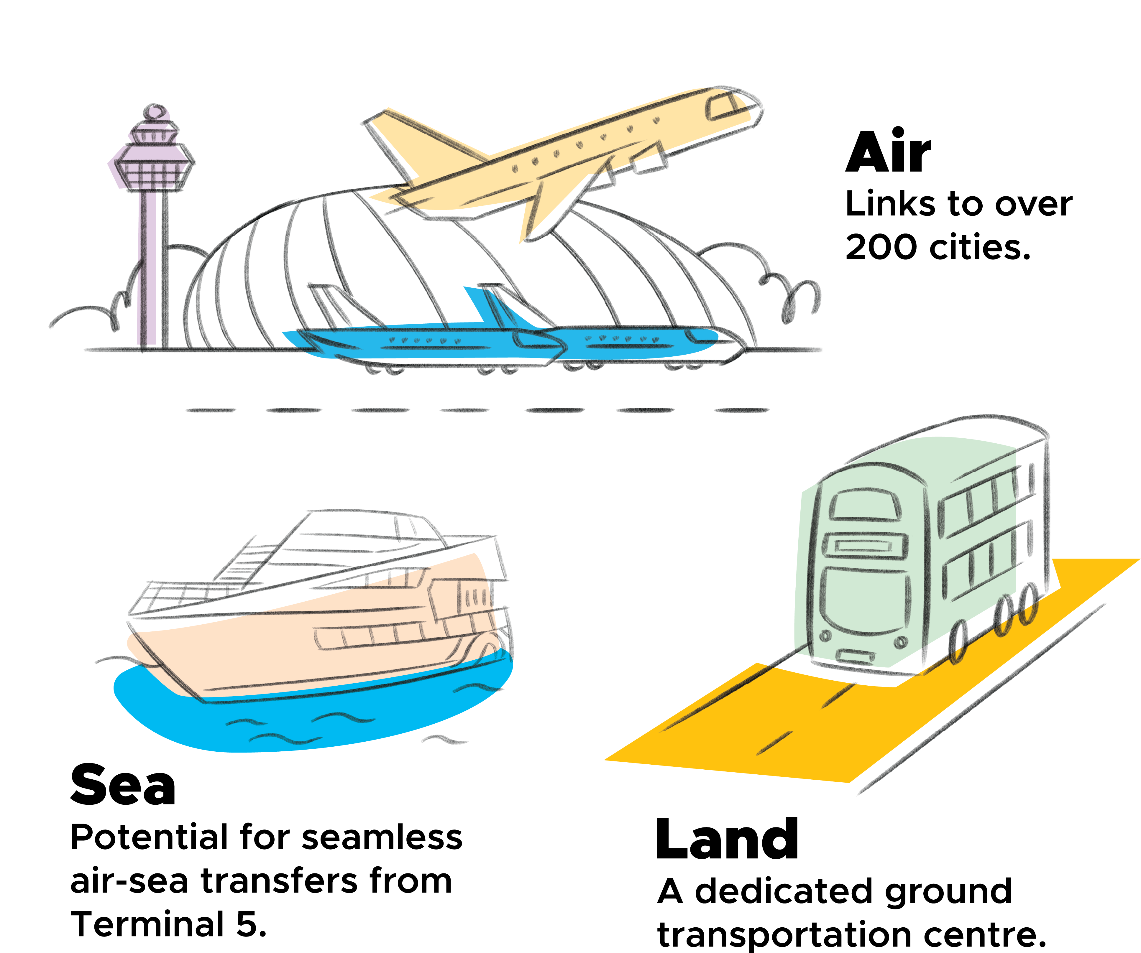
Terminal 5 is expected to be operational in the mid-2030s and will include a dedicated ground transportation centre where passengers can access rail, bus and other point-to-point transport services. Both the Cross Island Line and the Thomson-East Coast Line will be extended to connect Terminal 5 directly to the City Centre.
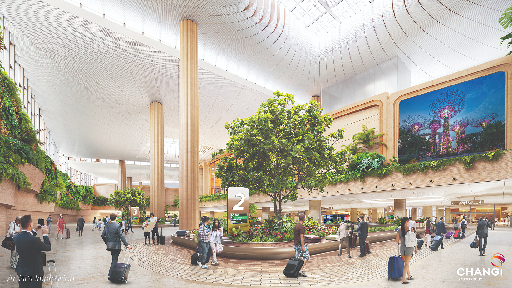
Upcoming Changi Airport Terminal 5. (Artist's impression for illustrative purposes. Source: CAG)
Terminal 5 will enhance the airport's connectivity in a variety of ways:
Terminal 2 underwent refurbishment and expansion in 2023. The newly redesigned Terminal 2 emphasises sustainability, automation and elements of nature seamlessly incorporated throughout the terminal. A new 255-room hotel is also under construction.
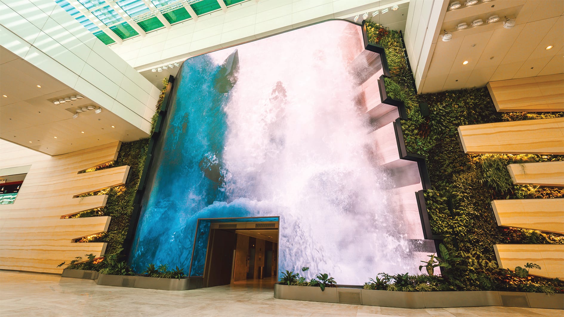
Changi Airport Terminal 2. (Source: CAG)
Changi East Industrial Zone will increase the airport's cargo handling capacity to 5.4 million tonnes per annum. Changi East Urban District will serve as a vibrant business and lifestyle destination located at the doorstep of Terminal 5.
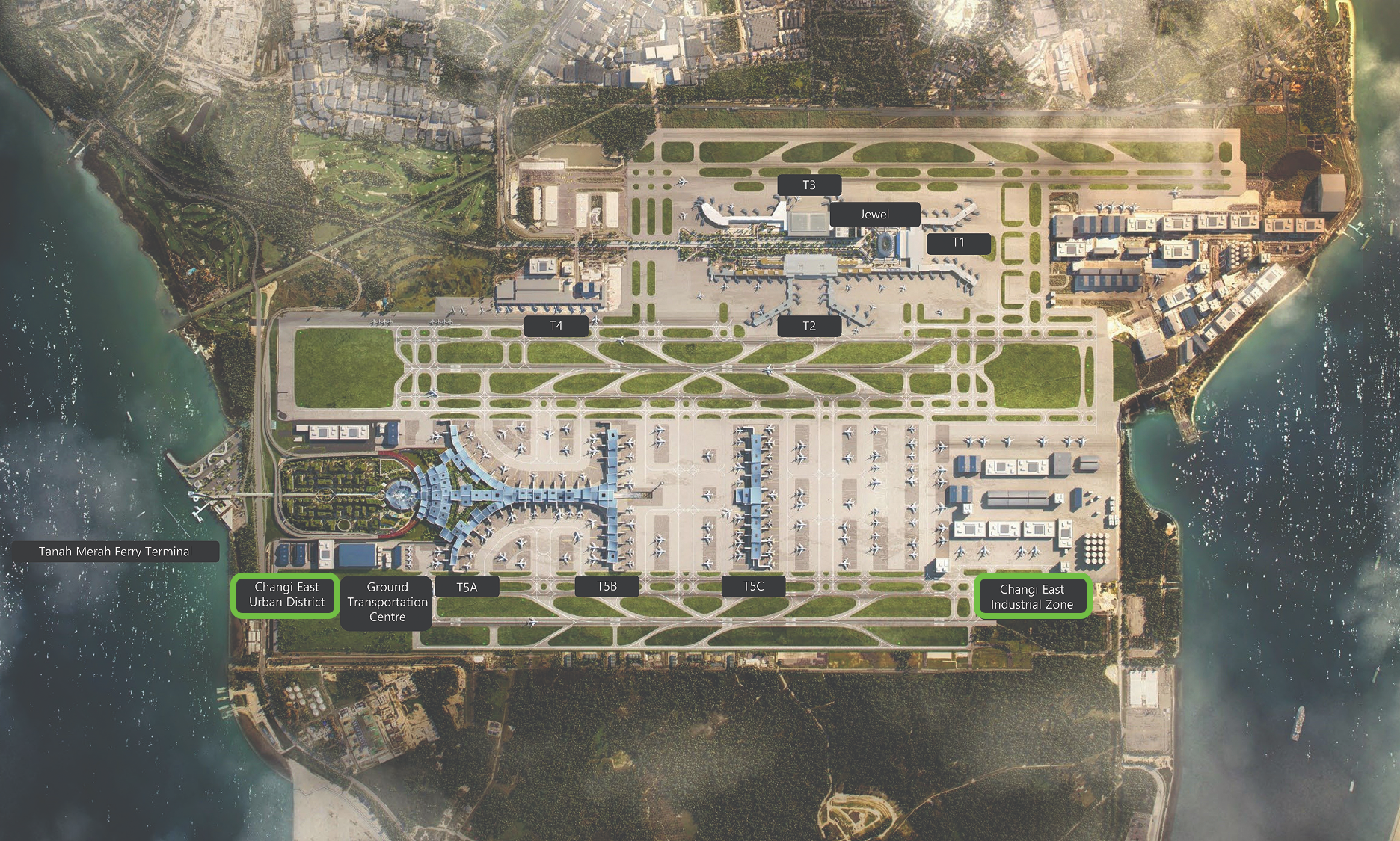
Map of Changi Airport. (Source: CAG)
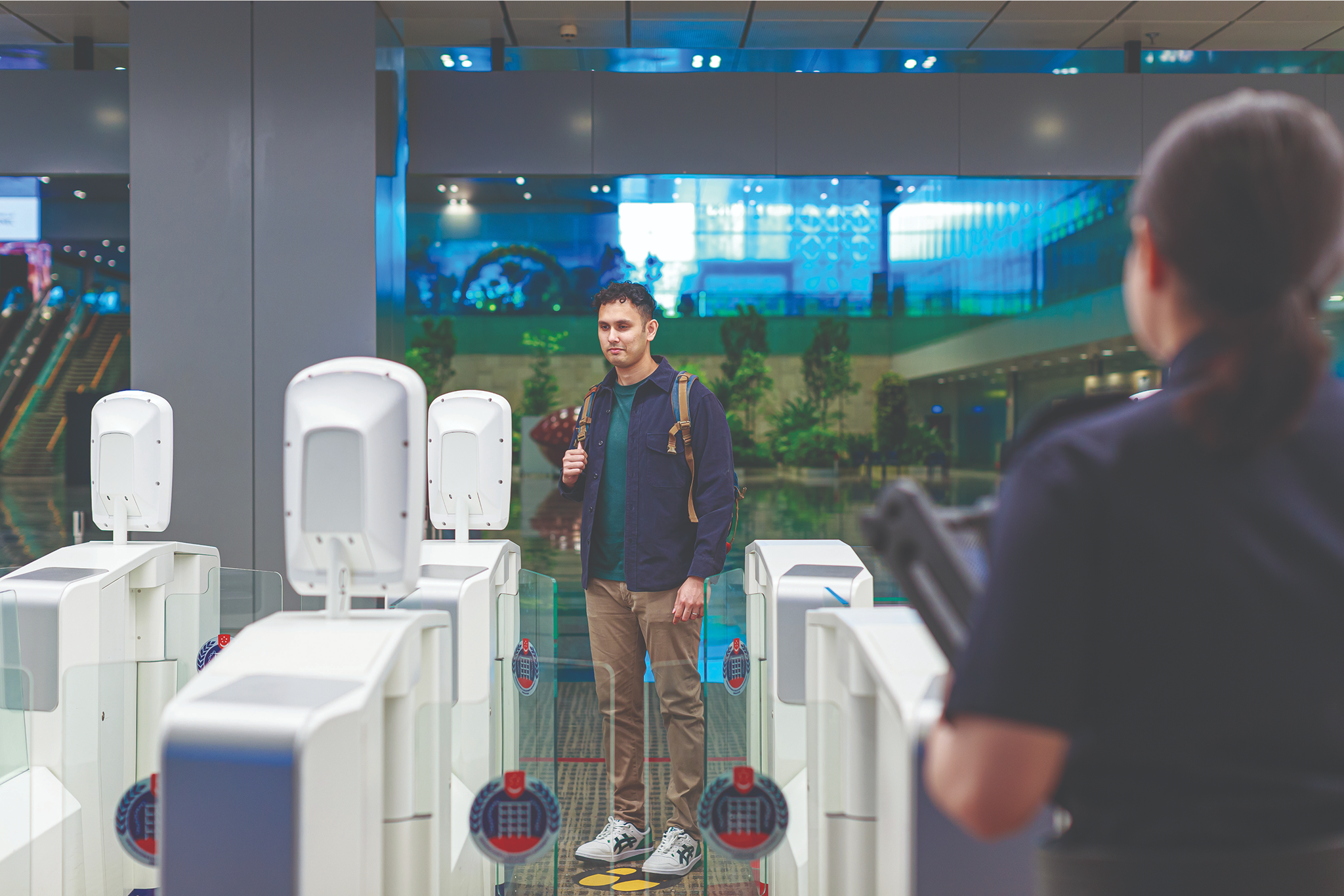
Redefining border clearance
Remember your last visit to Changi Airport? Residents can now experience 60% faster and more seamless immigration process by using facial and iris biometrics at the automated lanes instead of showing your passport. These enhancements are designed to streamline your experience at the checkpoints. ICA has also implemented paperless clearance for conventional cargo across all checkpoints (including air) which eliminates the need for hardcopy permits, shaving off 30% of clearance time and improving the competitiveness of our logistics services.
Source: ICA
Changi Business Park
Changi Business Park (CBP), strategically located near Changi Airport, is envisioned as an innovative lifestyle and business hub that integrates work-live-play-learn elements. High-value industries will be introduced to CBP, which may include aerospace sectors that can benefit from the proximity to Expo Interchange, Changi Airport and the Singapore University of Technology and Design (SUTD).
Source: JTC
Rejuvenating existing business nodes
Tampines Regional Centre
The first regional centre in Singapore is welcoming more housing, workspaces and community facilities to support new live-work trends. As part of the Enabling Sustainable Growth exhibition in October 2024, a workshop was held to collect feedback and insights on the future of Tampines Regional Centre.
A convenient, connected community
Convenience
Tampines Regional Centre is well-connected by two MRT lines and a bus interchange. It brings a wide range of shops, offices and community facilities nearer to homes in the East Region, reducing commutes and giving more time for leisure and family. Rejuvenation will transform it into a more vibrant destination with more diverse offerings for all.
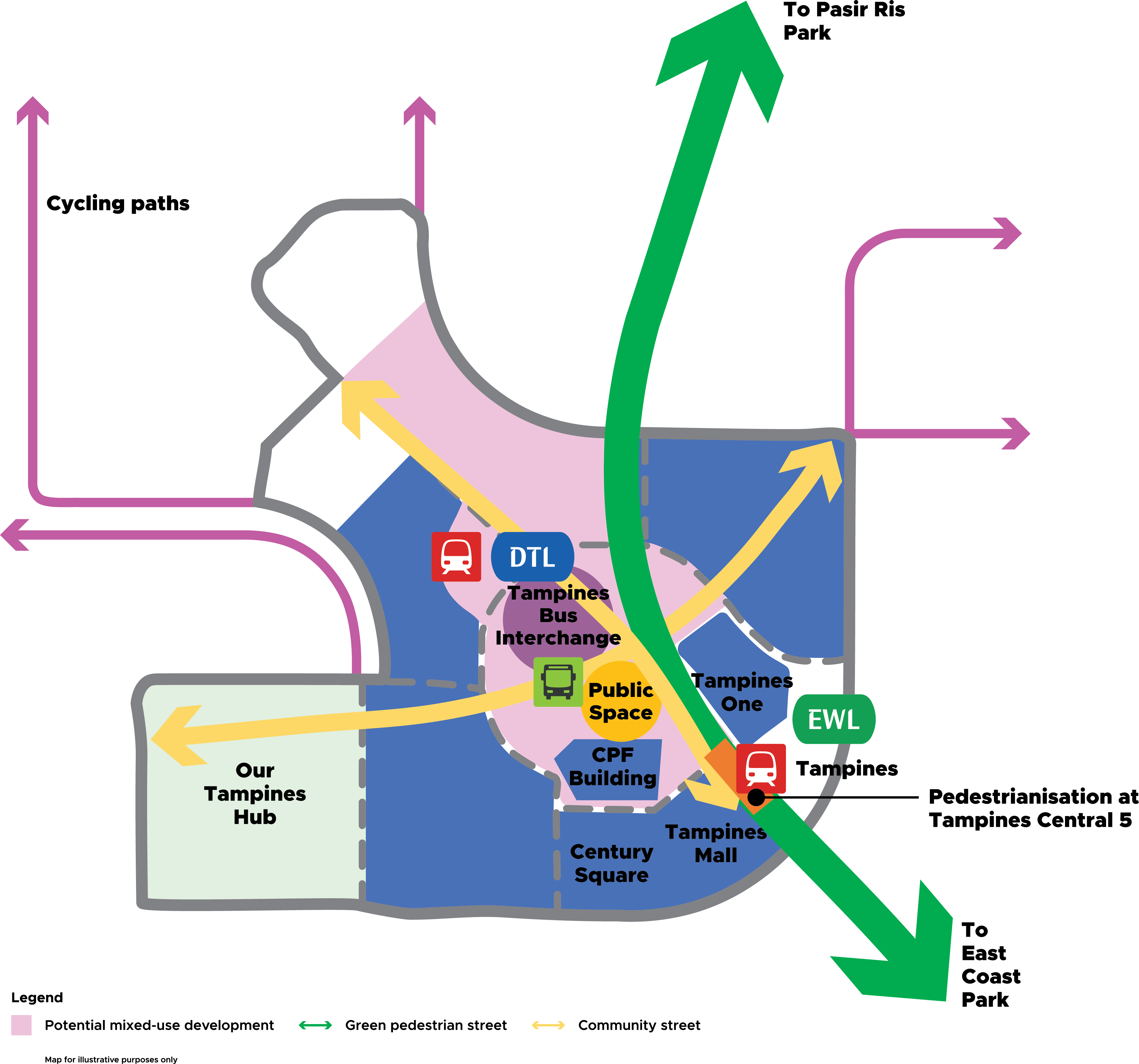
Connectivity
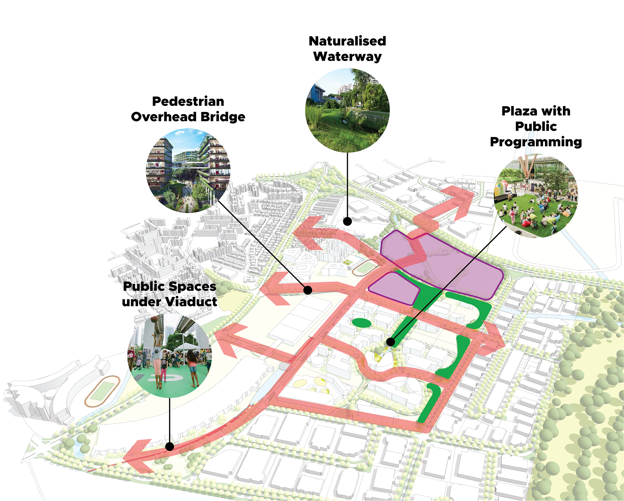
A seamless pedestrian and active mobility network is planned to link up the surrounding areas to Tampines Regional Centre. This includes the pedestrianisation of Tampines Central 5 to allow better pedestrian connectivity to the nearby malls. The road network will also be reconfigured to make the centre more pedestrian-friendly and reduce conflicts between pedestrian circulation and community activities.
Artist's impression for illustrative purposes only. (Source: LTA)
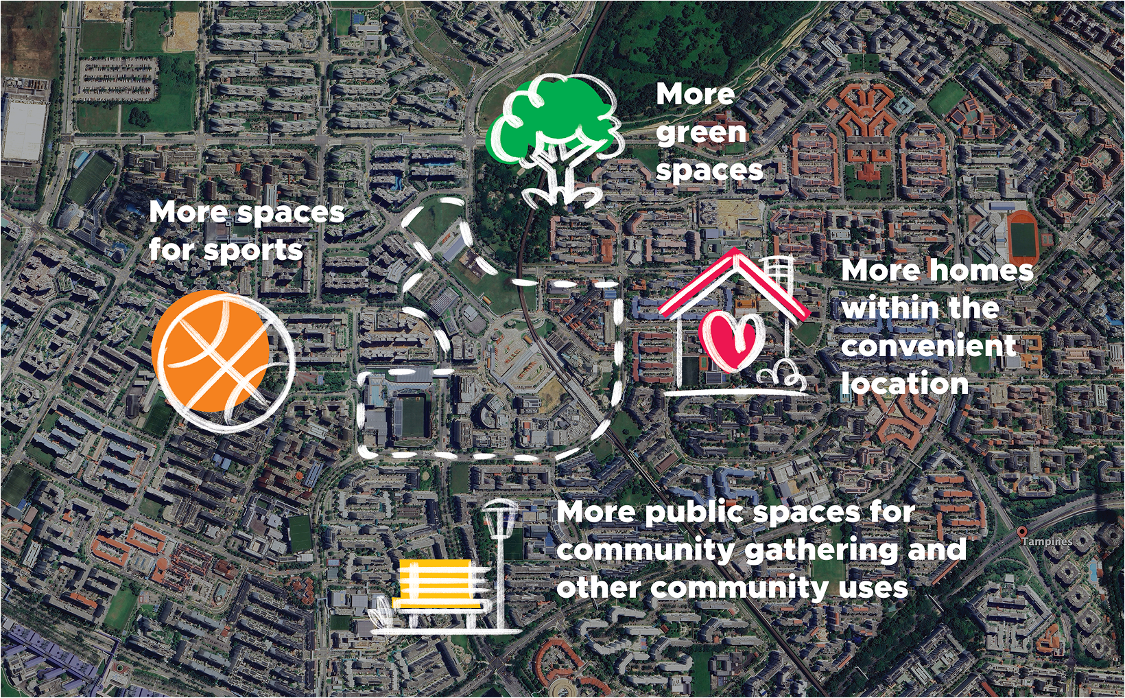
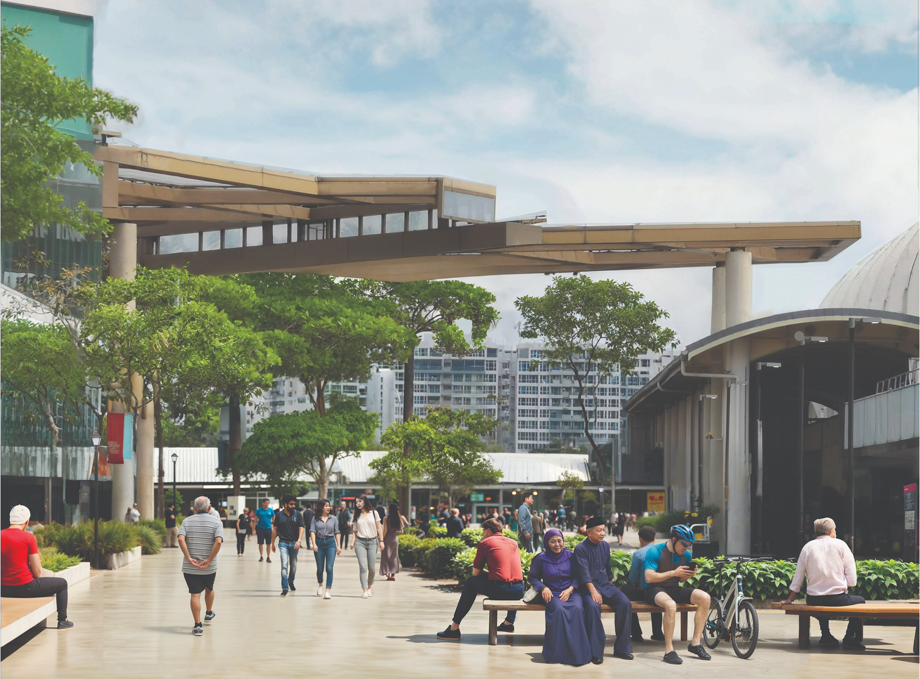
Community
There are plans to study the redevelopment of Tampines Bus Interchange into a mixed-use development with an integrated transport hub. A centrally located public space will also be introduced at the heart of Tampines Regional Centre, at the junction of the community streets. New housing, workplaces and community facilities will also be injected to future-proof Tampines Regional Centre for new live-work-play trends.
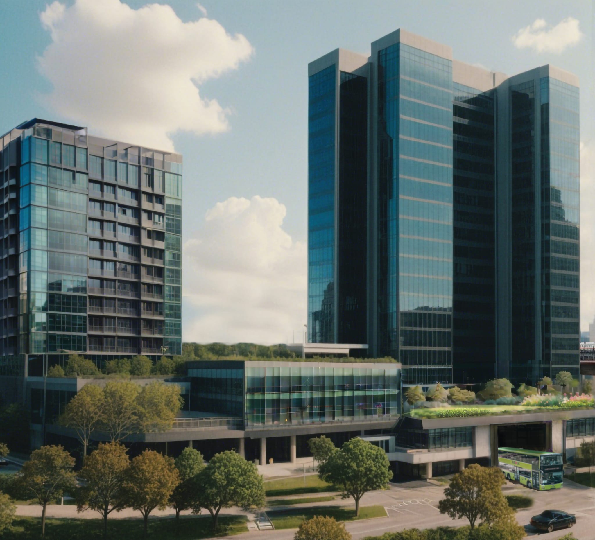
Image was created with the assistance of AI for illustrative purposes only.