
Optimising Land
Discover how Singapore is maximising its limited land resources by building upwards, rejuvenating older areas and unlocking new possibilities underground.
Last updated 25 June 2026
As both a city and a country, Singapore must balance many competing needs within our limited land. To make every space count and shape a liveable environment for current and future generations, we carefully steward and optimise our land resources through innovative planning strategies.
Building higher
To make more efficient use of land, we build higher and intensify land use, especially in areas supported by good transport and infrastructure networks. This allows more homes, workplaces and amenities to be located in convenient and accessible areas.
Such intensification is done sensitively, with careful consideration given to infrastructure capacity and compatibility with surrounding developments. Urban design guidelines are also introduced to maintain the quality of our living and working environment, and create a liveable city for all.
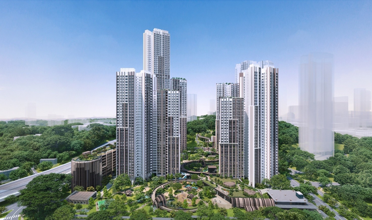
Artist’s impression of the first BTO project next to Outram Park MRT station, at the base of Pearl’s Hill City Park. At over 60 storeys, the development will be Singapore’s tallest public housing project. It will be designed sensitively to respond to Pearl's Hill's unique hilly terrain. (Source: HDB)
Redeveloping brownfield sites
Redeveloping brownfield sites — previously developed land that is no longer used for its original purpose — allows us to recycle and optimise land to meet new needs and support strategic long-term goals.
This enables us to leave undeveloped areas as they are for longer, leverage the existing transport and utility networks in brownfield sites, and rejuvenate older precincts into new vibrant communities. Redevelopment is also carried out sensitively, with careful considerations given to the heritage and character of the area.
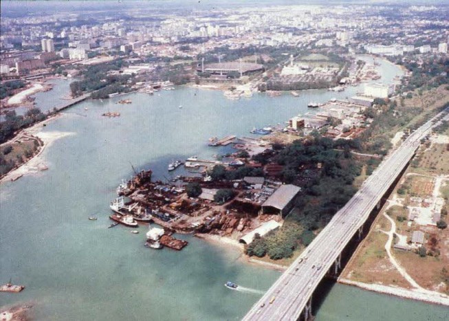
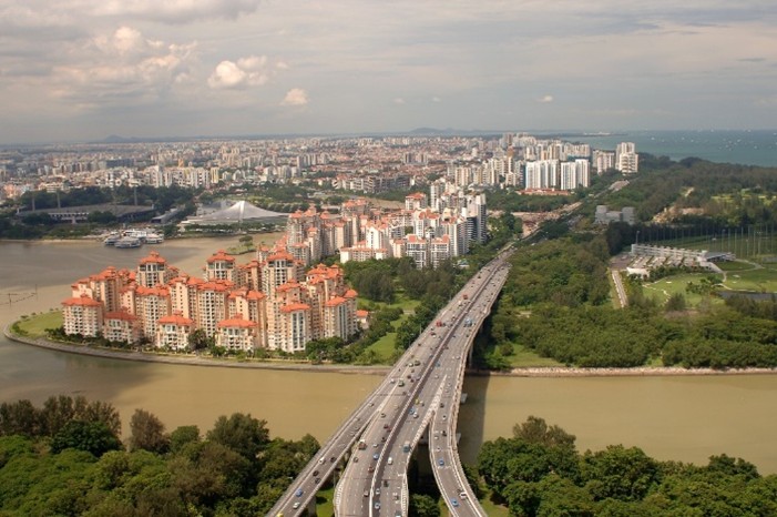
From shipyards to waterfront living
The shipyards that used to be found in Tanjong Rhu were phased out by the mid-1990s and the area was redeveloped for residential use. Today, Tanjong Rhu is a vibrant waterfront neighbourhood with easy access to recreational uses in the area.
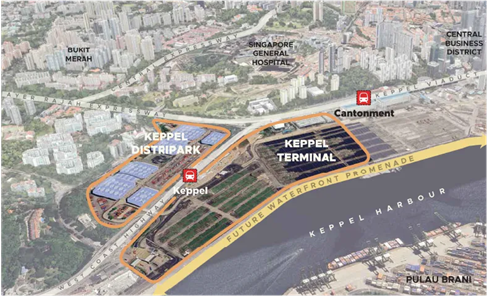
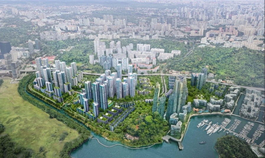
Reimagining the Greater Southern Waterfront
When the container terminals at Tanjong Pagar and at Pasir Panjang relocate to Tuas after 2027 and 2040 respectively, about 1,000 ha of waterfront land will be freed up. This presents an opportunity to transform the Greater Southern Waterfront (GSW) into a new waterfront district for homes, workplaces and recreational spaces. Find out more about the GSW here.
New housing areas within the Greater Southern Waterfront (under study).
Transforming the former Keppel Golf Course site
The former Keppel Golf Course site will see 10,000 new public and private homes, kickstarting the transformation of the GSW.
Artist’s impression of future public housing at the former Keppel Golf Course site. (Source: HDB)
A new future for Paya Lebar Air Base
Paya Lebar Air Base will be redeveloped into a highly liveable and sustainable new town after the air base functions relocate to Changi and Tengah Air Bases from the 2030s. Find out more about the plans for Paya Lebar Air Base here.
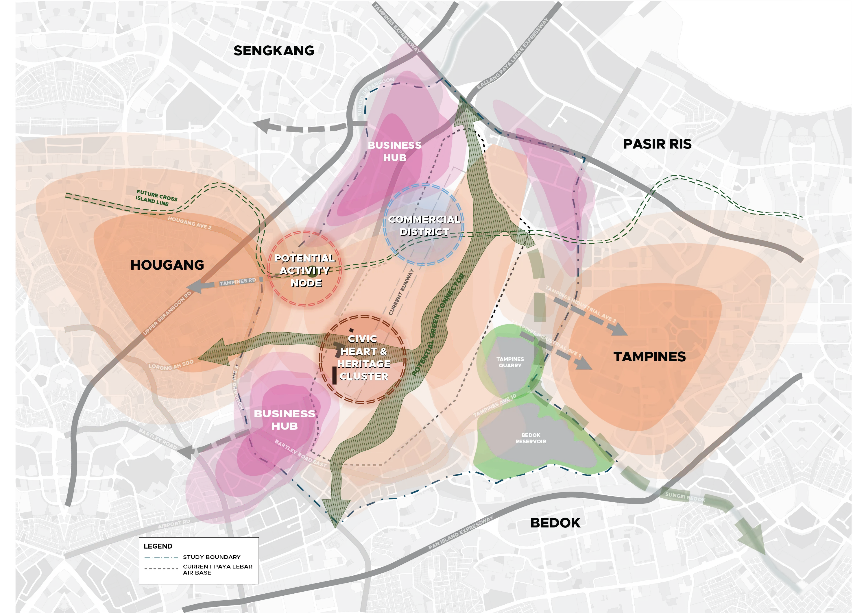
Conceptual plan of how Paya Lebar Air Base could be redeveloped in the future.
Co-locating compatible uses
Co-locating complementary uses within the same development allows us to make better use of land and bring services closer to residents.
Instead of having multiple single-use developments across separate plots of land, thoughtful planning enables different compatible uses to be integrated more efficiently while improving convenience and accessibility.
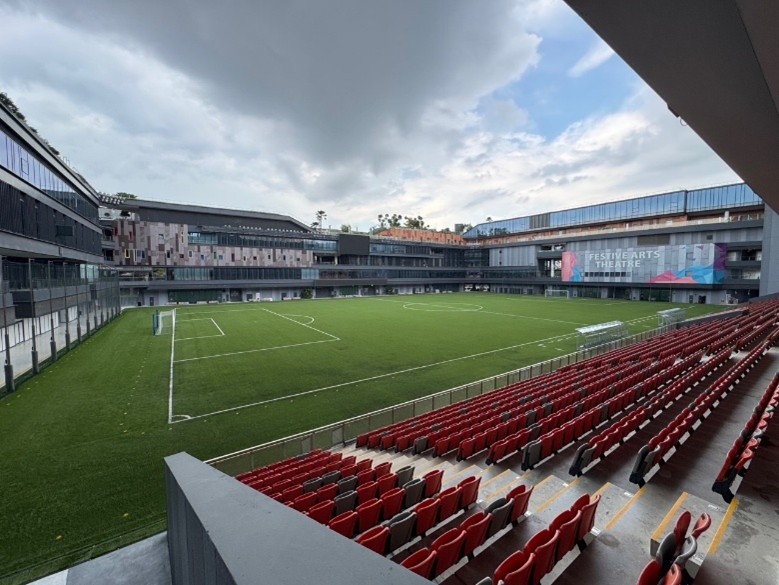
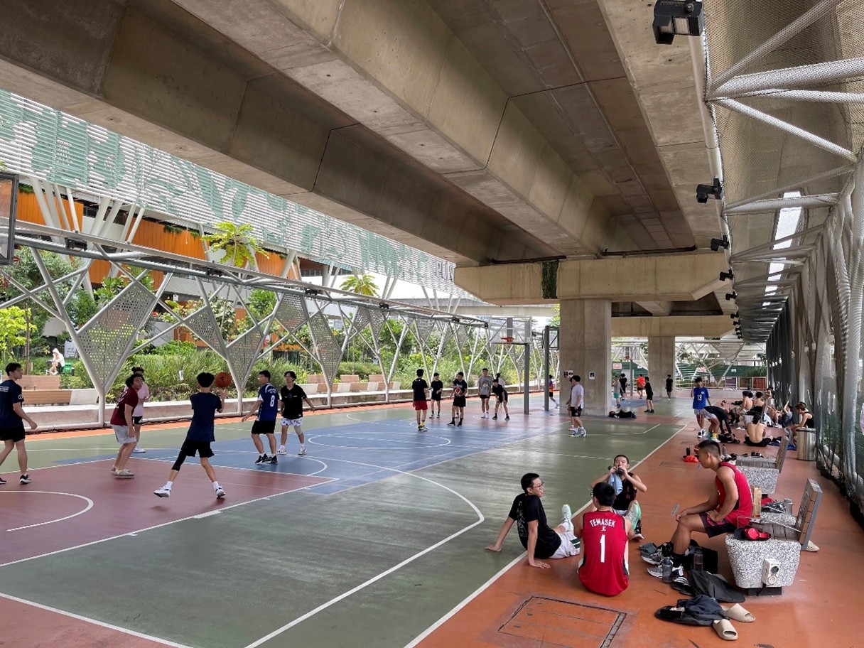
Our Tampines Hub is an integrated development located in the eastern region of Singapore that houses a sports stadium, swimming pool, library, shops and eating places under one roof.
Public facilities are also planned and designed to support multiple functions. Our canals, waterways and reservoirs double up as recreational spaces. Fields and multi-purpose halls in schools are made available for sports and recreational use by the public on weekends. Suitable under-utilised spaces above multi-storey car parks and under viaducts can also be adapted for different community uses.
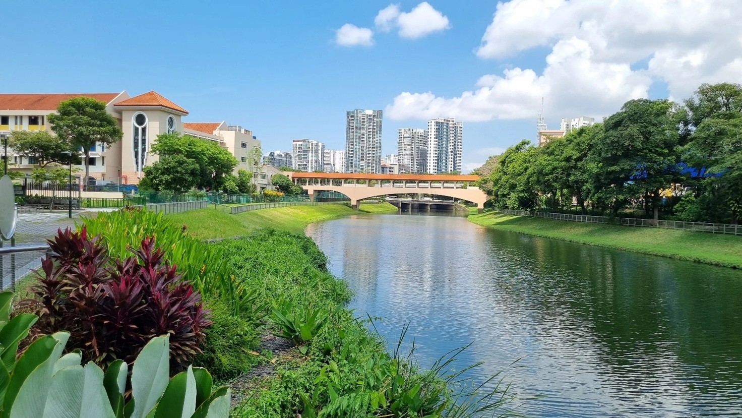
ABC Waters at Kallang River in Potong Pasir.
The under-viaduct space between Punggol MRT and Sam Kee LRT has been transformed into a lively community space.
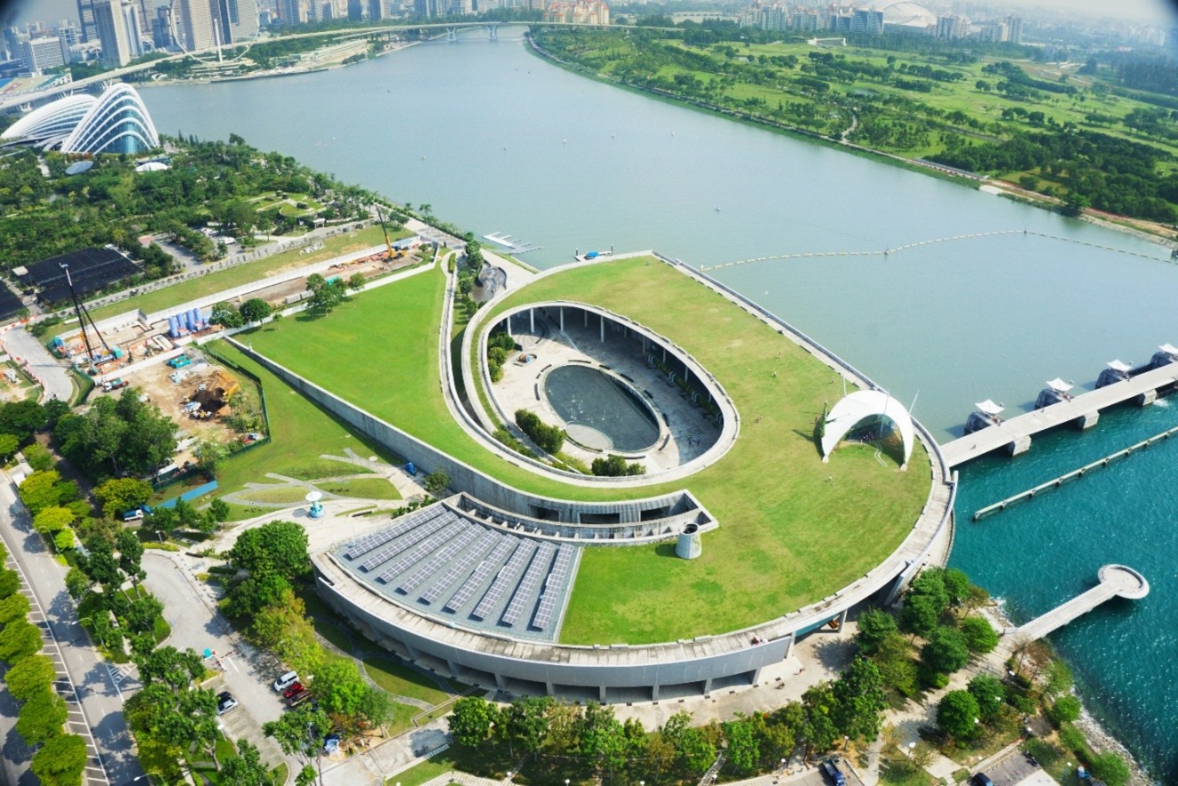
The roof of Marina Barrage also functions as a recreational space with stunning views of the city skyline. (Source: Singapore Tourism Board)
Creating new space underground
Going underground expands our space resources and frees up valuable surface land for more people-centric uses like housing, parks and community spaces.
In Singapore, underground spaces are developed at different depths to support a range of uses, including bringing more convenience and seamless connectivity to people.,
Basement spaces
Shallower basement spaces can house pedestrian links, retail spaces, car parks and utility facilities, while deeper basements can be utilised for MRT stations and water reclamation plants.
Linear infrastructure
Major infrastructure networks for rail, road, water, sewage and electricity are built underground to reduce their impact on the surface environment. Solutions such as Common Services Tunnels (CSTs) and Utility Specific Ducts (USDs) enable multiple utilities to be consolidated, saving space and providing capacity for future infrastructure needs.
Caverns
Built within deep rock to yield large underground spaces, caverns such as the Mandai Underground Ammunition Facility and Jurong Rock Caverns have been developed for storage purposes.
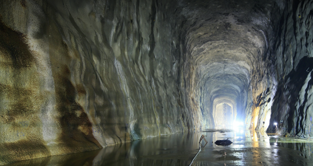
Located at a depth of 150m below the ground, Jurong Rock Caverns is the first commercial underground rock caverns facility in South-east Asia created for the storage of liquid hydrocarbons. (Source: JTC)
There is potential to continue to develop our underground technological capabilities and open up new frontiers of space creation. For example, deeper cavern spaces in Singapore remain largely untapped.
We are actively working with different partners to identify new underground uses, strengthen local capabilities, and develop innovative solutions to unlock more underground spaces.
For more information on our underground strategy, visit the following pages:
Creating new land
Beyond traditional methods of land reclamation, we have been looking at creative and innovative solutions for land creation.
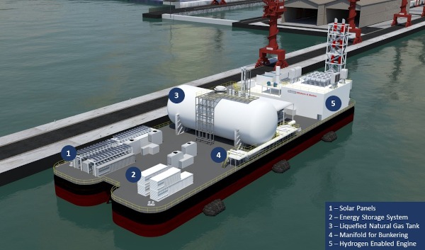
EMA partnered Keppel Offshore & Marine to test-bed Singapore’s first floating Energy Storage System. The project will explore a first-of-its-kind battery stacking solution to reduce land take by up to 40%. (Source: Keppel O&M)
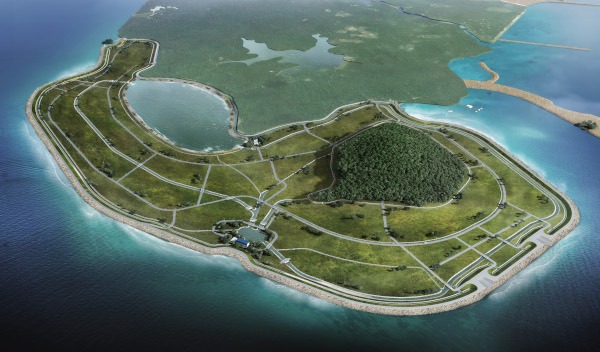
The polder project at Pulau Tekong significantly reduces the need for sand in reclaiming land. (Source: HDB)