
Smart Planning
Explore how we leverage data analytics and geospatial technologies to make more informed planning decisions, deliver better services, and build capabilities for the future of urban planning.
Last updated 15 May 2026
Planners and architects across planning agencies use data analytics and geospatial technologies to gain deeper insights and make more informed decisions in planning for land use, amenities and infrastructure. Through digitalisation, we can deliver better services and outcomes to serve citizens and businesses, and meet Singapore’s long-term planning needs.

Adopting Evidence-Based Urban Planning and Design
We work with agencies to assemble data and conduct analytics, enabling planners to make more informed planning decisions.
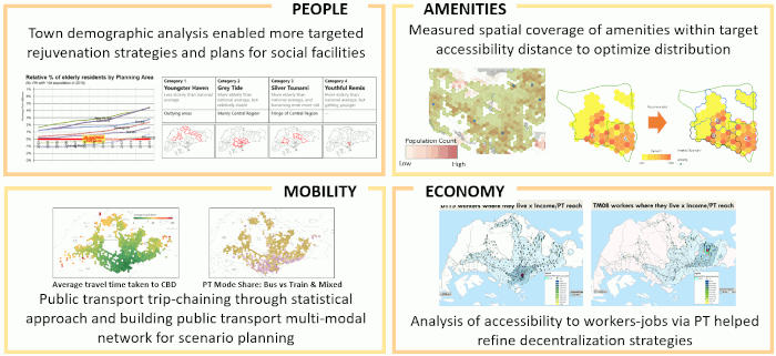
Informing planning decisions with analytic insights
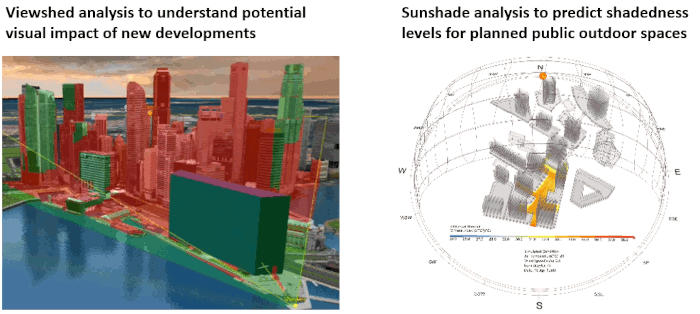
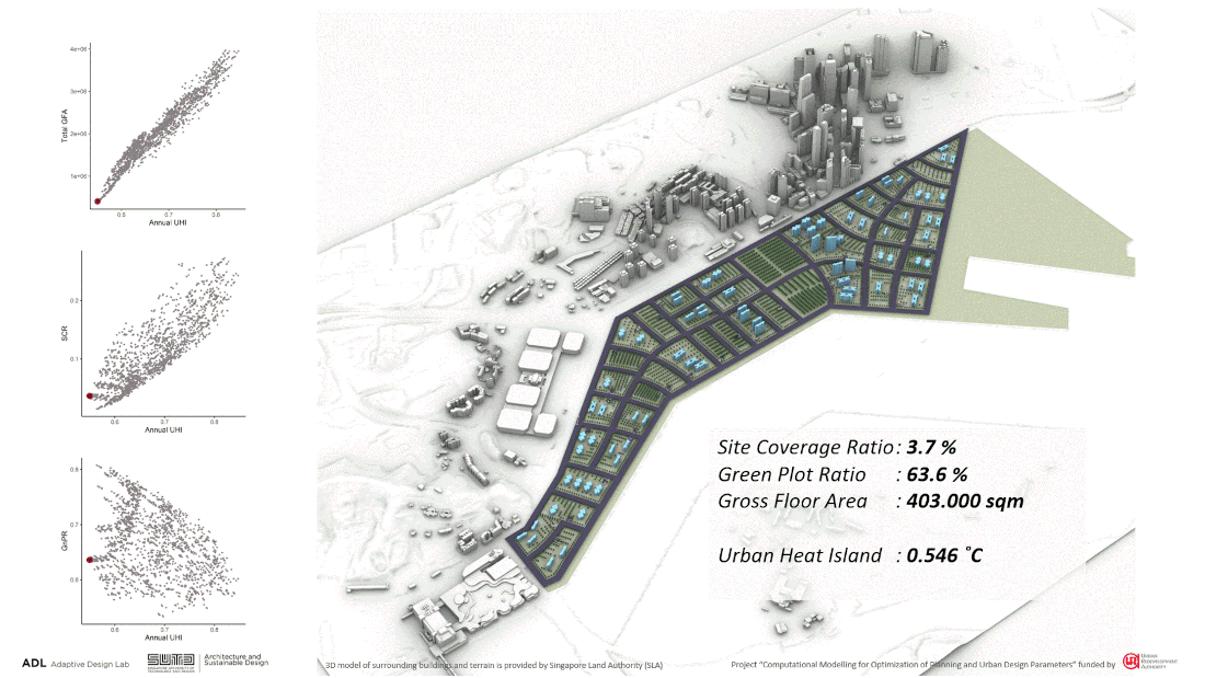
Informing urban design guidelines with analytic insights
Planners also test potential scenarios and solutions before implementation using Modelling & Simulation (M&S) to better anticipate development outcomes. Doing so supports a more holistic planning of land uses for our city.
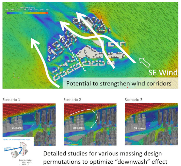
Environmental modelling to determine wind corridors to safeguard in new precincts
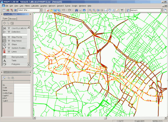
Transport modelling to assess the transport impact of new developments
With growing planning complexities such as having to address climate change and ageing population, integrated M&S is also useful in generating and evaluating a multitude of options quickly and accurately across multiple domains. This will allow planners to better understand trade-offs and identify the optimal range of solutions more effectively.
Read our paper [PDF, 368 KB] to learn more about URA’s vision for integrated M&S and the key initiatives to build up strategic and critical Science & Technology capabilities to advance urban planning and design in Singapore.
Generating various development options with procedural modelling and multi-objective optimisation. (source: Dr Elif Aydin, SUTD Adaptive Design Lab)
Streamlining Workflows with Digital Tools
To support a more data-informed work process, we have developed in-house digital tools and harnessed Artificial Intelligence (AI) technologies to streamline our planning workflows.
ePlanner
ePlanner is a web-based geospatial platform that enables planners across government agencies to quickly visualise planning and 3D data, and run various analytics easily such as buffer analysis, sunshade analysis, line of sight analysis and 3D site simulation. Planners can also quickly simulate various development scenarios for their planning studies.
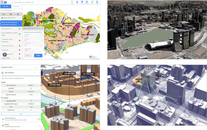
Screenshots of ePlanner user interface
OneTool
OneTool supports our planning workflows by bringing together government agencies to track the implementation of infrastructure projects and map future land use scenarios. With a common and integrated platform, agencies can develop a more holistic picture to formulate plans and coordinate the implementation of infrastructure development.
Smart Urban Planning Assistant
Tapping Natural Language Processing technologies, we developed this tool to identify precedent cases for case evaluation more quickly and accurately.
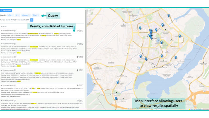
Search engine to quickly identify precedent cases for case evaluation
AI Image Generation
We have adopted AI image generators to create artist impressions for internal design reviews and public engagements, to achieve better outputs while saving time and cost. We also use prompt engineering and train AI image generators to produce images that better reflect Singapore’s urban context.
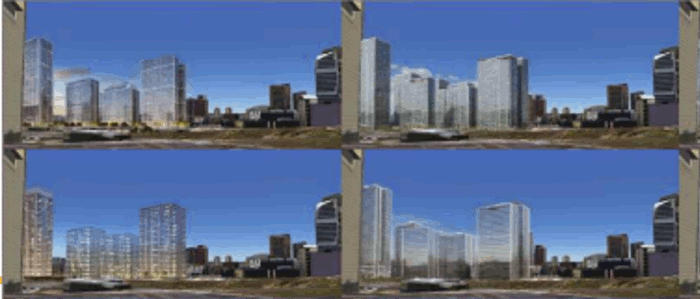
Visuals of a proposed development developed using generative AI
Better Services for the Public, Industry
We have also developed online platforms to make planning and real estate-related information and services more easily accessible for the public and professionals.
URA Space
URA SPACE is a one-stop geospatial platform for professionals, businesses and the public to obtain up-to-date planning and real estate information. Users are able to view current and past Master Plans and site-specific planning information (e.g. Land Betterment Charge rates, past development approvals, urban design guidelines, use of property, private residential property transactions) as well as purchase season parking tickets at URA carparks.
One Stop Developer’s Portal (OSDP)
The OSDP is an integrated platform envisaged to offer a digitalised end-to-end service journey for developers, Qualified Persons, architects, engineers, solicitors and other related users. Through the OSDP, users can conveniently access land administration and regulatory services, from purchasing land to licensing and de-licensing of developers upon completion of the project.
Building Capabilities
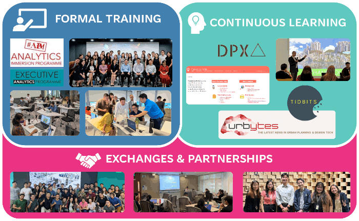
Multi-pronged approach to capability building
People are at the core of our capabilities. We adopt a multi-pronged approach to build a growing community of planners and architects who are trained in data analytics, user experience design and geospatial technologies. This includes trainings, talks and publication of self-help resources.
These initiatives are led by our Design & Planning Lab, a team dedicated to driving digital planning and urban design technology efforts across URA. They also work closely with Government agencies and external partners to develop tools and solutions to tackle Singapore’s urban planning challenges.
Hear what our interns have to say about working at the Design & Planning Lab.
