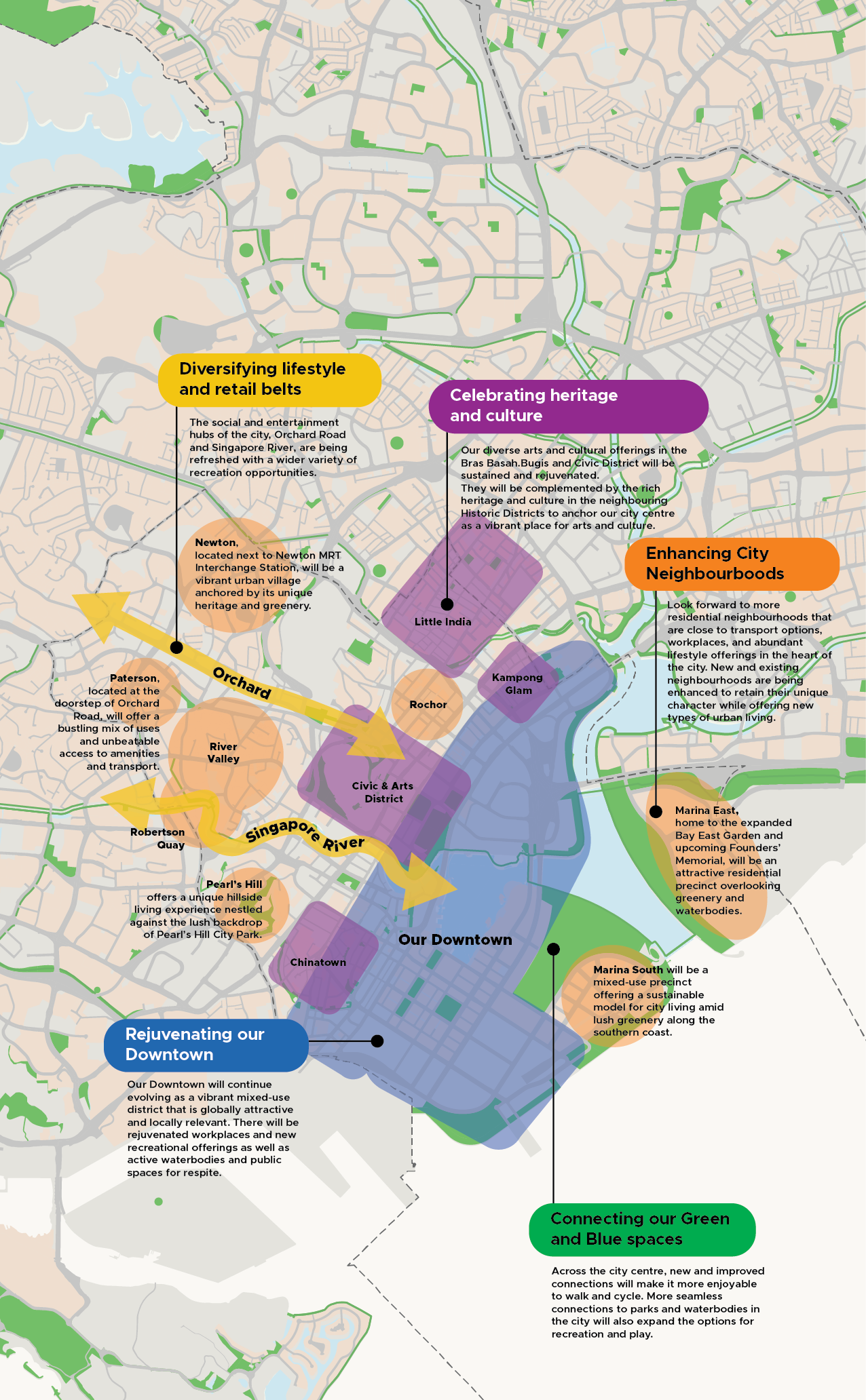
Enhancing City Neighbourhoods
Look forward to more residential neighbourhoods that are close to transport options, workplaces and abundant lifestyle offerings in the heart of the city. New and existing neighbourhoods are being enhanced to retain their unique character while offering new types of urban living.
Last updated 7 May 2026
The dynamic heart of the city
From dynamic business hubs to residential neighbourhoods and lifestyle precincts for recreation, arts, culture, and entertainment, the diverse uses in Singapore’s city centre make it a vibrant place for all.
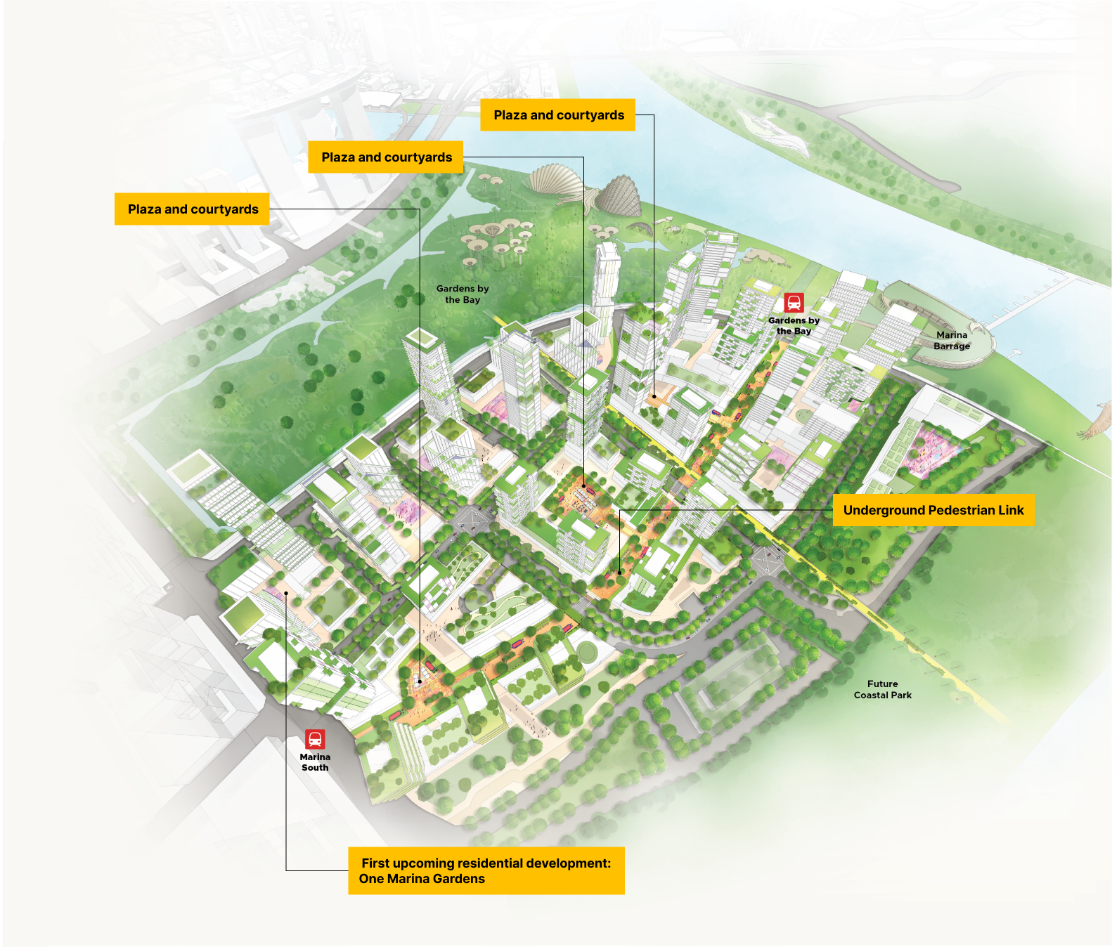
Marina South: A new model for city living
Set amid lush gardens along the southern coast, this 45-hectare mixed-use residential neighbourhood is planned to introduce more than 10,000 new homes.
10-minute neighbourhood
Residents will enjoy excellent connectivity to two MRT stations and amenities for daily needs all within a 10-minute walk. Gardens by the Bay and the Marina Coastal Park will also be a short walk away via the elevated landscaped bridge.
Marina South – A 10-minute neighbourhood.
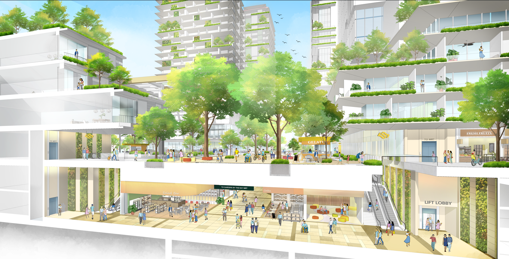
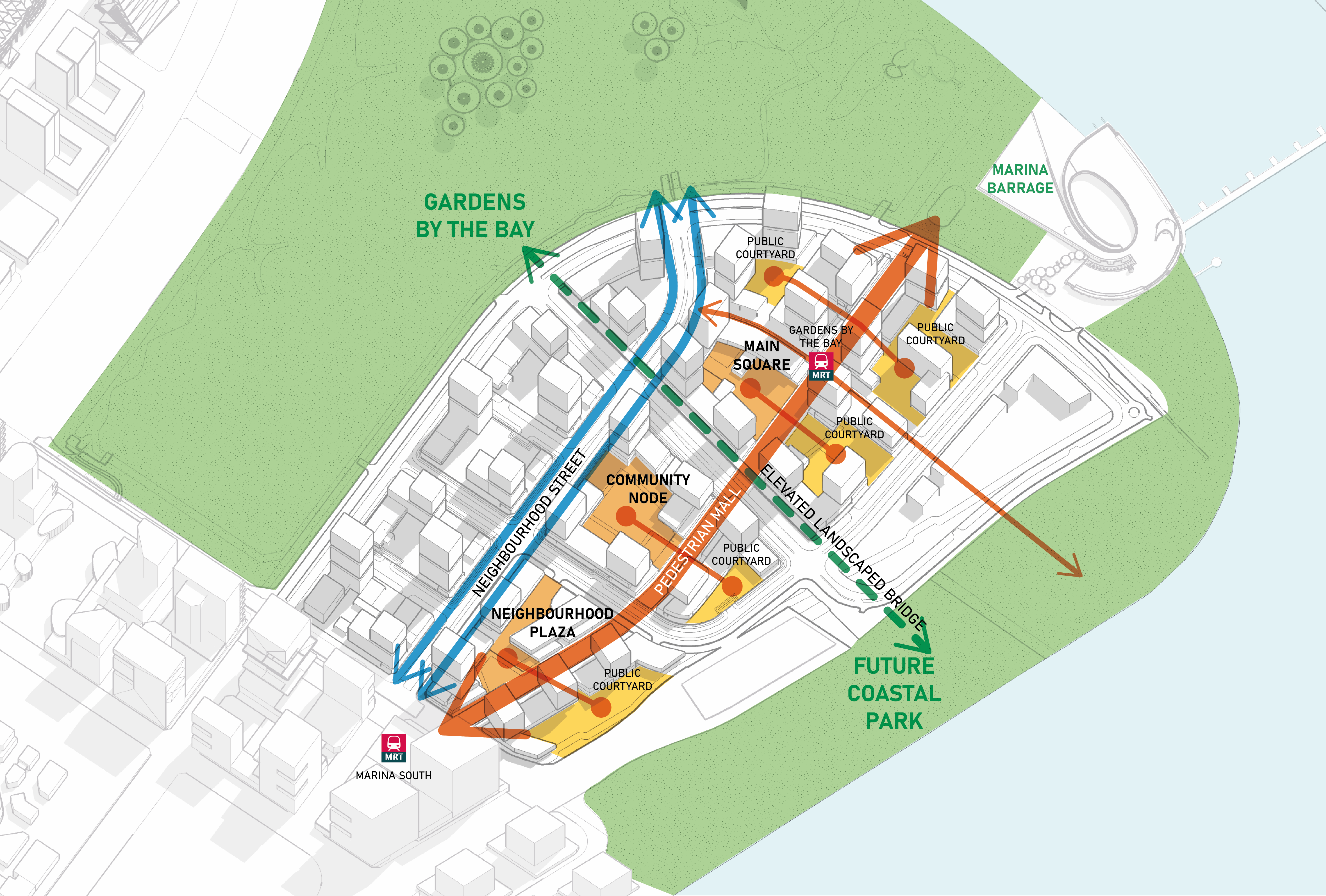
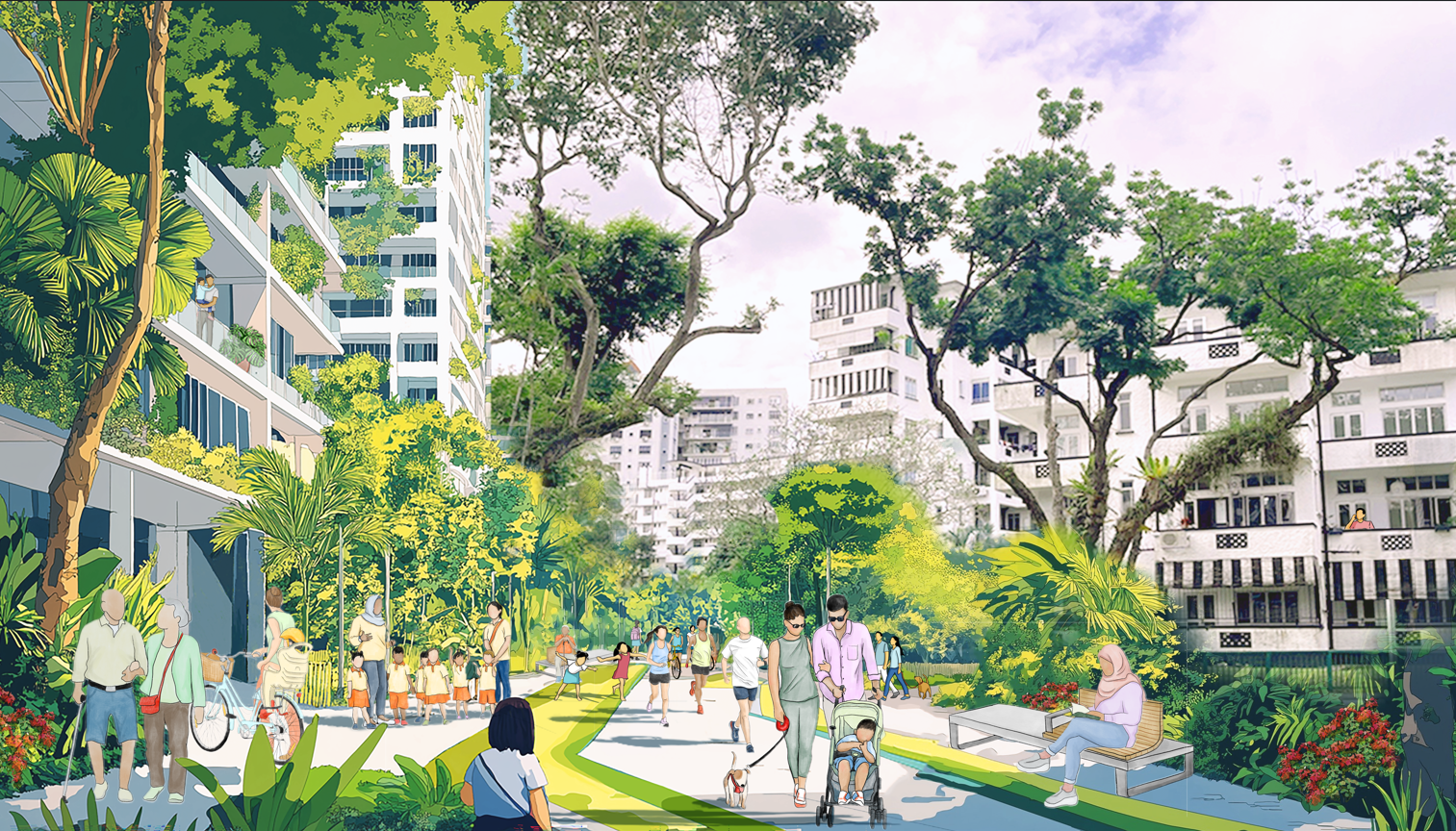
Community-centric neighbourhood for all
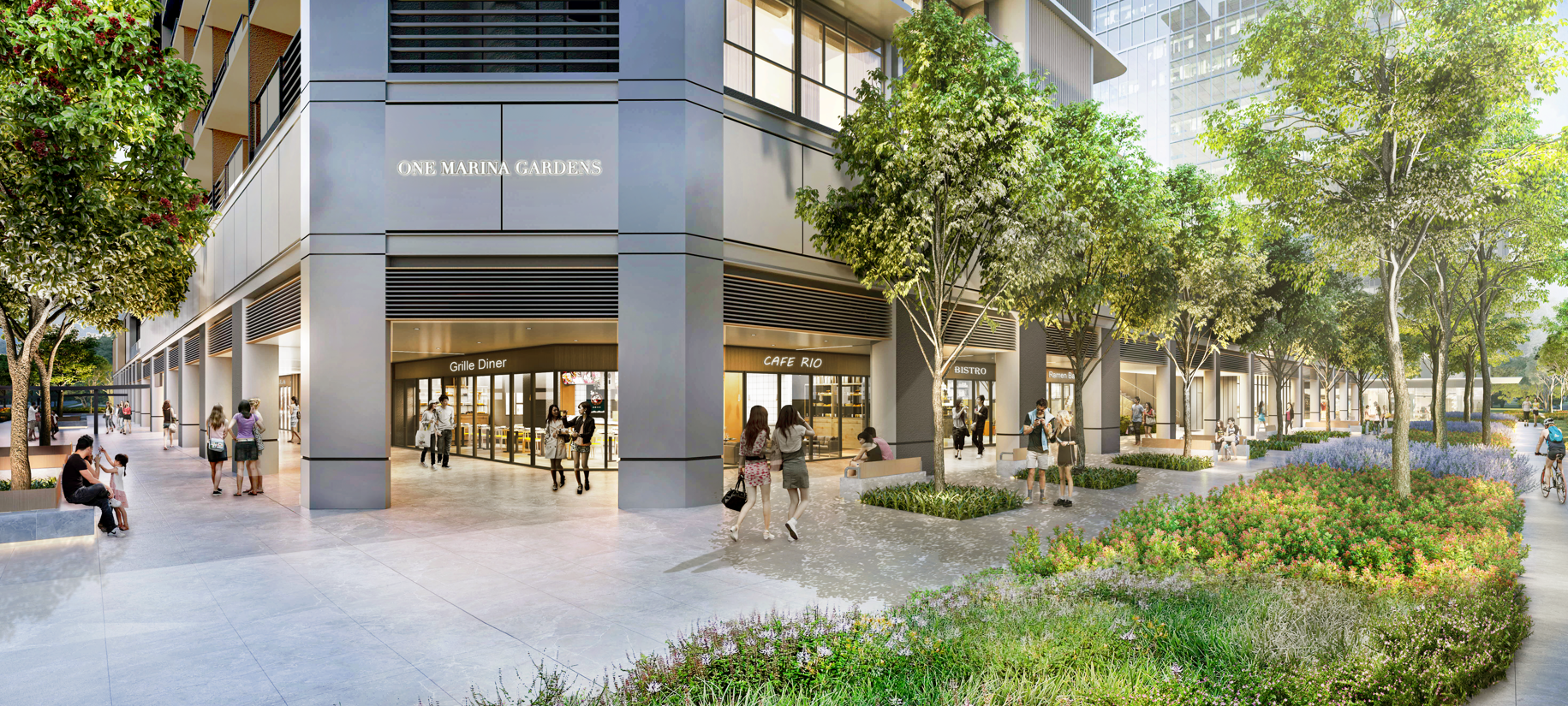
Pedestrian malls, intimate courtyard spaces and friendly neighbourhood streets will form a network of public spaces that serve as “living rooms” for everyday interactions and activities.
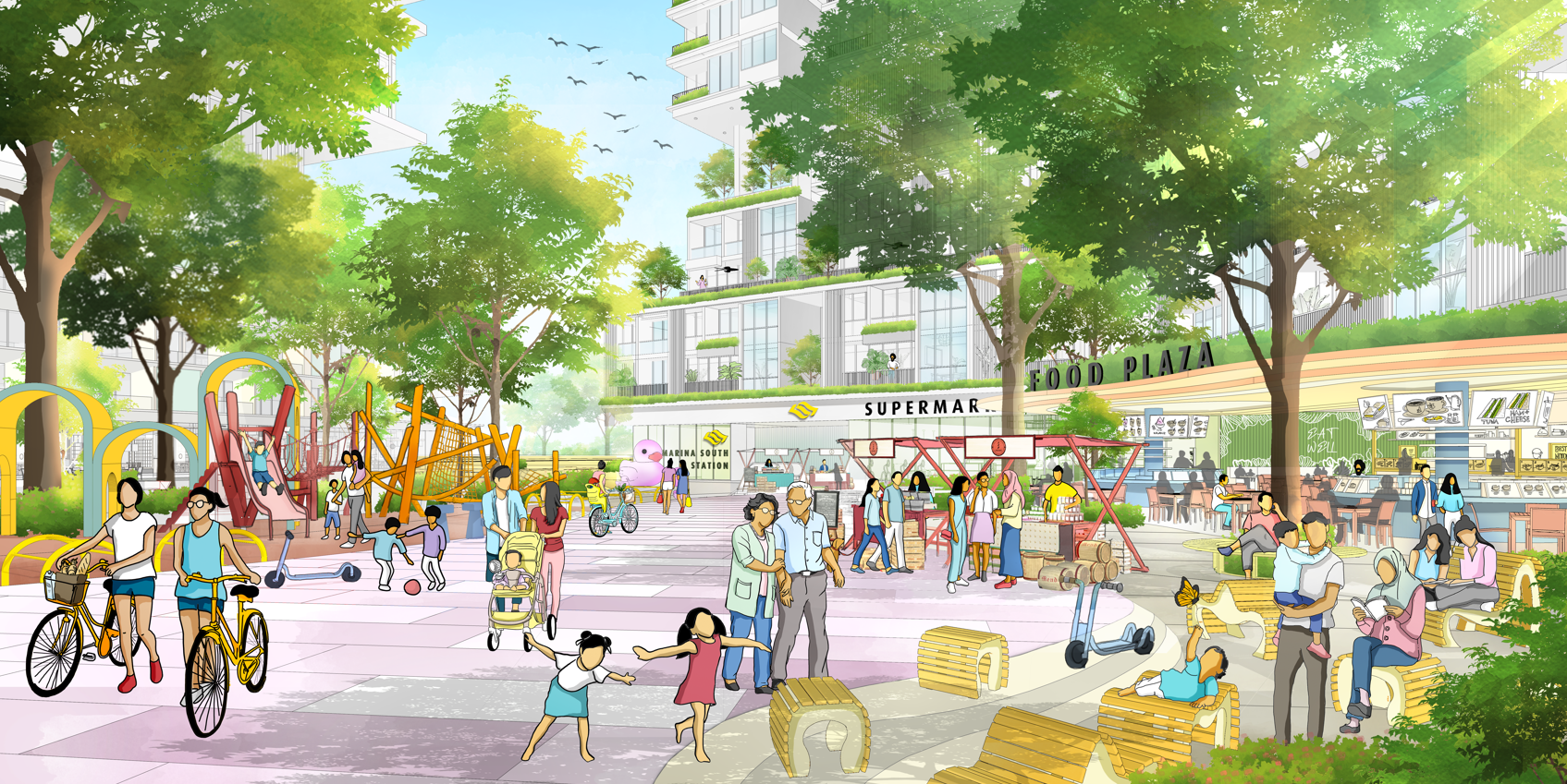
Plazas and courtyards within developments fronting the pedestrian mall provide spaces for events and casual meetups with friends and family.
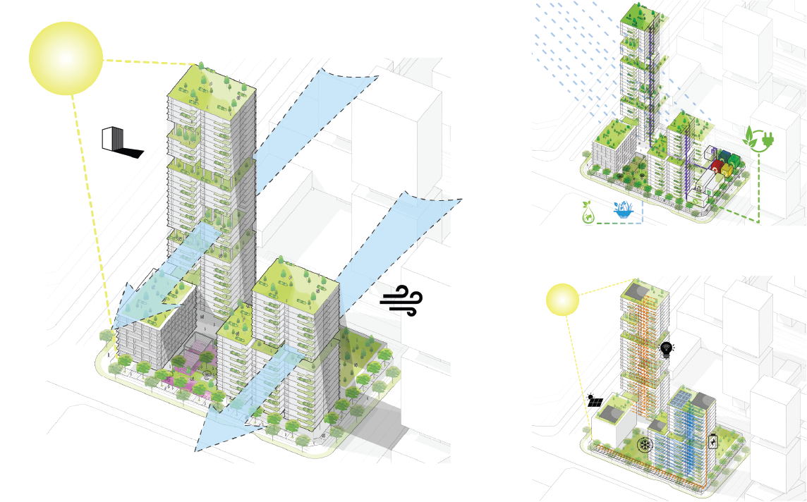
Green, blue and cool
Through environmental modelling, building forms are guided to channel wind to key streets and public spaces to lower ambient temperatures and mitigate the urban heat island effect. Lush greenery will keep streets and social spaces cool, with native plant species to facilitate movement of birds and butterflies!
Sustainable living
Developments are required to be energy efficient and adopt tropical design. Recycling collection points and composting facilities for food waste as well as features for stormwater management are also encouraged.
Future Marina South developments will minimize solar gain and encourage natural ventilation, prioritise energy efficiency and sustainable waste management.
Pearl’s Hill: Hillside Living in the City
As the only other hill in the city besides Fort Canning Hill, the area offers attractive city living set against a backdrop of hilltop greenery topped by the historic Pearl’s Hill City Park.
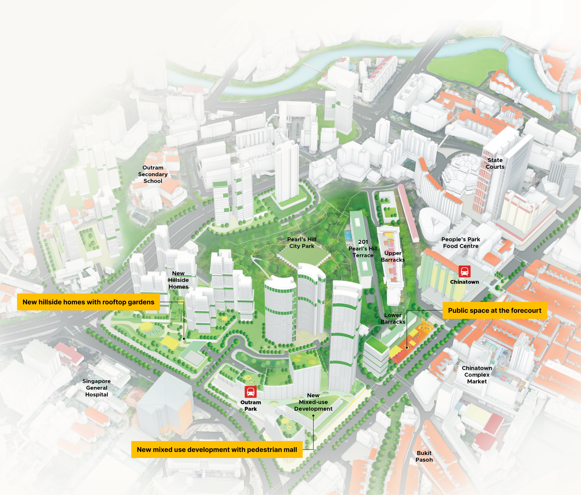
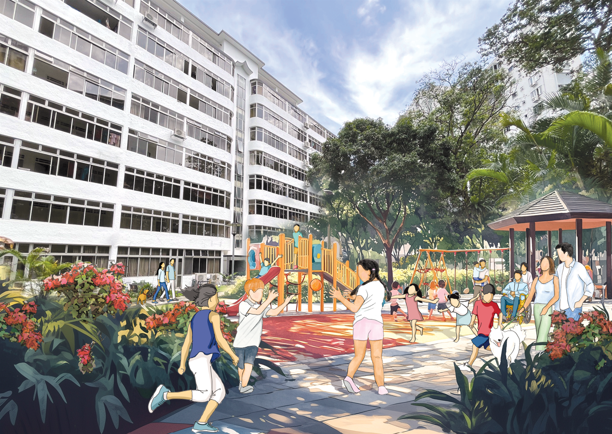
Diverse homes, inclusive living
Pearl’s Hill will get a new lease of life with some 6,000 new homes at the foothills and a new mixed-use development on top of the Outram Park MRT station. There will be a variety of public and private housing with amenities and public spaces nestled amid lush greenery for community interaction.
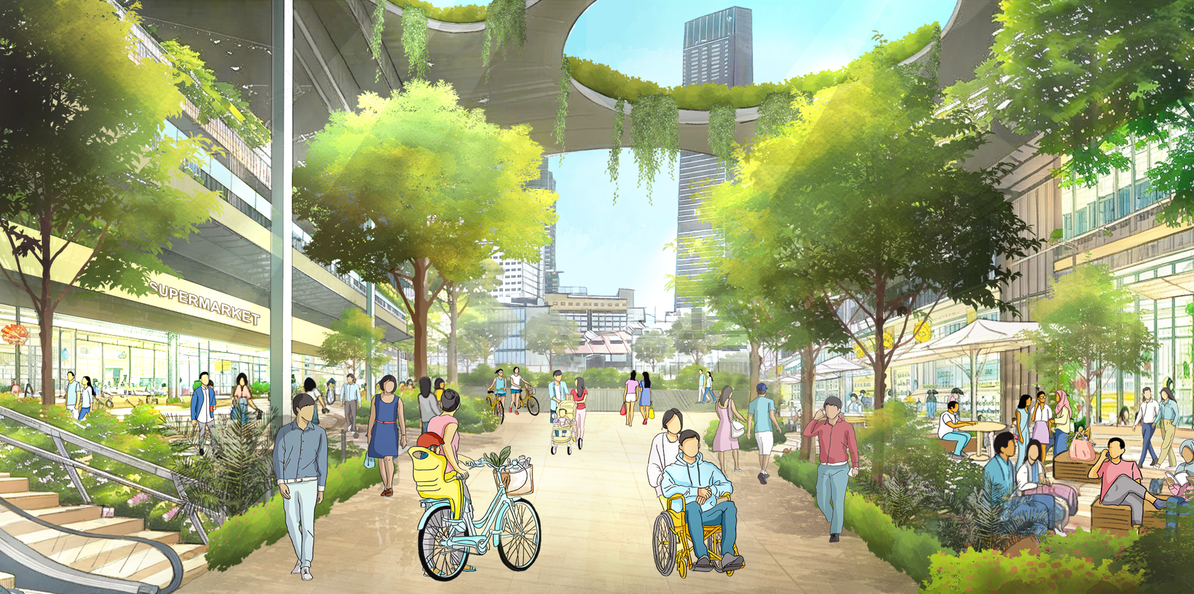
A planned Pedestrian Mall at the future integrated mixed-use development will provide easy access from Outram Park MRT station towards Eu Tong Sen Street and Chinatown.
A lush, hillside environment
Stepped building forms with sky gardens and roof terraces will offer views to the hill park and reinforce the experience of hillside living in the city.
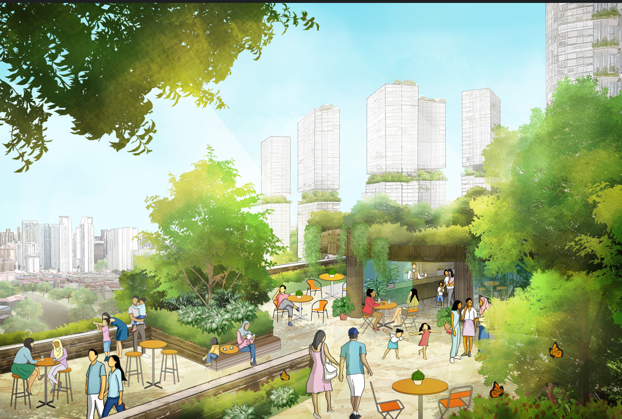
Terraced buildings, sky terraces and rooftop gardens offer vantage points for residents to enjoy views to and from the hill park.
Connected spaces, connecting places
The new neighbourhood is Walk Cycle Ride (WCR)-focused and will be well connected to public transport. A network of ground-level and elevated connections will link residents conveniently to Pearl’s Hill City Park as well as the surrounding precincts, such as Robertson Quay and Chinatown. There will also be a Hill-to-Hill Corridor connection to Fort Canning Park!
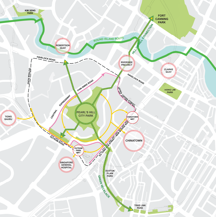
Parl's Hill Connectivity Plan
Celebrating the hill’s history
The former police barracks, being part of the Police Heritage Trail, offer opportunities for inventive reuse with a mix of lifestyle uses and accommodation options.
There are also plans to turn the forecourt of the Lower Barracks into a new community space along Eu Tong Sen Street. Connectivity enhancements will be introduced to improve public access to the heritage enclave, facilitating visitors’ appreciation of the area’s rich heritage.
A nearby State property at 201 Pearl’s Hill Terrace will support the Housing and Development Board’s Parenthood Provisional Housing Scheme by temporarily housing families awaiting the completion of new flats.
A public space at the forecourt of the Lower Barracks will provide residents and visitors opportunities to explore and develop a greater appreciation of the area’s heritage.
Newton: An Urban Village for the Community
A unique mixed-use urban village, integrated with lush greenery, heritage and identity is set to be developed next to Newton MRT Interchange. Planned with 5,000 new homes around Newton Circus, Scotts Road and Monk’s Hill, residents will be well-served by public transport networks, parks, and amenities offered by new mixed-use developments. The area’s rich historical context will also make Newton a distinctive node along the Inner Ring Identity Corridor.
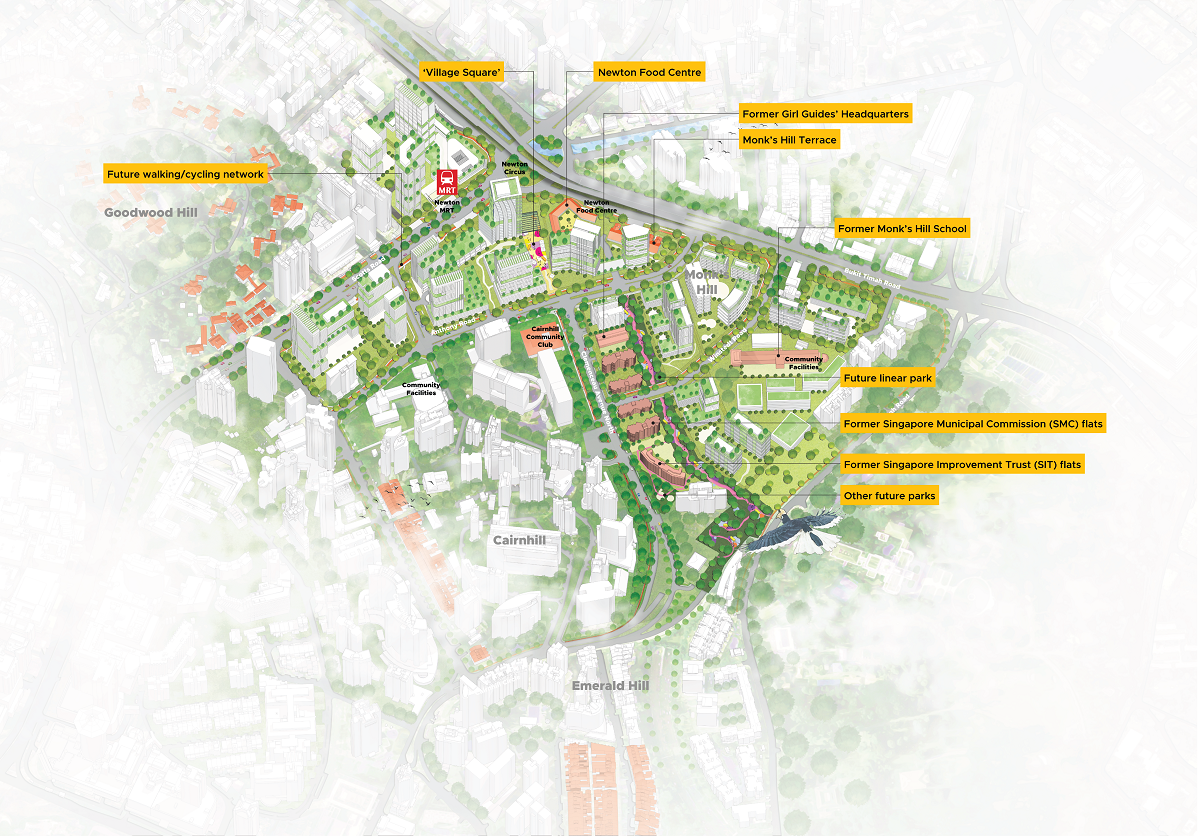
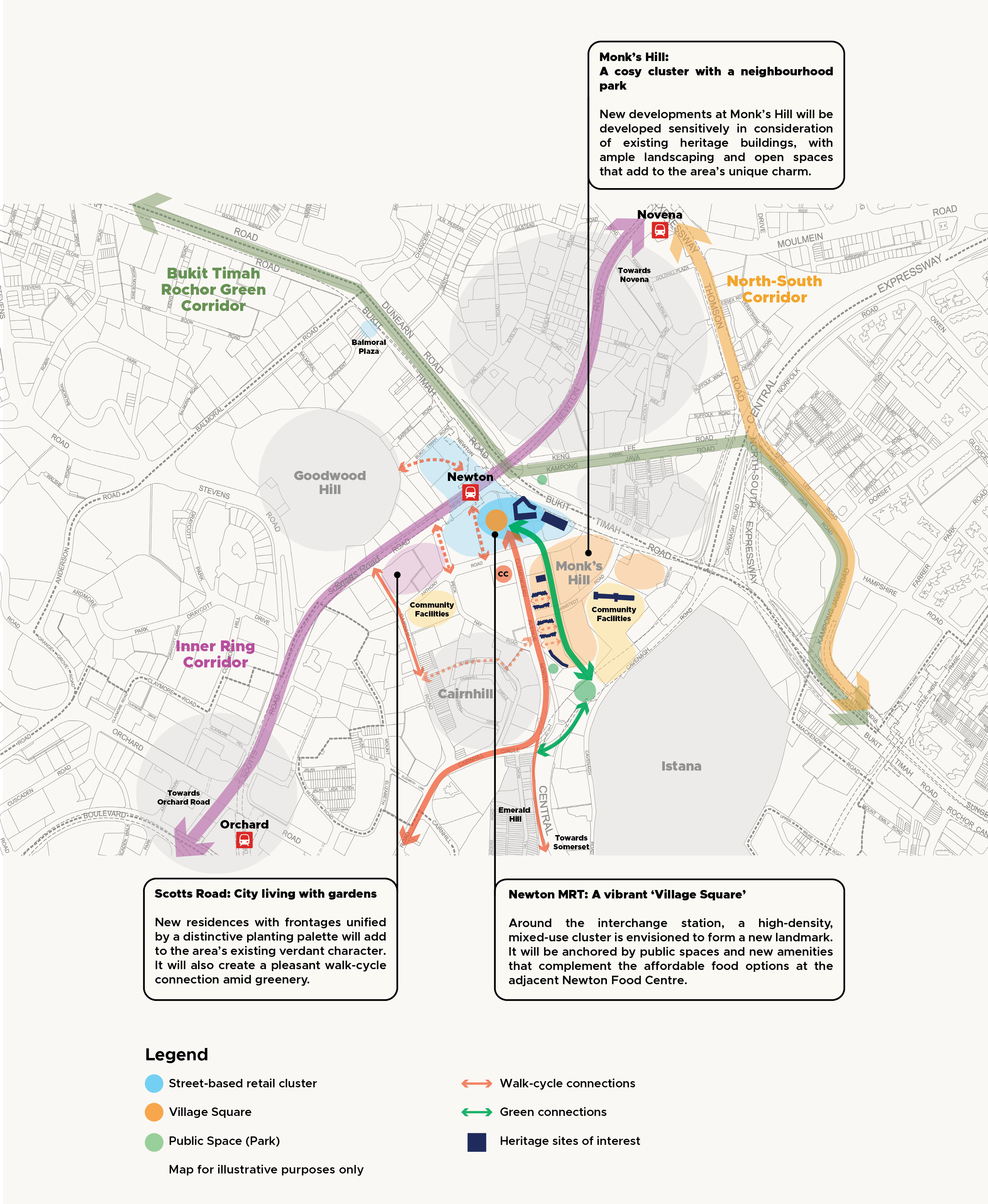
A distinctive urban village
Leveraging the area’s rich heritage and lush greenery, the Newton precinct will feature three distinct clusters, each providing a unique community living experience.
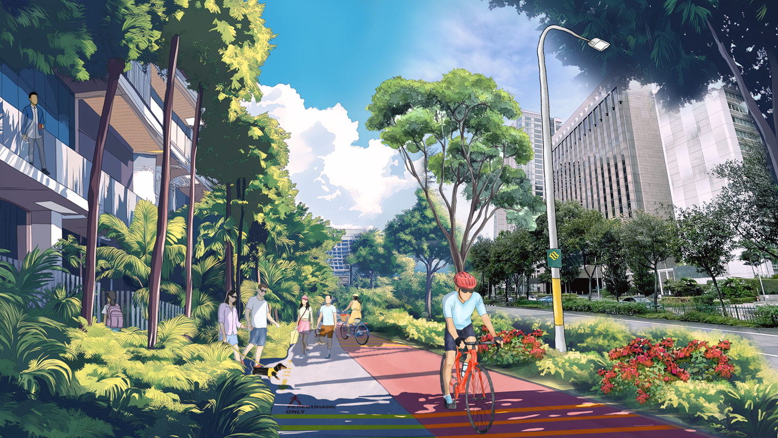
Linking up the neighbourhood - Walking, cycling, and access to recreation options will become more convenient with new connections to the future North-South Corridor, Orchard Road, and other nodes along the Inner Ring Corridor.
Embracing Newton’s rich history and identity
A selection of State properties unique in heritage and identity will be sensitively integrated within the new neighbourhood to create a charming and endearing sense of place.
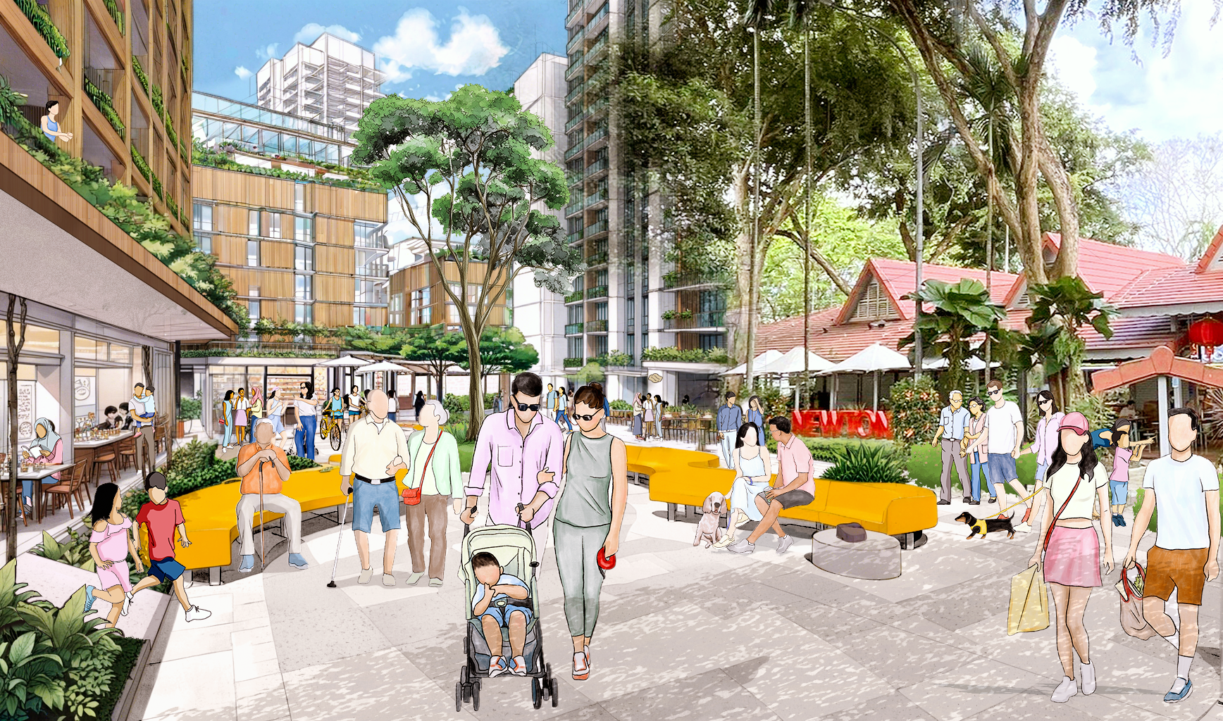
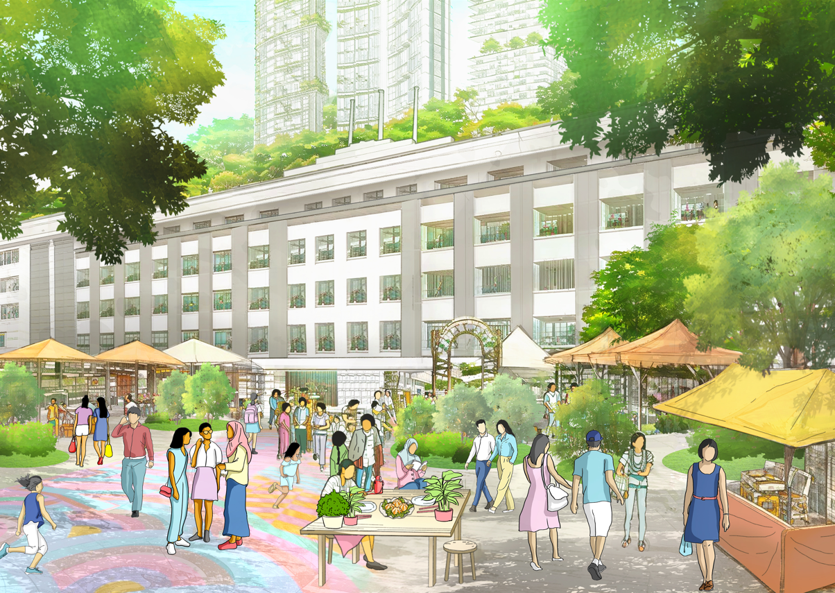
Introducing a welcoming “Village Square” - A new amenity node with a central public square has been planned next to Newton MRT Interchange Station, complementing the nearby Newton Food Centre, which will be retained as a familiar community node.
More spaces to connect
A variety of new public spaces will be created to give both existing and new residents opportunities to unwind and interact as a community.
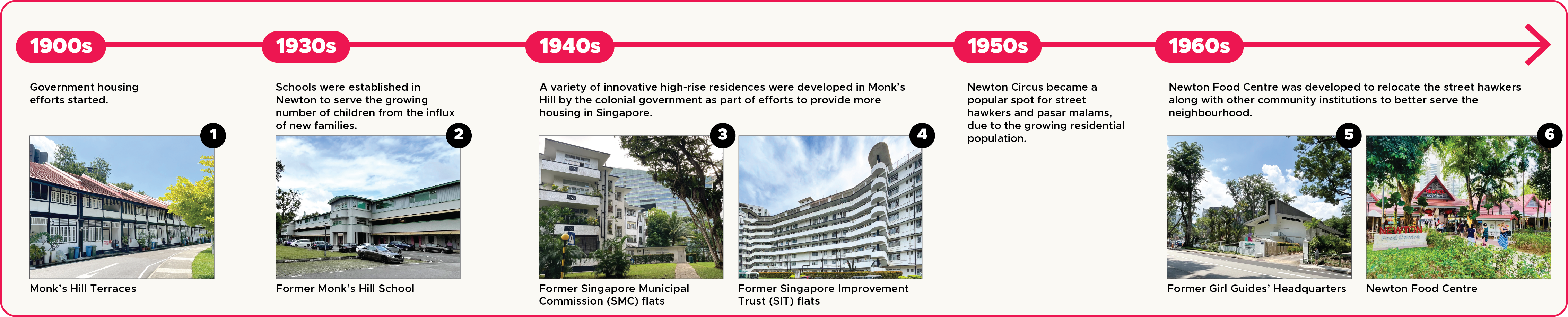
Newton's heritage: From Plantations to Homes
Since the 1900s, Newton has evolved from a place of nutmeg plantations into a residential precinct. Several of its unique heritage properties will be retained and integrated with new developments to create an endearing neighbourhood.