
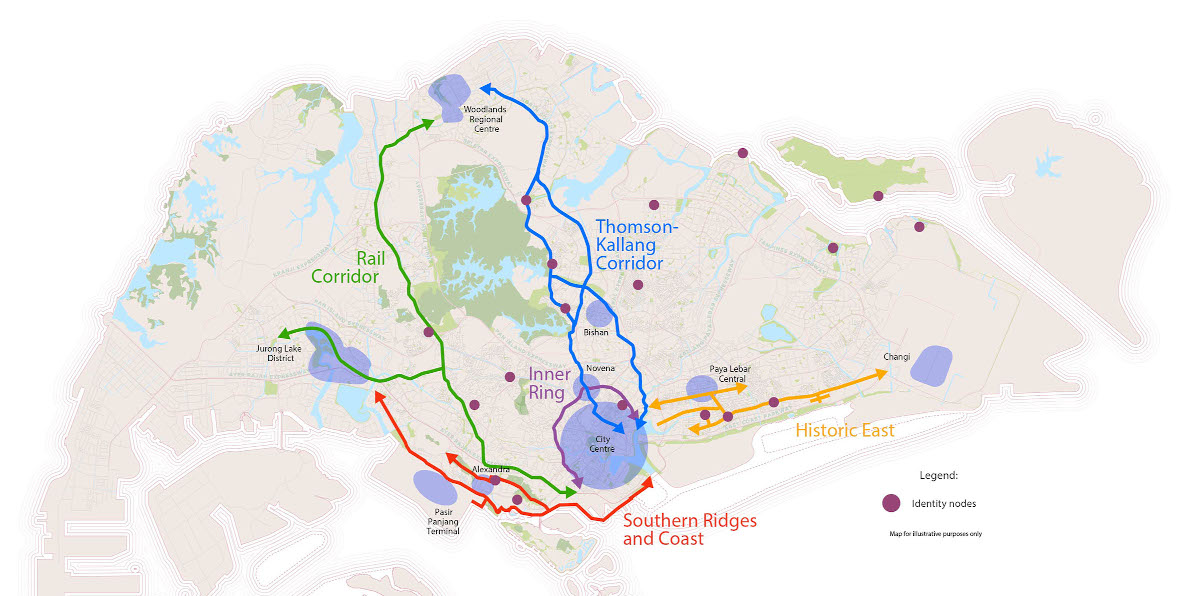
Identity Corridors
These distinctive corridors around our island have a strong identity and character that resonates with residents and visitors.
Last updated 25 May 2026
We will develop strategies to preserve their appeal, and strengthen walking and cycling infrastructure along them, so that they will continue to be well used and loved by future generations.
Which corridor is close to your heart?
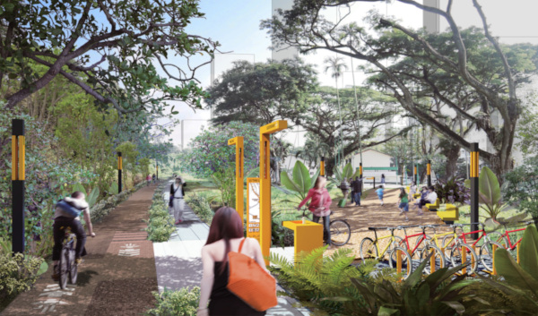
Thomson-Kallang Corridor
Green gateways with charming urban villages and community nodes
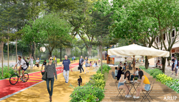
The North-South Corridor will have community spaces and lush greenery developed along it. © LTA / ARUP
Public spaces along the North-South Corridor will be co-created with the community, while Kallang River will have improved accessibility, enhanced landscaping to restore habitats and promenade spaces for recreation.
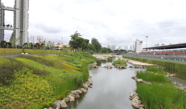
Stretches of the Kallang River have been enhanced under the Active, Beautiful, Clean Waters Programme
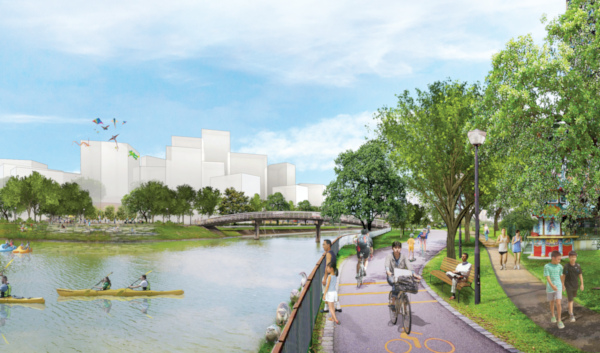
Future developments along the Kallang River will relate sensitively to the waterfront
Rail Corridor
A green spine with rich heritage for recreation, community and nature
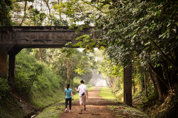
The Rail Corridor has been transformed into an inclusive community space that retains the unique identity of the former railway line. © STB, Lim Wei Xiang
Besides on-going works to enhance accessibility and greenery along the main 24km route, there will be opportunities to co-vision with the community to develop activity nodes along the Rail Corridor. Urban design guidelines will guide adjacent development plans along this corridor to ensure that they complement and contribute to its green character and experience. There are also plans to study the Old Jurong Line and Jurong Lake District, as part of this corridor.
Urban design guidelines will be developed to enhance the green character of the Rail Corridor, including where it converges with Tanglin Halt. © URA / Nikken Sekkei Ltd
An upcoming park at Silat Avenue will provide easy access to the Rail corridor. © ADDP Architects LLP
Historic East
A charming network of cycling streets and neighbourhoods extending to the East Coast
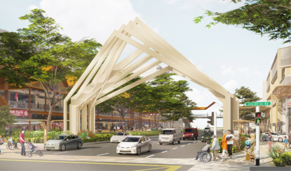
A future landmark archway will be developed along Changi Road © BDP Architects (Southeast Asia) Pte Ltd
The Geylang Serai Cultural Belt will rejuvenate the area around Geylang Serai Market with a new festive plaza, a landmark archway and new cycling paths. Walking and cycling enhancements are also under study along the rest of the Geylang-Changi Road corridor.
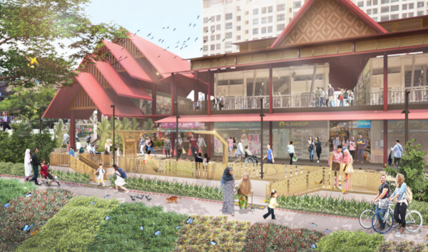
The public realm in front of Geylang Serai Market will be refreshed as part of the competition winning design for the Geylang Serai Cultural Precinct. © BDP Architects (Southeast Asia) Pte Ltd
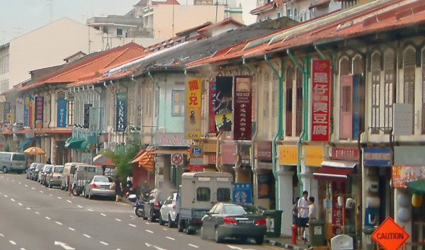
The low-rise, historic character of Geylang–Changi Road will be reinforced through urban design guidelines. © Wikimedia, photo by Calvin Te
Southern Ridges and Coast
A coastal corridor along the Greater Southern Waterfront with rich heritage
An approximately 10km-long coastal promenade will connect Marina Barrage to the Southern Ridges. We will seek ideas from the public to shape the promenade into a distinctive public space that connects the Greater Southern Waterfront to its surrounding area.
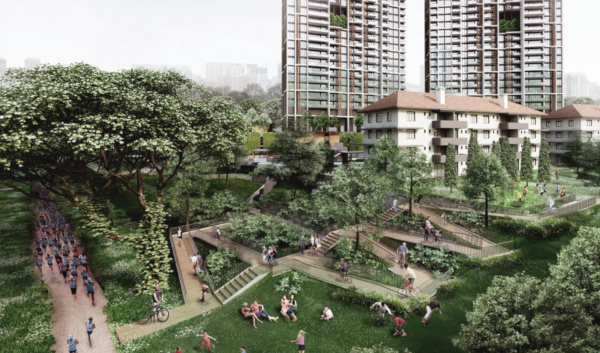
Inner Ring
A revitalised Inner Ring Corridor to connect the city fringe districts
More walking and cycling spaces could be introduced to encourage people to explore the different neighbourhoods along this corridor that runs along Zion – Kim Seng – Scotts – Newton – Moulmein – Balestier – Lavender – Crawford Roads.