
INPAC
INPAC is a centralised digital platform for planning and coordinating Singapore's underground utilities. Learn how it streamlines consultation and supports smarter infrastructure planning.
Last updated 16 June 2026
The Infrastructure Network Planning and Alignment Clearance (INPAC) platform is a centralised digital consultation system that supports the planning and implementation of Singapore’s infrastructure network and underground utilities laying projects.
INPAC enables the appointment of the Lead Implementing Agency (LA), facilitates multi-agency consultations, and supports the sharing of infrastructure mapping data across government agencies. It leverages GIS-based data analytics to streamline the process of identifying new utility corridors, enhancing efficiency and decision-making.
Streamlining coordinated consultation
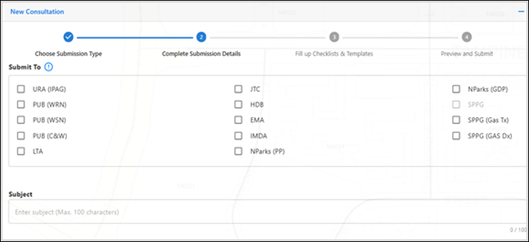
INPAC features a streamlined consultation process by enabling users to consult multiple agencies simultaneously. Cases are routed to the relevant agency and case officers, with standardised response timelines and automated reminders to keep consultations on track. This ensures timely feedback and early resolution of conflicting requirements across participating agencies.
Complete underground information at your fingertips
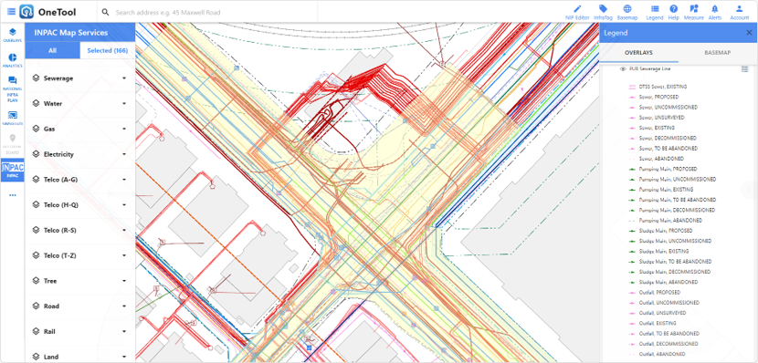
INPAC’s comprehensive underground utility map service speeds up project planning by providing planners with early access to key site information. This includes information on utilities that are due for renewal or abandonment, critical underground infrastructure like railway and cable tunnels, and consolidated past ground investigation reports such as trial trench and borehole reports.
This integrated map of both existing and planned utilities from all infrastructure agencies enables planners to identify constraints early and design more effective solutions for new utility alignments.
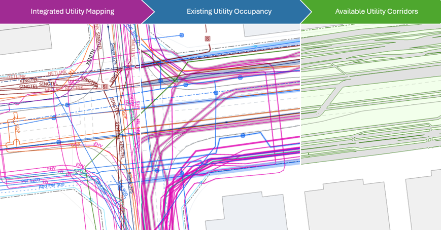
Towards smarter infrastructure planning
By digitalising utility maps, INPAC enables the development of analytical tools such as space occupancy analysis and 3D clash detection. These capabilities help agencies analyse projects more accurately and quickly vis-à-vis overlapping utility plans and constraints, determining the best path that optimises space and works while future-proofing subterranean space for future needs.