
Enhanced Site Investigation
Discover how underground utility mapping is enhanced through advanced scanning technologies and comprehensive site surveys.
Last updated 12 June 2026
Enhancing site investigations
Accurate and reliable underground data is essential for effective planning and implementation of infrastructure. Under the Major Infrastructure Workflow, enhanced site investigation methods are used to improve the accuracy and accessibility of underground utility records through advanced technology and comprehensive methodologies to map underground utilities.
How it works
To provide a more accurate utility mapping and reporting, the workflow uses a systematic process, encompassing digital data collection, comprehensive site surveys as well as detailed documentation and analysis using advanced underground scanning technology.
Advanced non-invasive geo-referenced technologies such as the Multi-Channel Ground Penetrating Radar (MCGPR) and Active Electro-Magnetic Locator (EML) are required under the Major Infrastructure Workflow. Such enhanced methodologies provide better visibility of what lies beneath the ground, reducing the need for exploratory trial trenches while making necessary trenches more targeted and effective.
During excavation works, advanced mapping technology such as the Geolocated Point Cloud (GPC) is adopted to create precise digital records of exposed utilities and newly constructed utilities with accurate 3D positioning data. This ensures that underground utilities are properly identified, geo-referenced and documented before the trench is covered up.
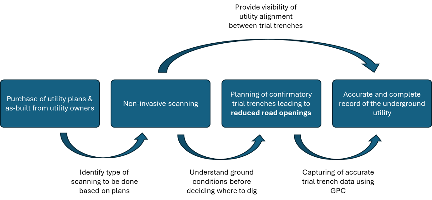
The workflow also helps to capture data inaccuracies in existing utility records to enable Utility Owners to update their utilities plans. This improves the quality and reliability of underground data over time.
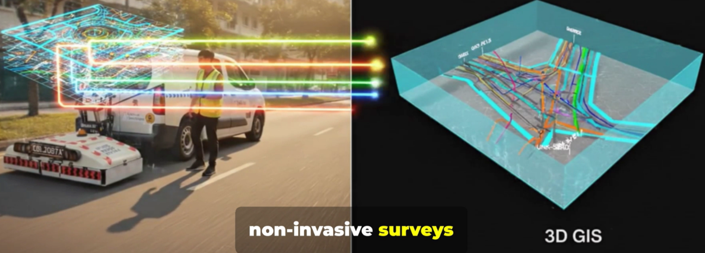
Images were created with the assistance of AI for Illustration purposes only
Smarter planning, better coordination
The implementation of this enhanced workflow brings significant advantages to Singapore's infrastructure development.
More accurate underground data supports better planning, minimising costly construction delays and rework. Better visibility of underground utilities also improves safety, protecting workers and existing infrastructure.
By leveraging technology, we are able to plan infrastructure more efficiently to support Singapore’s continued development, and improve the lives of Singaporeans through better project delivery and reduced disruption to daily life.

(Image created with the assistance of AI for Illustration purposes only)