
Convenient & People-Centric Journeys
Explore plans for a sustainable and well-connected transport system, with expanded rail network, enhanced bus connectivity and greener travels.
Last updated 4 June 2026
Connecting people and places sustainably
Improving public transport connectivity across Singapore will make it faster and easier for more to travel on bus, rail and active modes. The reduced reliance on private vehicles means more can choose to walk, cycle or ride public transport, and lead healthier, more sustainable lifestyles.
Growing the rail network
Rail continues to be the backbone of our public transport system, playing a vital role to connect people and places. With the opening of new rail lines and stations, 8 in 10 households will be within a 10-minute walk from a train station by the 2030s.
View larger map of existing rail network
View larger map of upcoming and future rail network
View larger map of proposed rail lines under study
Faster travels in the east
Since Thomson-East Coast Line Stage 4 (TEL4) opened on 23 June 2024, residents along the East Coast have been enjoying convenient access to the rail network. They also enjoy significant time savings. A ride from Marine Parade to Shenton Way now takes only 20 minutes, half of what it used to take!
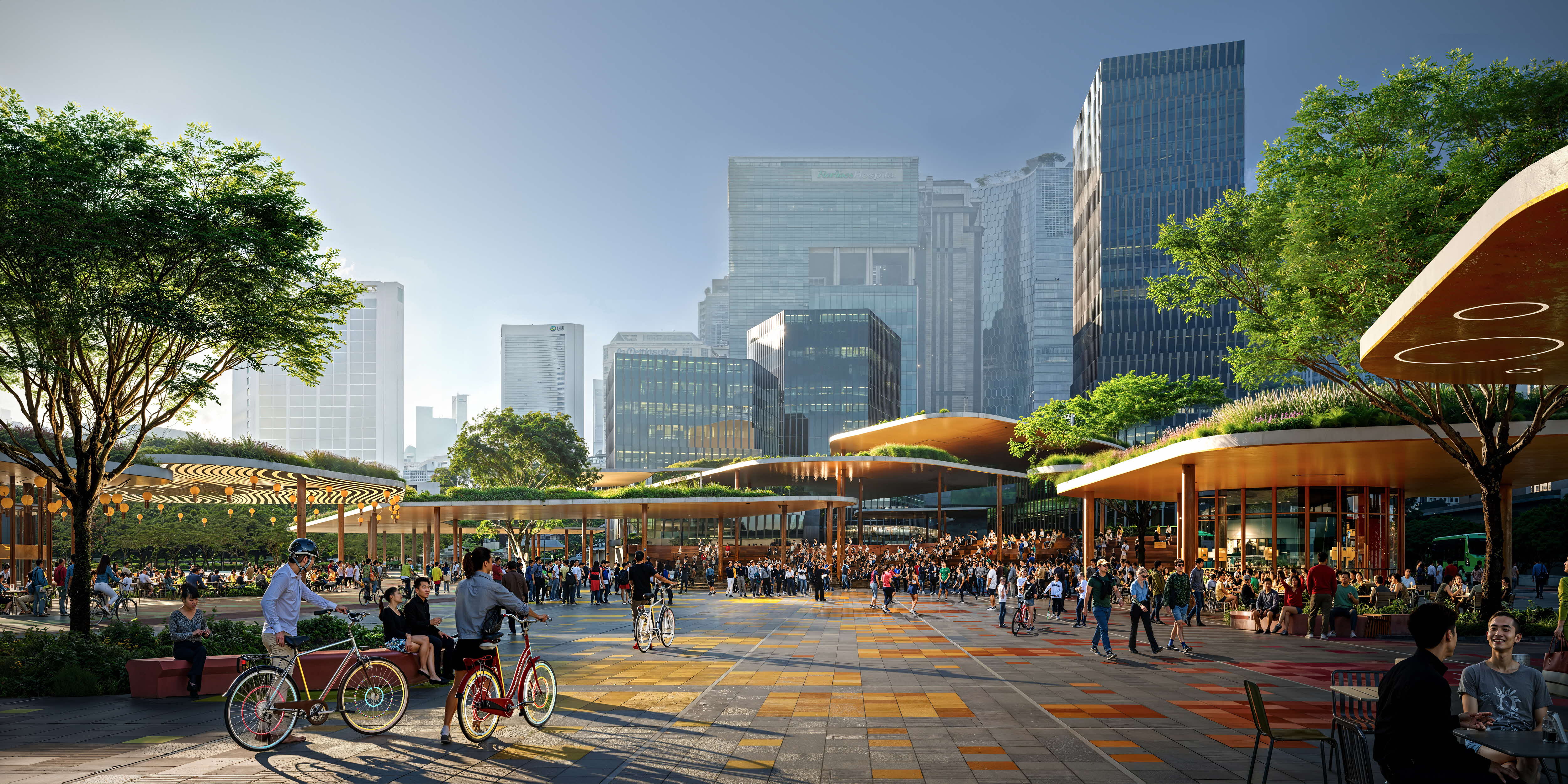
Reimagining Integrated Transport Hubs
Integrated Transport Hubs (ITHs) are evolving beyond mere transit points. Four upcoming hubs will add to the existing 15 islandwide, offering vibrant community spaces for commuters to gather and interact during their journeys, enriching their daily lives.
Bringing together transport and more
The newly completed Pasir Ris Integrated Transport Hub (ITH) connects a bus interchange to the MRT station. Beyond serving as a transport hub, it also sits within a mixed-use development comprising a retail mall, condominium, polyclinic and childcare facilities!
4 upcoming ITHs adding to the existing 15
Enhancing bus connectivity
The Bus Connectivity Enhancement Programme was launched in July 2024 to better support housing and employment growth. The bus network will be enhanced in consultation with the community, including:
Stepping up improvements to bus services, such as by adding more trips, adjusting routes or introducing new services in response to changing travel patterns.
Bringing forward the introduction of new bus services in new towns to better serve early batches of residents.
Introducing “express feeder” services in estates further away from MRT stations.
Adding peak period express buses to complement busier MRT lines.
Electrifying our buses
Singapore is committed to achieving a 100 percent cleaner energy bus fleet by 2040 to support its net-zero ambitions. With over 2,000 electric buses on the roads in the coming years, a bus ride will soon reduce carbon footprint by 70 percent as compared to driving an internal combustion engine car. Commuting decisions play an integral part in Singapore’s green endeavour. Make the switch to Walk, Cycle, Ride modes now!
Paving the way forward with Autonomous Vehicles
In recent years, a myriad of autonomous vehicles (AVs) has been increasingly deployed in pockets of cities and countries. Singapore has been using a risk-based testing framework to trial mature versions of AV technology since 2014 to improve urban mobility. Companies have operated AVs for goods delivery, road-sweeping and shuttles operating on fixed routes, while establishing use cases for articulated trucks and other passenger services. In 2026, the Land Transport Authority intends to pilot autonomous shuttles on Bus Service 400 and 191 to serve Marina Bay-Shenton Way and one-north respectively.
Discover Singapore’s AV use cases and safety assessment approach.
To support the bus network expansion, new ITHs are under construction in growth areas such as Tampines North. Bus priority measures will be implemented to raise service reliability too.
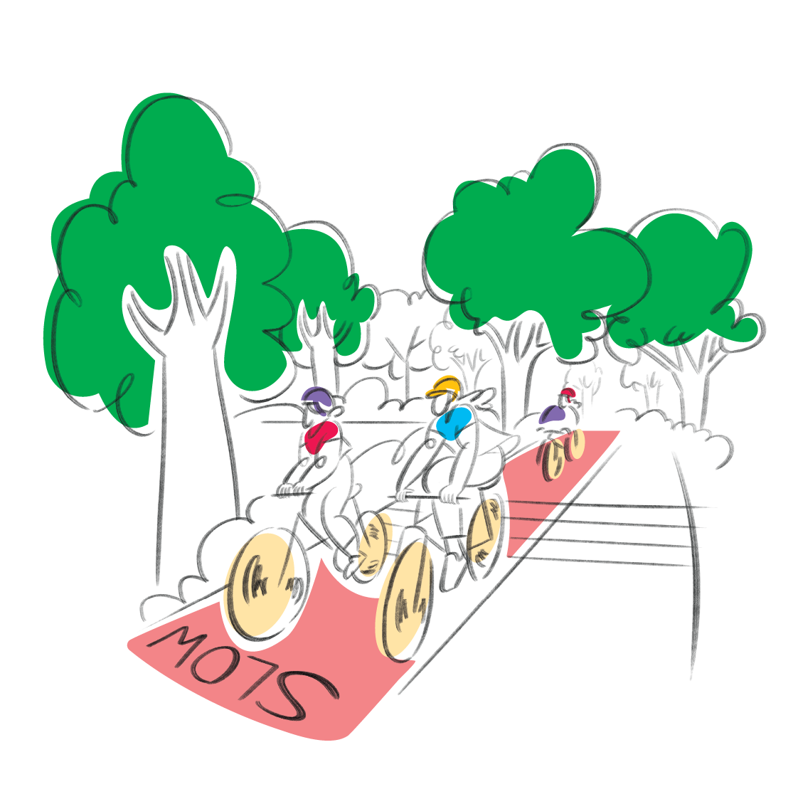
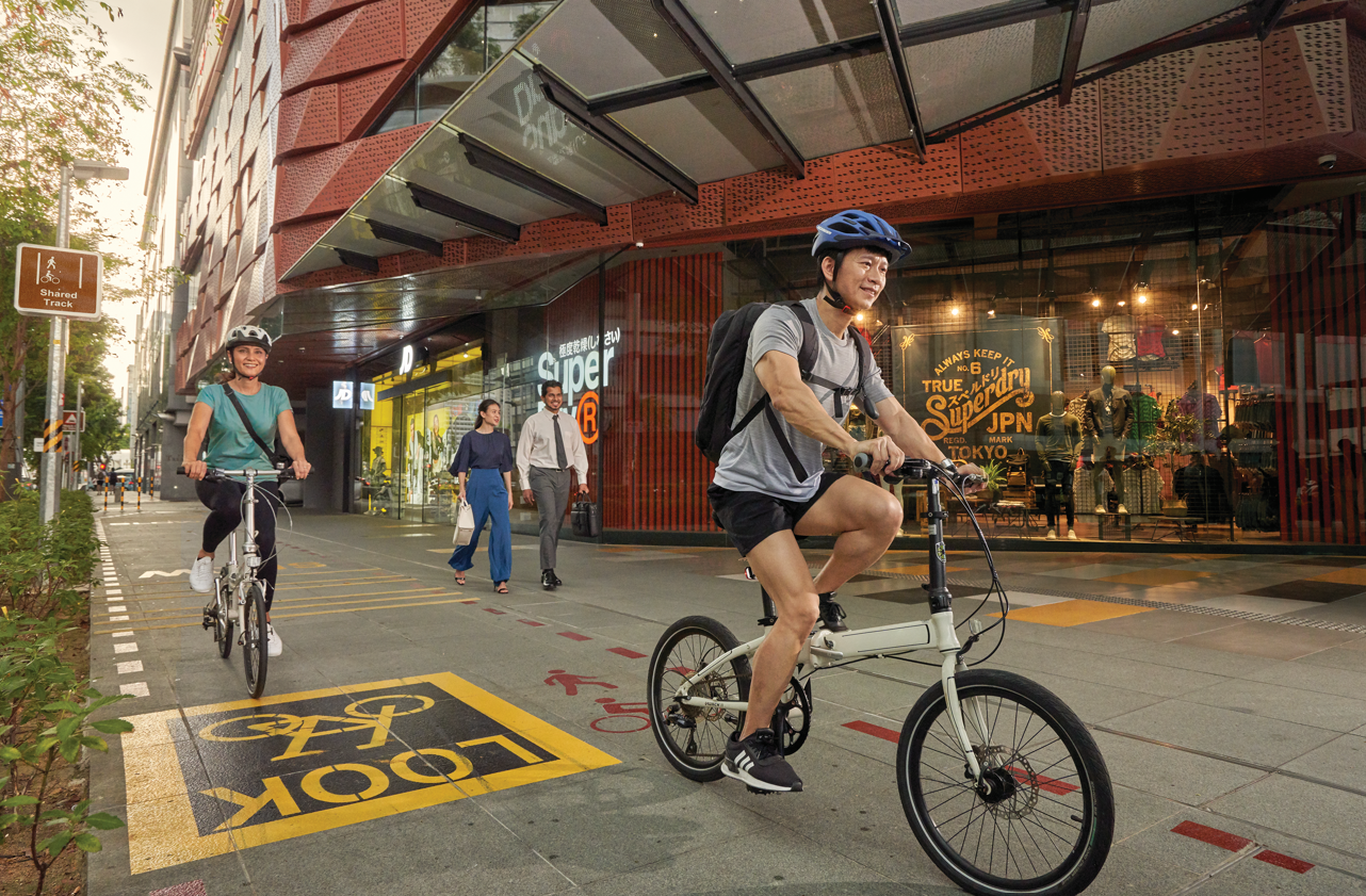
Supporting greener and healthier travels with active mobility
Active mobility offers many benefits. Making walking and cycling part of daily commutes helps one stay active and meet physical activity targets.
.jpeg)
By 2030, 1,300 kilometres of cycling paths and park connectors will connect residents to transport hubs, key amenities and recreational spaces.
Building places for people over spaces for cars
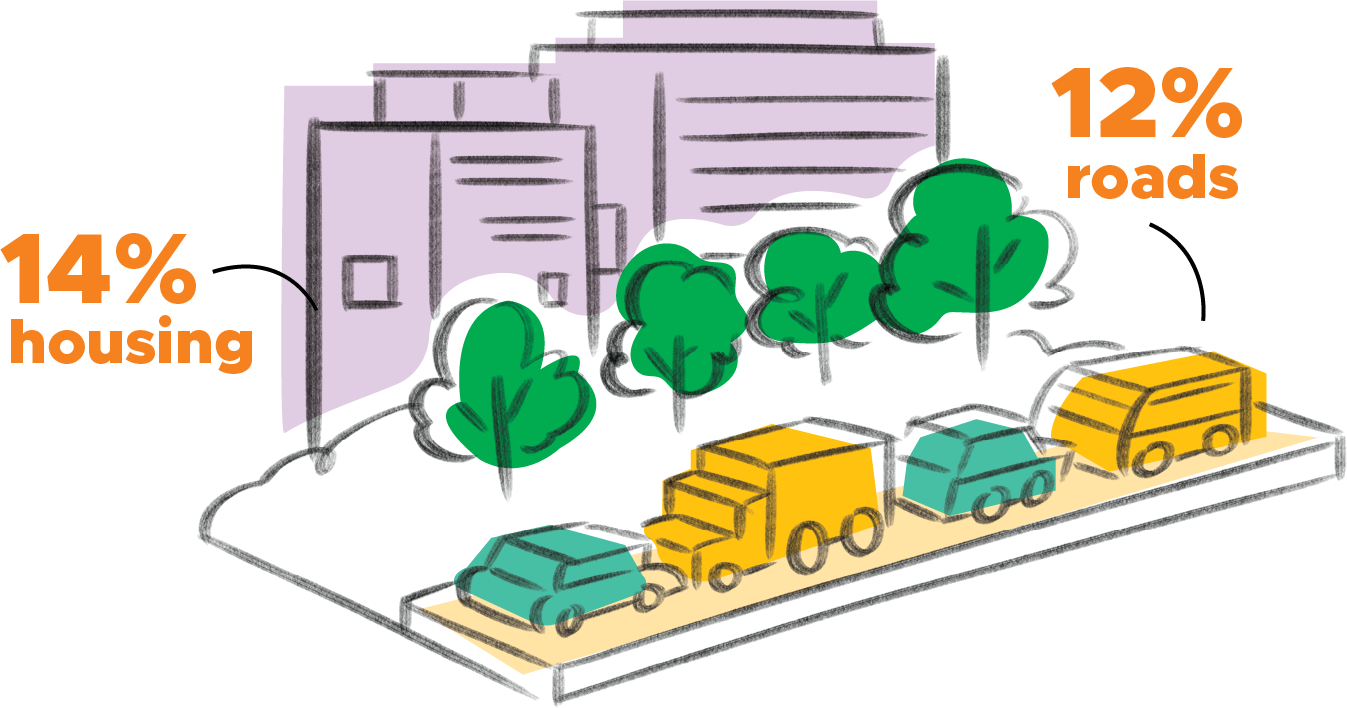
Roads occupy 12 percent of Singapore’s total land area. Spaces for walking, cycling and public transport need to be prioritised. As more homes and denser towns are built near train stations, reduced parking spaces also allow for more greenery, community amenities and a liveable environment.
Limited space for road expansion
Source: LTA
Good for the environment, and for you
By switching one short car trip1 a day to cycling, your annual carbon footprint can reduce by 0.3 tonnes — equivalent to some 50,000 full phone charges! Outdoor activities through active mobility also enhance cognitive function and mental health while supporting active ageing. When integrated with community spaces, active mobility infrastructure creates vibrant areas for social interaction and community bonding too!
1 Assuming the distance is 5 kilometres, and using the local emission factor for internal combustion engine car of 0.17 kgCO2e/pax-km.
Source: LTA
Ensuring safer, more inclusive and enjoyable journeys
Our streets and first-and-last-mile journeys are becoming safer and more comfortable for all.

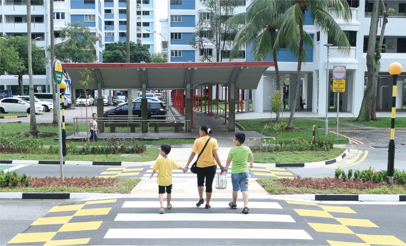
Say hello to Friendly Streets
The Friendly Streets initiative will be expanded to all towns by 2030. Look out for additional pedestrian-friendly features that make walking to key neighbourhood amenities more convenient and pleasant.
Source: LTA
Ang Mo Kio Street 31 is the first completed Friendly Streets pilot. Various features, including reduced traffic speed and signalised crossing with longer crossing time, have improved pedestrian safety.
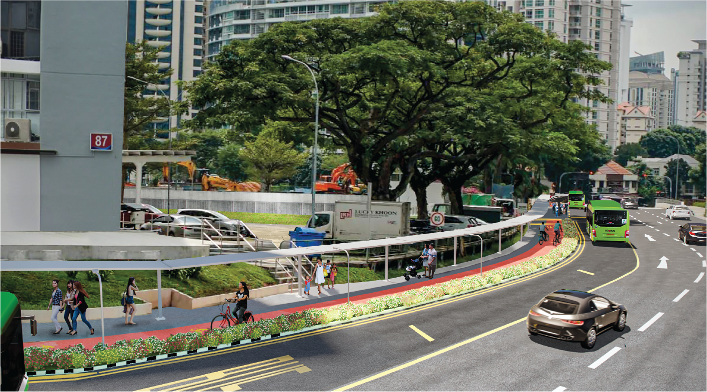
Transforming road spaces to enhance Walk, Cycle, Ride experiences
Road spaces traditionally used by cars can be repurposed to provide improved travel for pedestrians and cyclists or community spaces to enliven neighbourhoods.
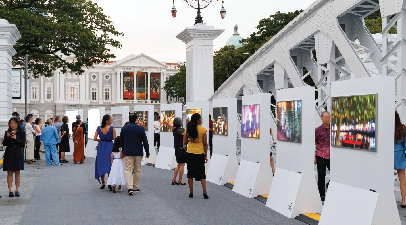
‘Two Rivers’ exhibition by Melisa Teo on Anderson Bridge.
Connaught Drive and Anderson Bridge/Fullerton Road have been closed to all vehicular traffic since December 2021. The pedestrianised area can now host arts and cultural activities to enliven the Civic District.
Source: LTA
Up to two existing road lanes along Zion Road will be repurposed into wider footpaths and cycling paths by 2026. The existing bus shelter opposite Great World City will be expanded too. Commuters will also enjoy sheltered pedestrian connectivity to Zion Riverside Food Centre.
Source: LTA
An 80-metre stretch of Choa Chu Kang Terrace was pedestrianised in December 2024, making it more comfortable to walk to and from Sunshine Place, and a future MRT station on the Jurong Region Line.
More convenient access to public transport and amenities
Walking and cycling to key public transport nodes must be barrier-free, convenient, comfortable and inclusive. First-and-last-mile commuter infrastructure will be enhanced for commuters, especially seniors, to lead more active lifestyles and stay socially connected.
North-South Corridor
See preliminary ideas from the Henning Larson Design Team on possible activities along the corridor!
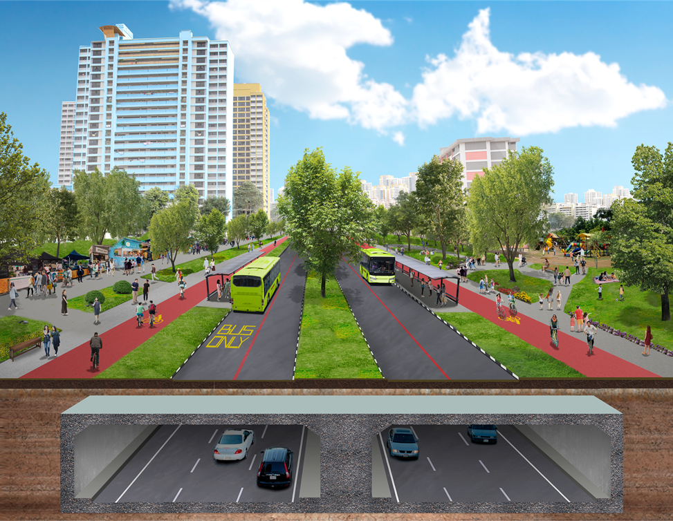
North-South Corridor: Redefining journeys for tomorrow
The upcoming North-South Corridor (NSC) enhances connectivity from the north to the city, serving towns such as Sembawang, Yishun, Ang Mo Kio, Toa Payoh, Novena and Rochor. As the 21.5-kilometre multimodal transportation corridor channels more traffic to the elevated and underground, lanes, surface streets may be repurposed for walking, cycling, public transport and community spaces.
The ongoing public engagement to make the NSC a community-centric mobility corridor has turned out several ideas:
Creating a shared space for all
On surface streets, priority will be given to public transport modes such as buses. There will also be more continuous and comfortable walking and cycling paths.
Source: Henning Larsen and Co
Ensuring safer and more inclusive journeys
The corridor will be seamless and accessible to make journeys safer and more inclusive for all including motorists, pedestrians and commuters on active modes like cycling.
Source: Arup
From roads to meaningful places
Road spaces can be repurposed for people from all walks of life to gather and connect.
Source: Henning Larsen and Co