
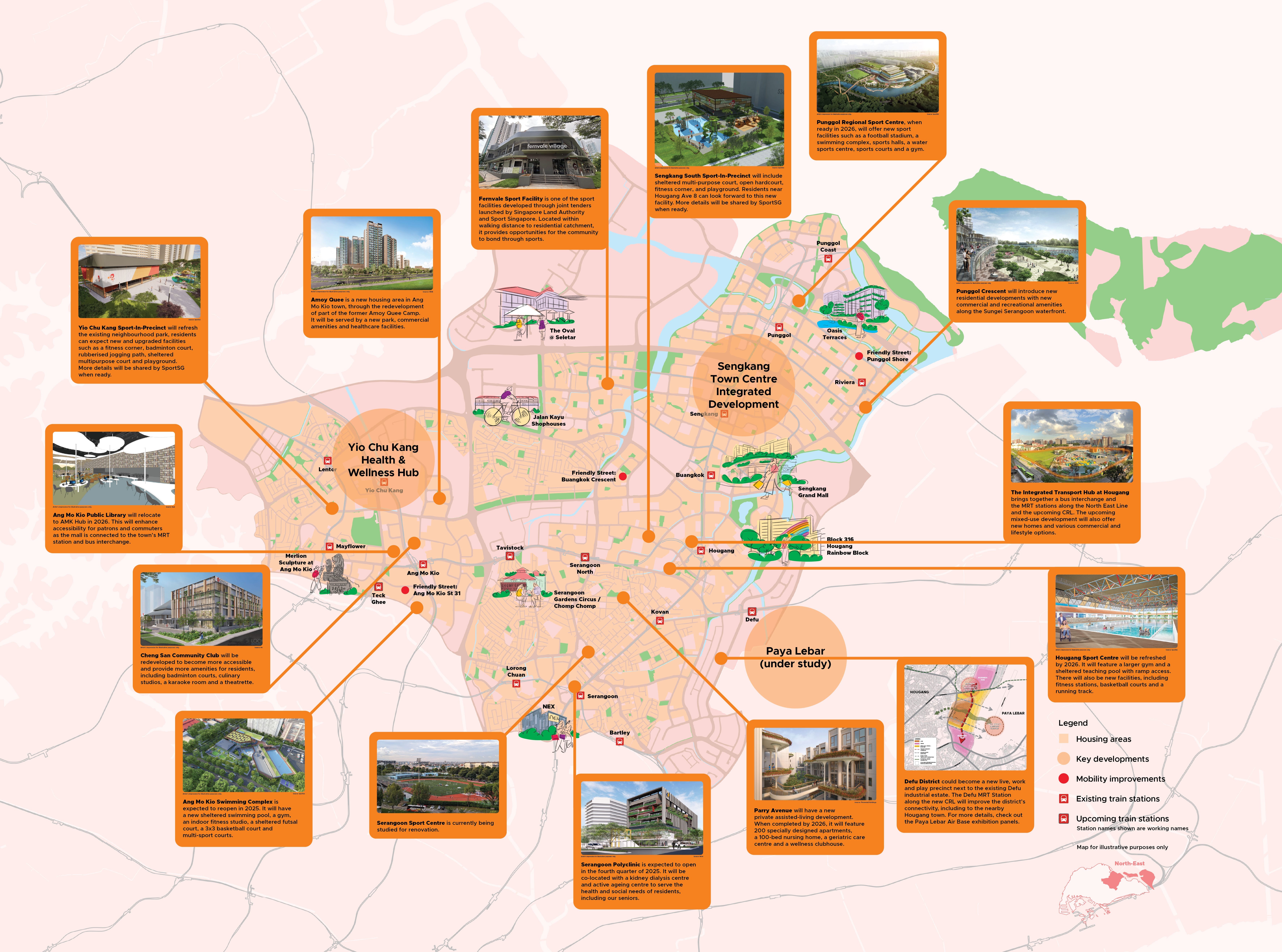
Livelier Neighbourhoods for All
The North-East region is becoming more inclusive to live, work and play in, with new amenities and community hubs to meet diverse needs.
Last updated 2 June 2026
Vibrant neighbourhoods that support inclusive live, work and play
Established towns such as Ang Mo Kio, Hougang and Punggol will welcome new housing options that meet diverse needs. Fresh amenities and recreational options will enliven the neighbourhoods.
The upcoming Cross Island Line (CRL) will also boost the region’s public transport connectivity and enhance access to new live, work and play amenities.
Enhancing active and wellness lifestyle options
New and upgraded facilities in the region will enhance access to sports and recreation for everyone. New community amenities will also enable residents to stay active and well with greater ease.
A one-stop hub in Sengkang
Sengkang Town Centre could become more vibrant with an integrated community hub that makes everyday living more convenient for residents. The hub will feature a variety of commercial, healthcare, sports and recreation facilities, all seamlessly connected to the Sengkang MRT Station.
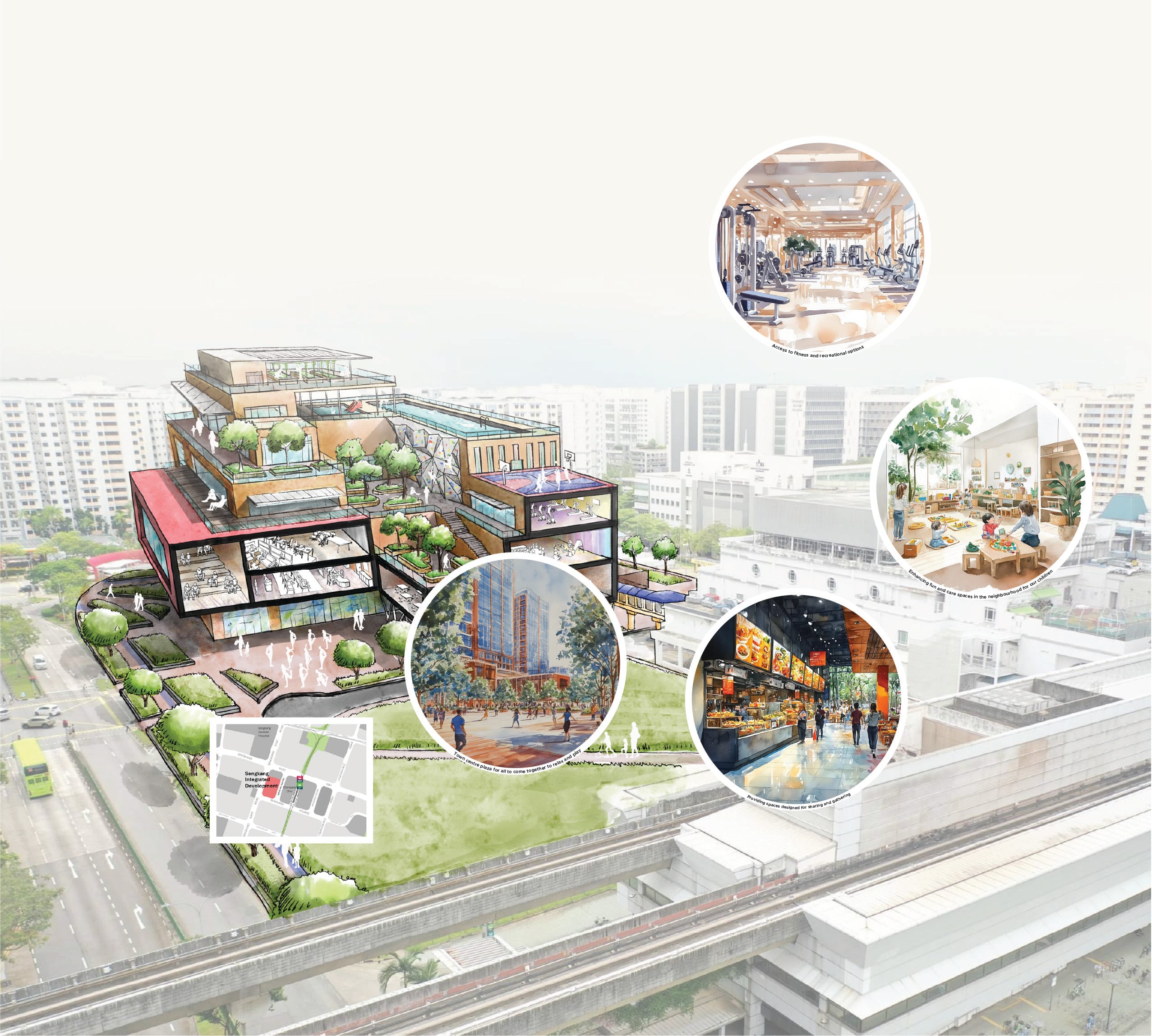
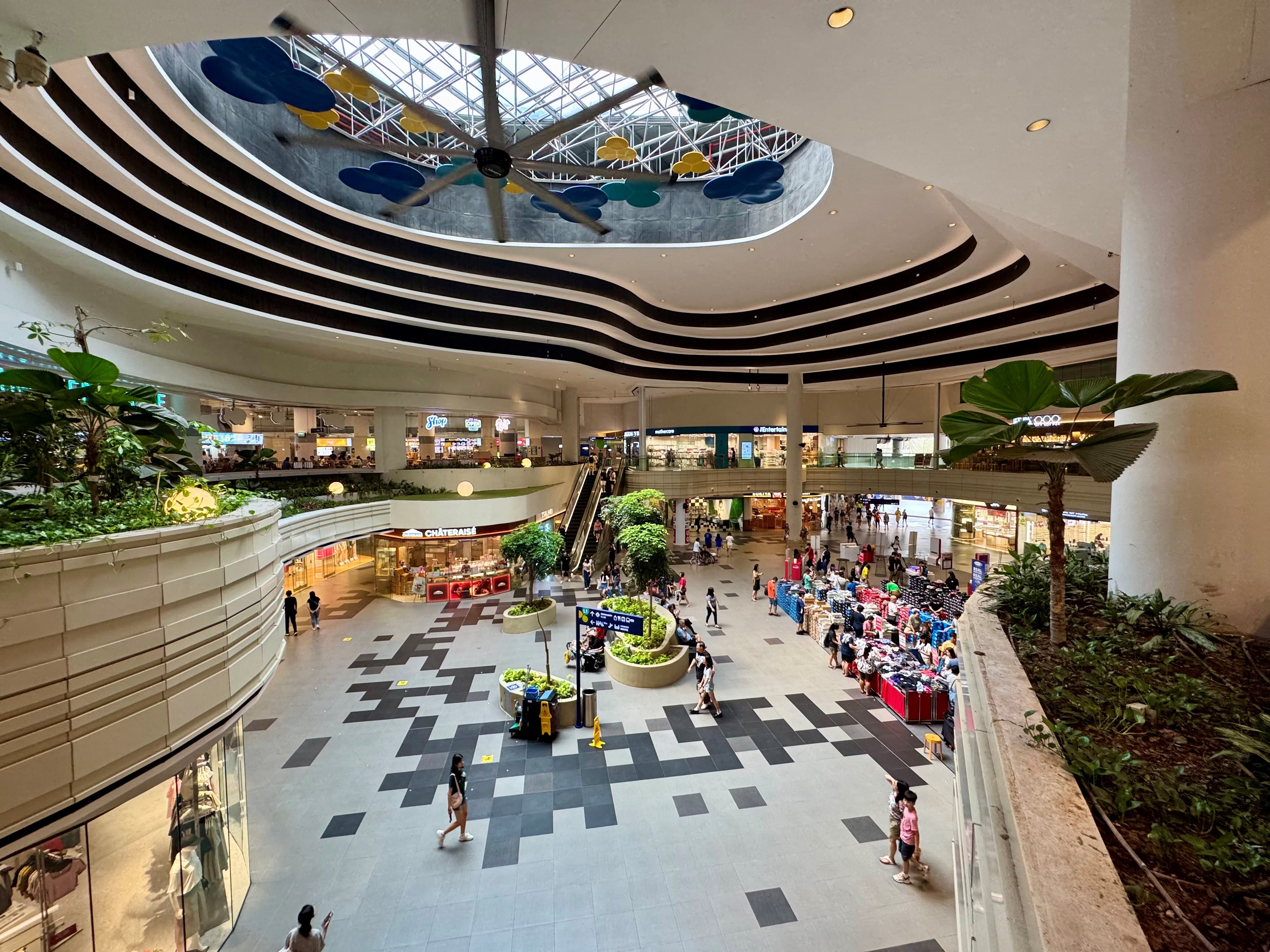
A unique gathering space and focal point for residents
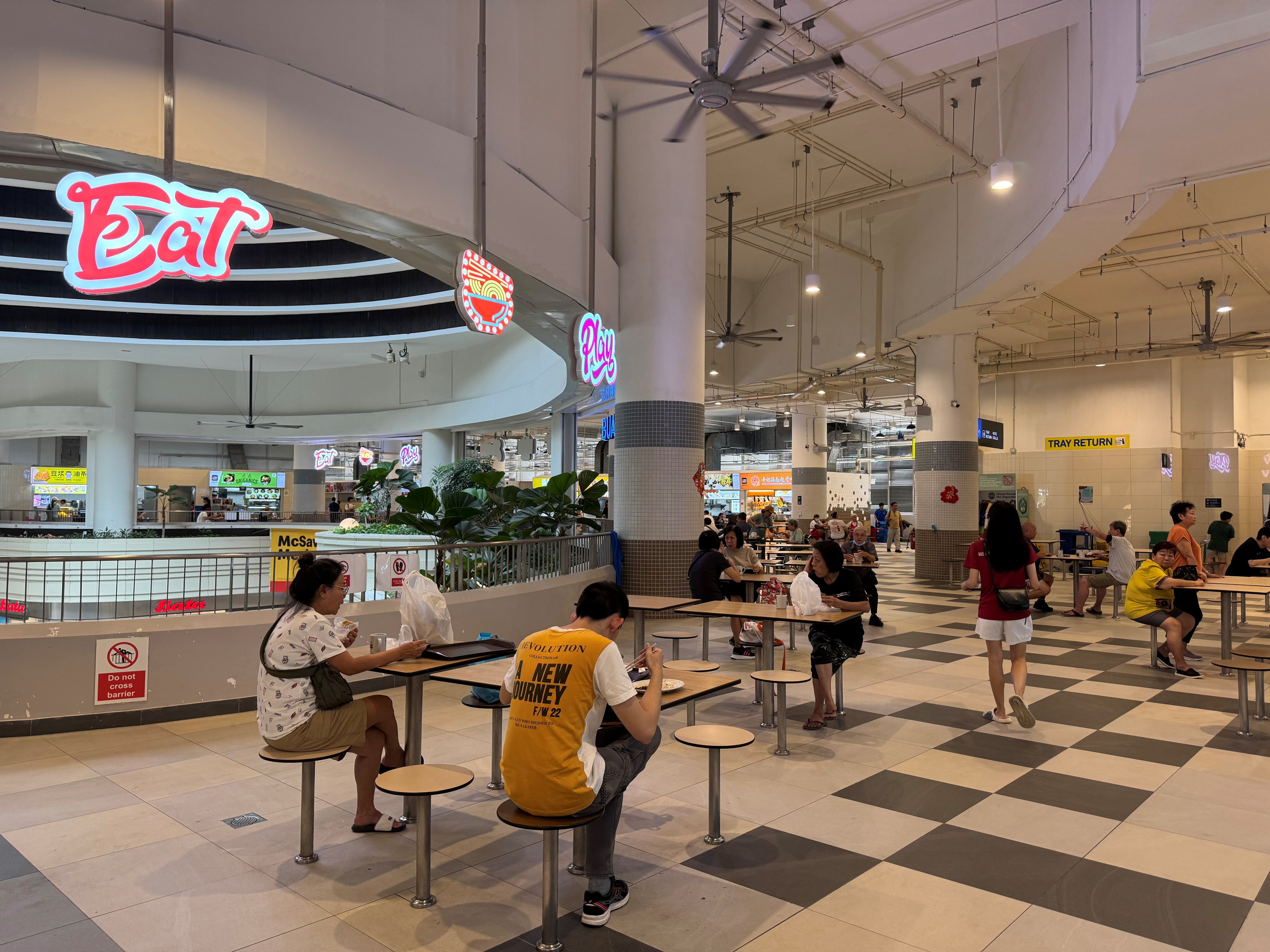
Sengkang Grand Mall is an integrated development featuring a shopping mall, hawker centre, community club, childcare centre, playground, bus interchange and public spaces. Since its opening in 2023, the mall has provided residents with greater access to amenities and fostered community interactions.
 - Copy.jpg)
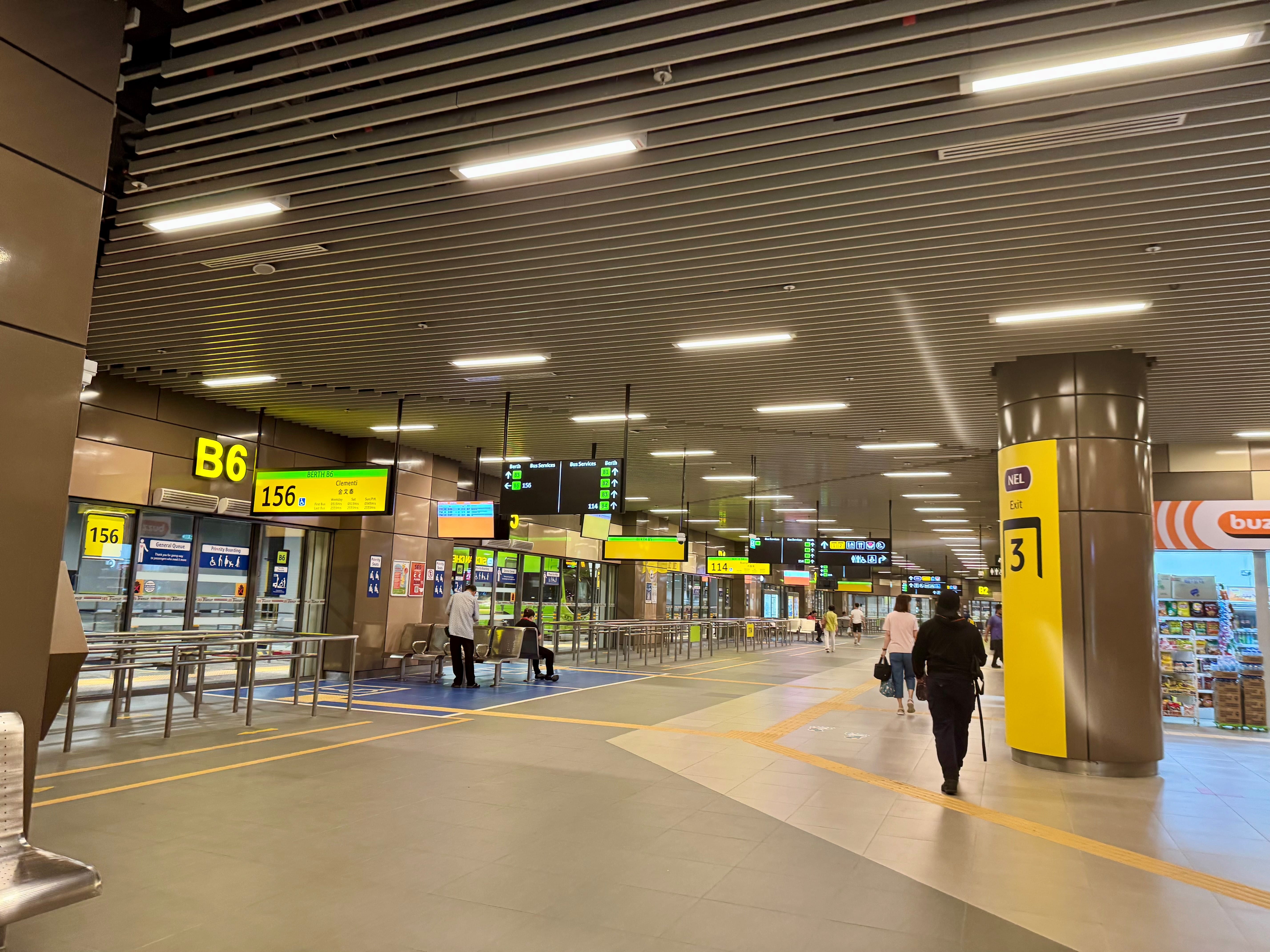
As Singapore’s 12th Integrated Transport Hub, residents can look forward to greater convenience in travelling within the town and beyond. A total of 7 bus services will be progressively added to the bus interchange, which commenced operations on 1 December 2024.
Where sports, wellness and healthcare meet in Yio Chu Kang
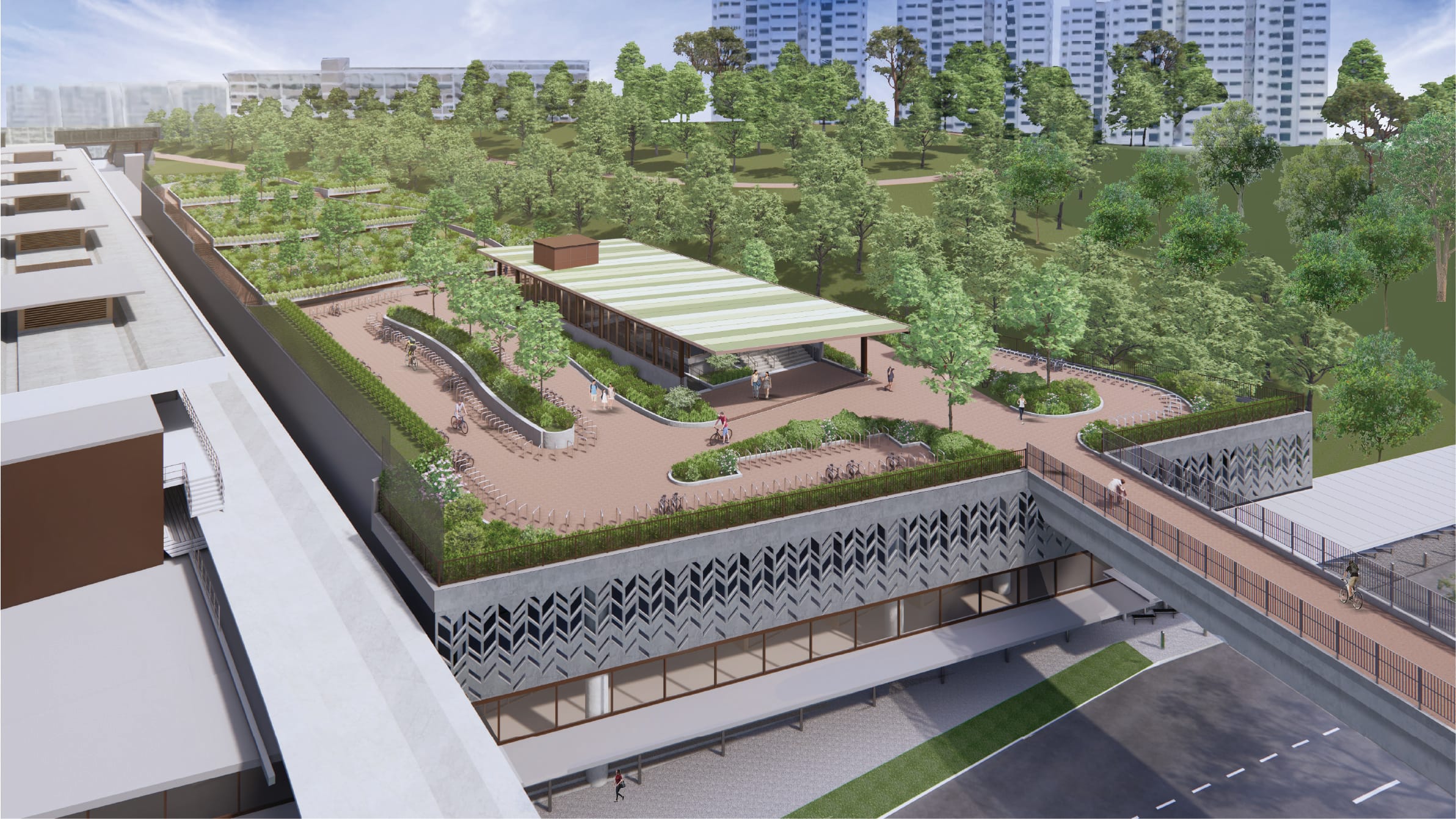
The current Yio Chu Kang Sports Centre could be redeveloped into a new destination node around Yio Chu Kang MRT Station that brings together sporting, wellness and healthcare uses. This refreshing addition to the area could connect to new transport facilities and cycling routes within the North-East region.
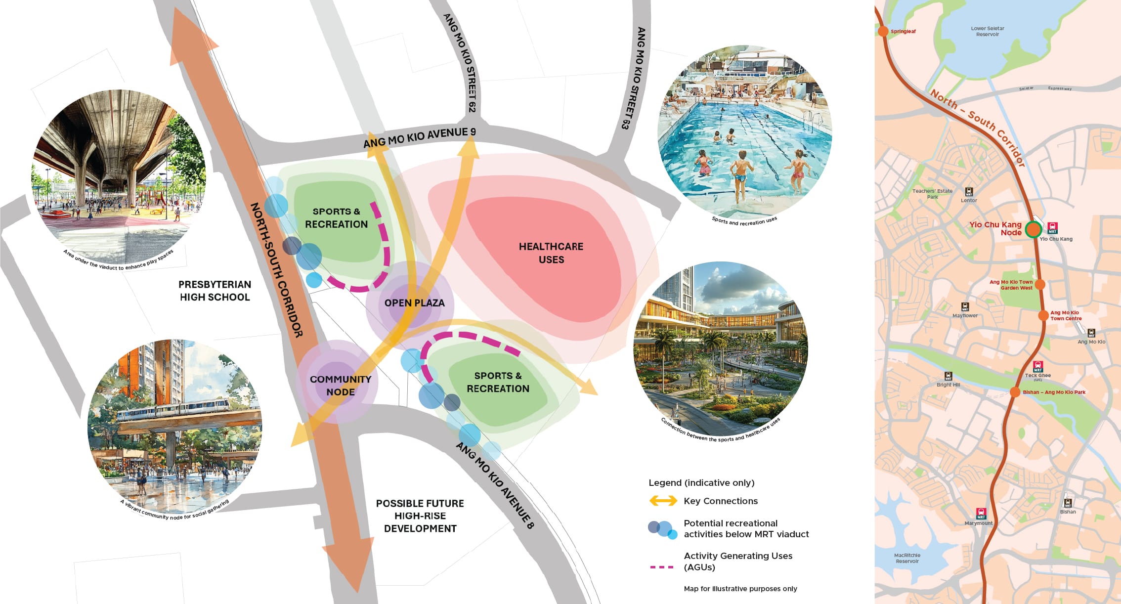
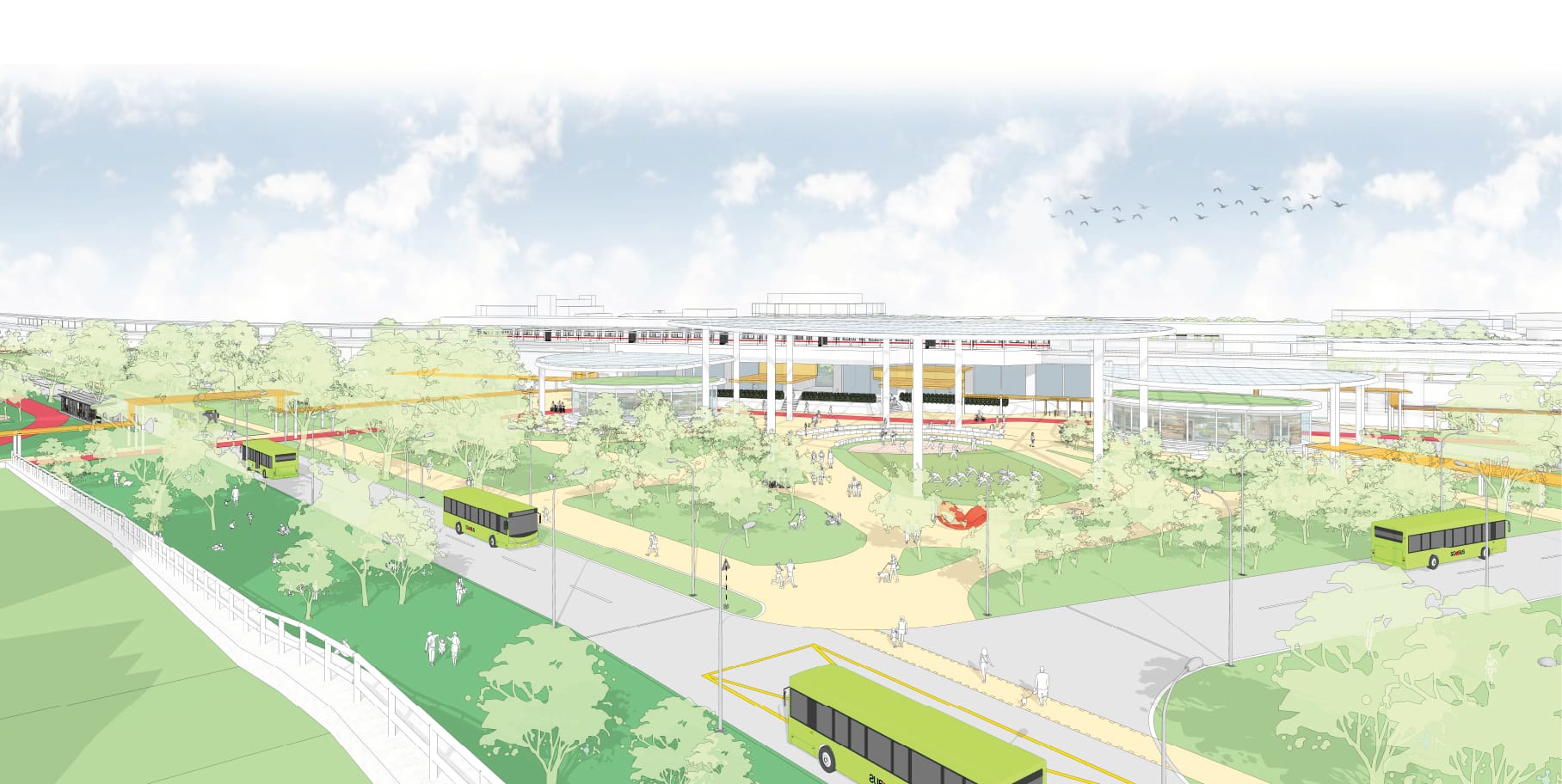
The North-South Corridor (NSC), a 21.5-kilometre long multimodal transportation corridor with an underground expressway, will allow the at-grade road to be repurposed for walking, cycling and public transport, making travelling to the north and the city more convenient. With more space reclaimed for pedestrians, residents can look forward to more public spaces for recreation and social activities.
Artist’s impression of community node at Yio Chu Kang (under study). Source: LTA, Henning Larsen
As part of the NSC plans, the area in front of Yio Chu Kang MRT Station is being studied for a community node to complement the upcoming wellness and healthcare hub, by supporting its sports and wellness programmes and encouraging multi-generational integration.
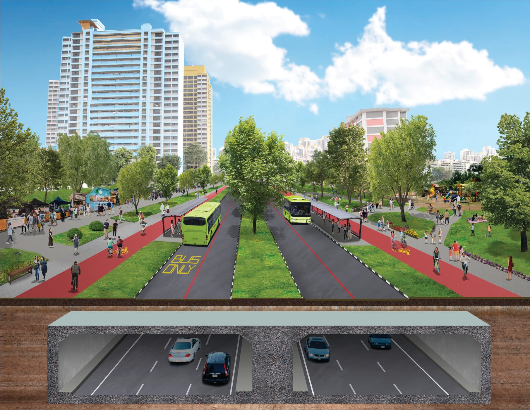
More spaces will be freed up above ground for walking, cycling and buses. Source: LTA, Arup
Getting around town more quickly and sustainably
Speeding up public transport
The new CRL Phase 1 stations at Defu, Hougang, Serangoon North and Pasir Ris will improve public transport connectivity for North-East residents and provide easy access to recreational spaces such as the Bishan-Ang Mo Kio Park.
When completed in 2032, the upcoming Punggol Extension will also provide a direct link between north-eastern areas, such as Punggol and Sengkang, to eastern areas, such as Pasir Ris and Tampines North.

From Pasir Ris to Punggol Central (40 minutes without CRL)

From Punggol East or Riviera Station to Loyang Industrial Area (45 minutes by bus)
Creating safer routes for walking and cycling
.jpg)
Future cycling path along Serangoon Ave 3. Source: LTA
By 2025, residential areas such as Kebun Baru, Serangoon, Hougang, Sengkang West and Lentor will progressively welcome new cycling paths and park connectors. This will improve connectivity to key amenities such as transport nodes, shopping malls and neighbourhood centres.
Source: LTA
An elevated walking and cycling bridge will be constructed with the upcoming CRL Ang Mo Kio MRT Station. Residents will be able to walk or cycle seamlessly and safely to the station via the bridge, bypassing road traffic.
Making streets safer for all
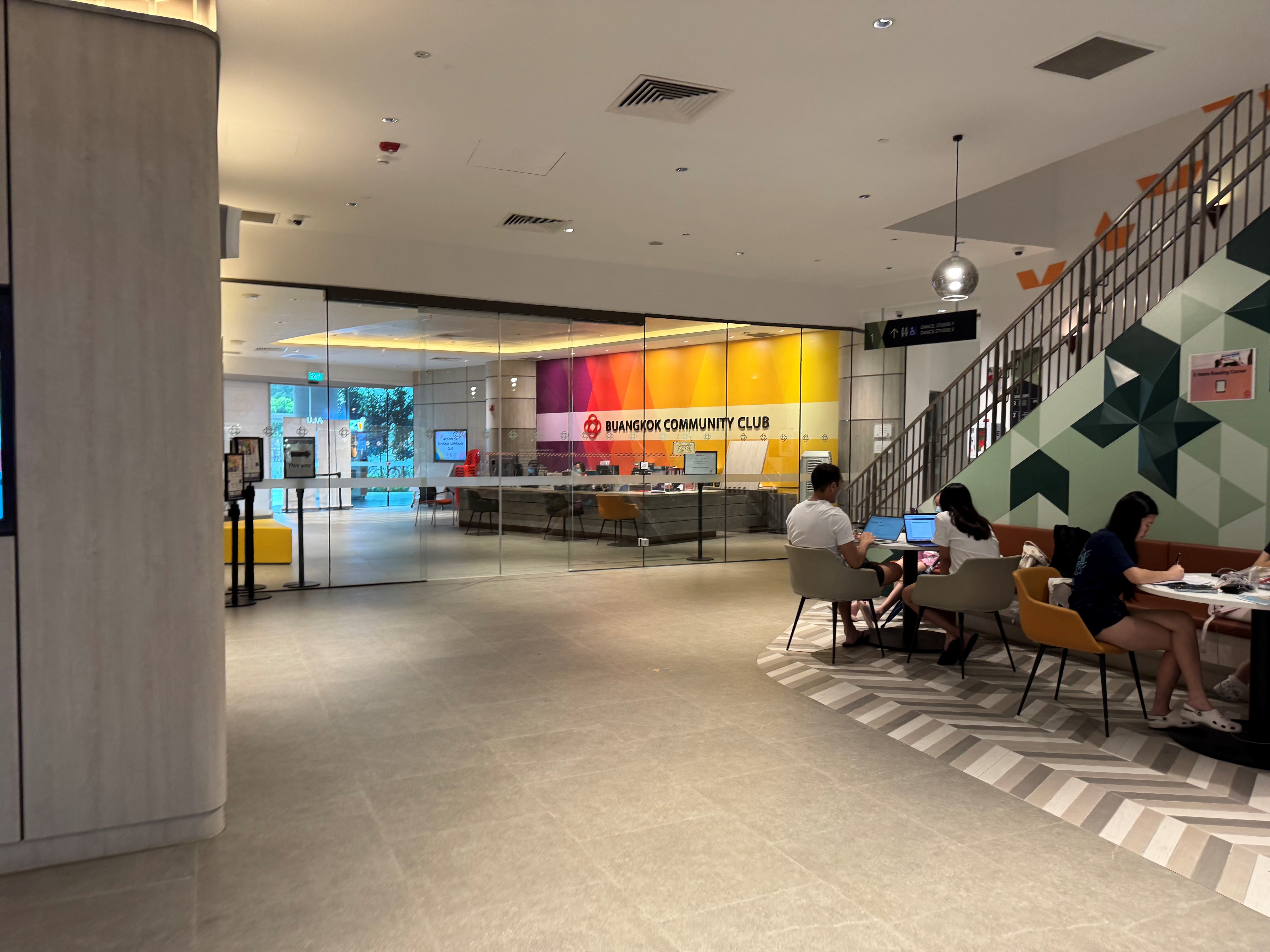
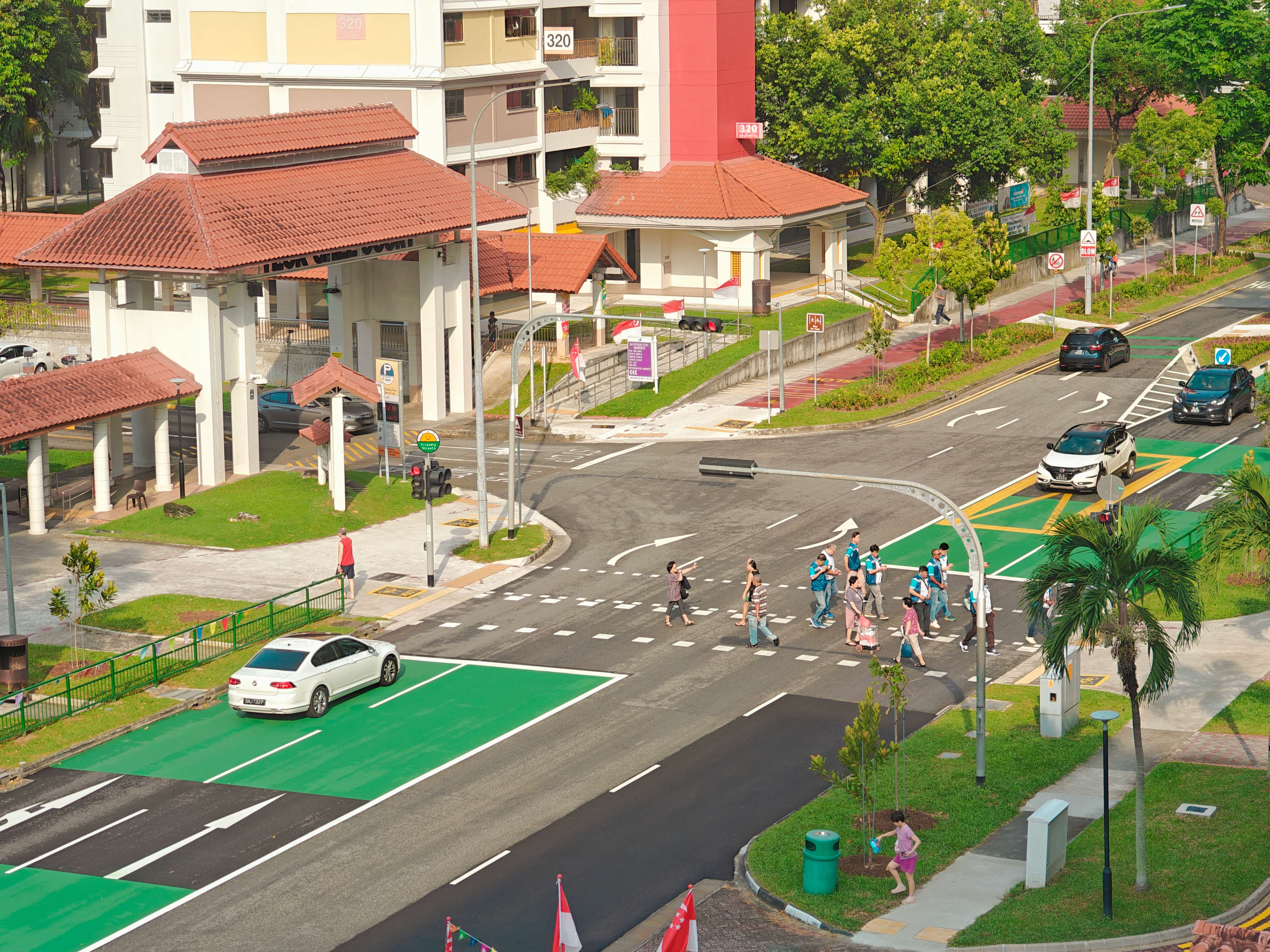
The Friendly Streets initiative, developed by the Land Transport Authority with the community, will enhance pedestrian safety, convenience and comfort through kerbless crossings that are suitable for wheelchairs and prams; and traffic-calming measures. It is being implemented in areas such as Buangkok and Punggol.
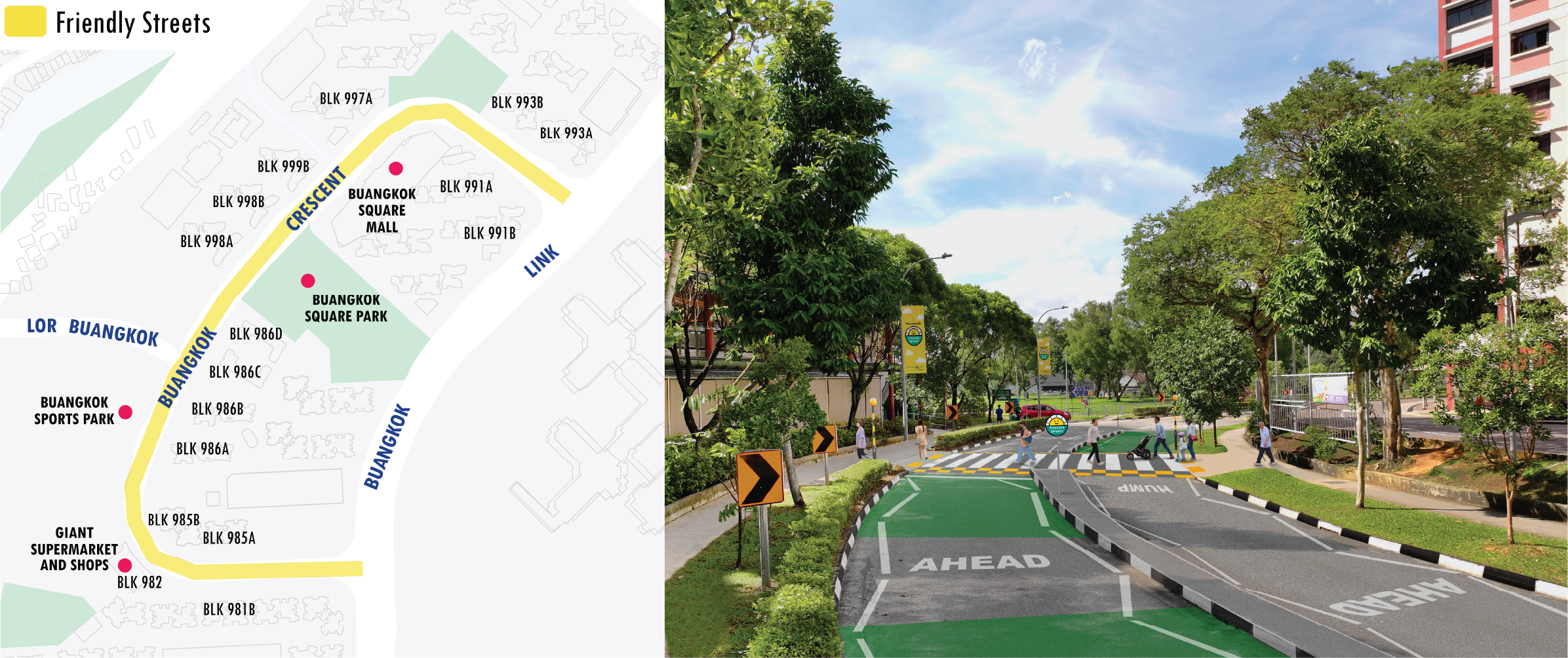
At Buangkok Crescent, residents accessing amenities such as Buangkok Square Mall and neighbourhood parks will benefit from more barrier-free crossings and traffic-calming measures such as green-coloured road surfaces.
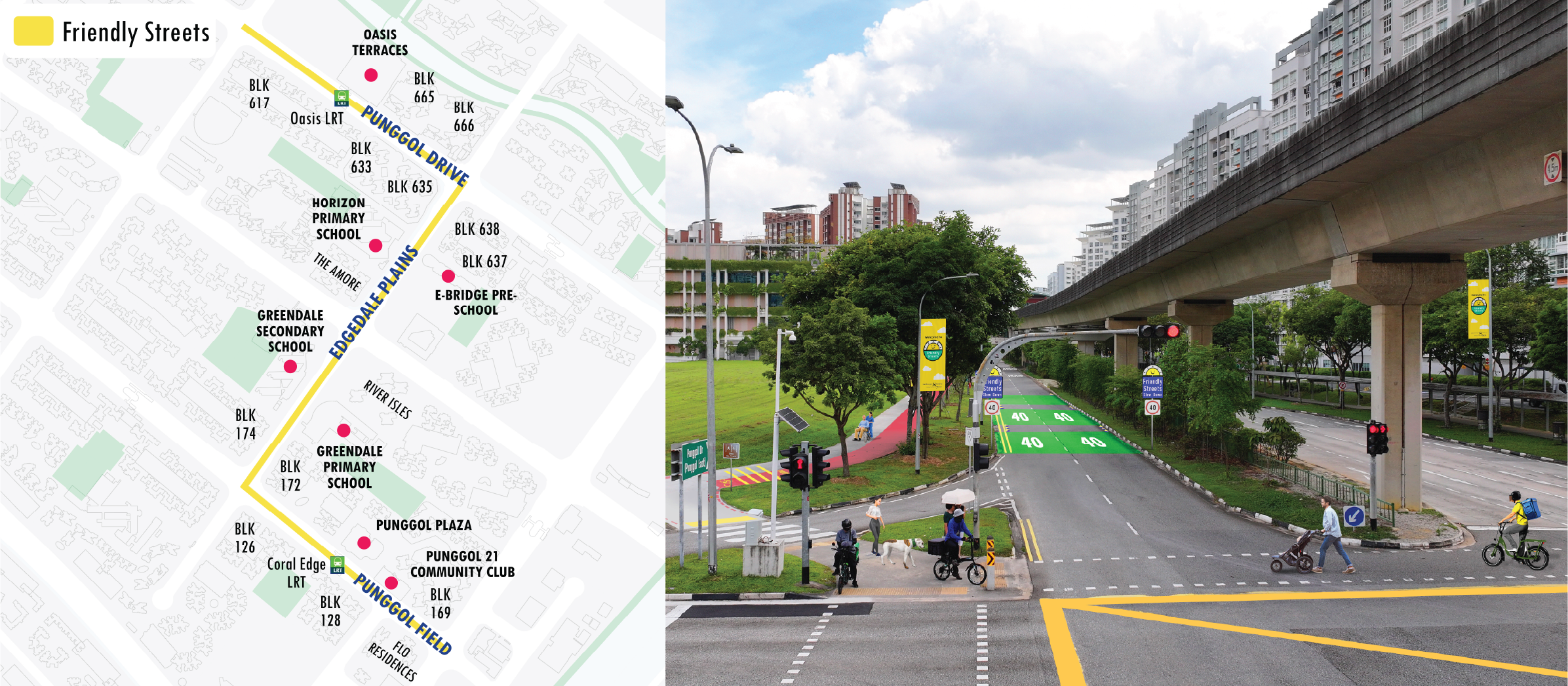
At Punggol Shore, new signalised pedestrian crossings and street signs with green road surface markings will remind motorists to slow down. This will benefit residents going to nearby schools and amenities such as Oasis Terraces, Punggol 21 Community Club and Punggol Plaza.
Singapore’s First Friendly Streets
Ang Mo Kio Street 31 is the first completed Friendly Streets pilot in Singapore. It benefits residents visiting amenities such as Teck Ghee Court Neighbourhood Centre, Teck Ghee Primary School and transport nodes such as Ang Mo Kio MRT Station and the upcoming CRL MRT stations in the vicinity.
Source: LTA