
Conservation Area
Pasir Panjang Road No. 222-240 Conservation Area
Applicable Guidelines
Secondary Settlement Guidelines
Conservation Area
Pasir Panjang Road No. 222-240 Conservation Area
Find out more about Pasir Panjang Road No. 222-240 Conservation Area.
Important Information
All proposed works will need to comply with the Conservation Guidelines and the Specific Restoration Guidelines (SRG). Conservation Permission is required before all additions & alteration works and operations of new use can begin.
Owners, architects and engineers intending to carry out restoration works or development within conservation areas are required to comply with the conservation principles, planning parameters and restoration guidelines for conserved shophouse and bungalow building typologies, as well as planning parameters and envelope control guidelines for new buildings within conservation areas accordingly.
For other building types, which do not conform to the standard shophouse or bungalow typology, these will be evaluated on a case-by-case basis in accordance with conservation principles. [1]
About
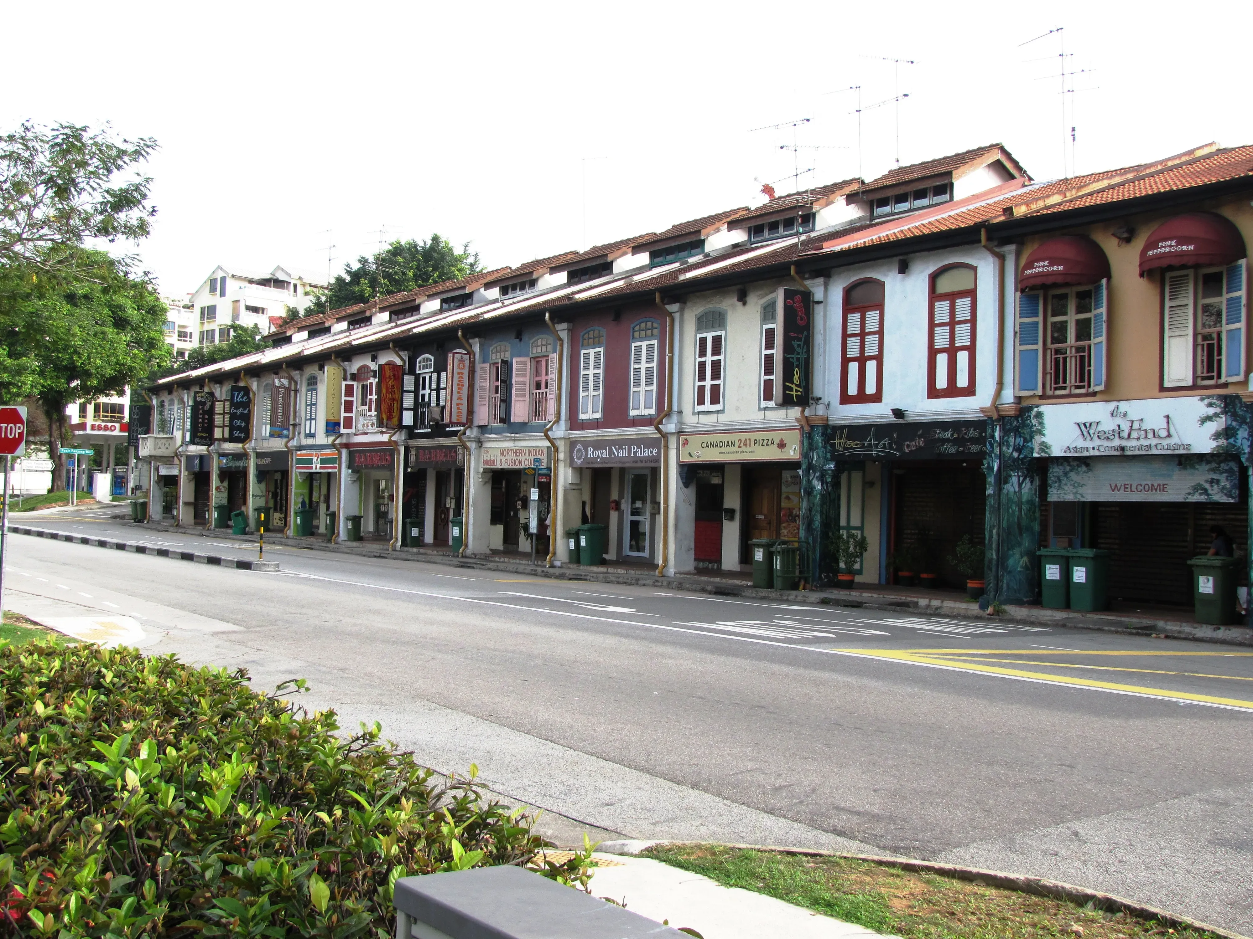
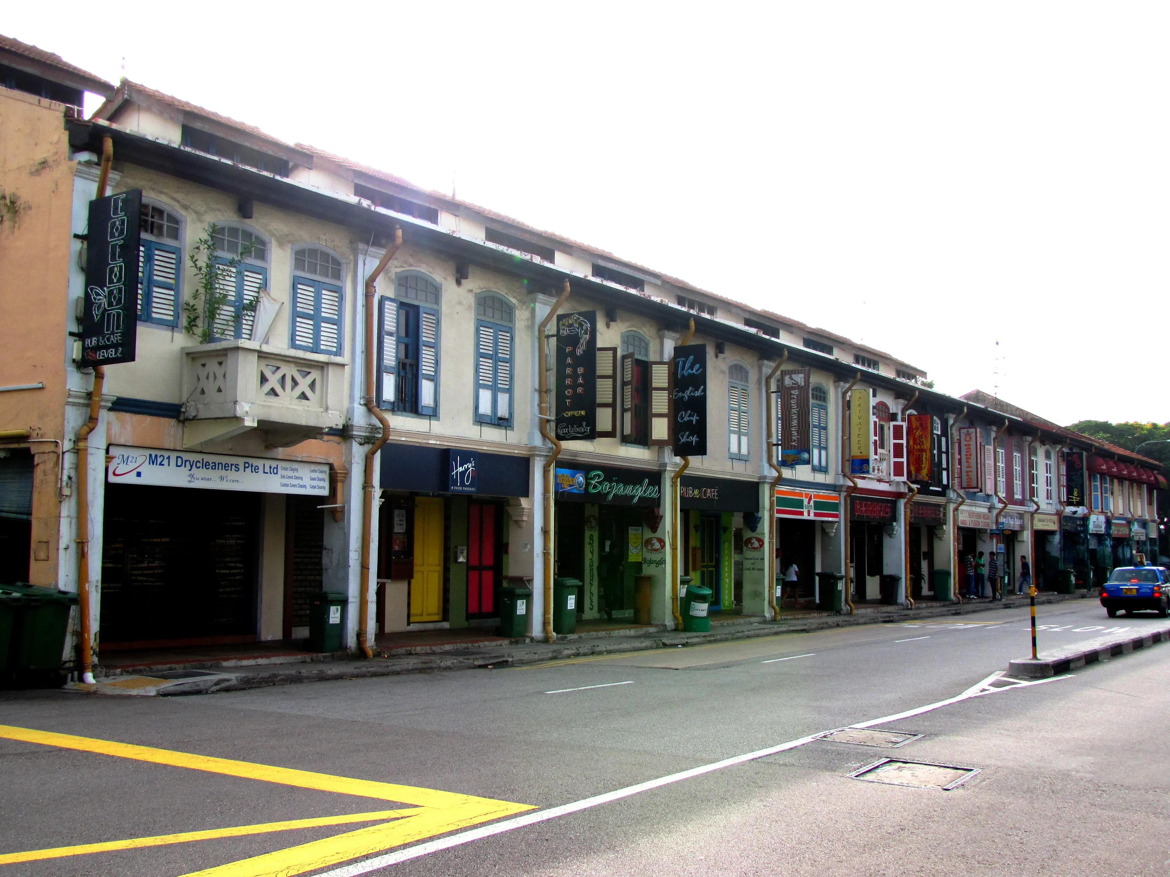
This row of 10 units of two-storey shophouses is better known as Pasir Panjang Village - a cluster of pubs, restaurants and shops that matches the feel of its laid-back neighbourhood.
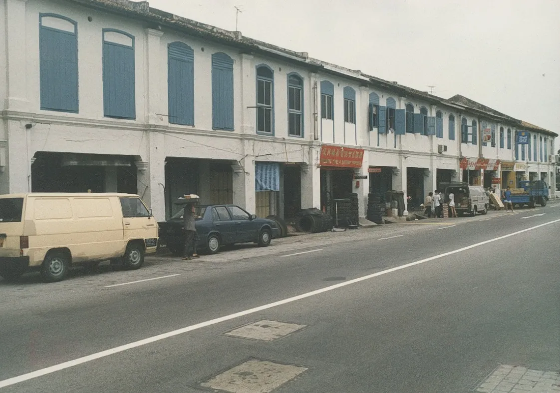
The History
The name Pasir Panjang literally means "long sand" in Malay, a reference to the long sandy beach that stretched along the coast in this area. Pasir Panjang Road, which once hugged the coastline, was laid down by the Government Surveyor of Singapore, John Turnbull Thomson, in 1841 and by 1850, it was extended as far as the Jurong River. This facilitated the development of a linear coastal settlement which stretches all the way to Clementi Road.
Providing a backdrop to the coastal settlement was a hilly ridge running parallel to the coastline. A low saddle along the ridge (known subsequently as ‘The Gap’) presented the opportunity to construct an inland road, which became today’s South Buona Vista Road.
In the 1920s, many of the wealthy Chinese built holiday and residential bungalows along the coast, some of which are still visible today. In 1930, some of the Malay families from the Kallang River Basin area were resettled here when Kallang Airport was constructed. In 1957, the Malay settlement here became known as the West Coast Malay Settlement. Right up to the early 1960s, this area contained many Malay fishing villages. The main economic activities were fishing and small scale agriculture.
Pasir Panjang was also a British defence position in the south and was a key battle site in World War II. Developments in the area took place mainly after the war was over. In the 1950s, the area began to take on a suburban character as bungalows were built along the coastline, fronting the sea.
Since the late 1960s, the coastal area at Pasir Panjang has been reclaimed for wharves and is almost entirely devoted to containerisation. The Pasir Panjang Terminal of the Port of Singapore is also located here.
The Architecture
This row of two-storey shophouses is a fine example of the First Transitional shophouse style, and expresses elegant simplicity in their architectural composition. The relatively restrained use of ornament emphasises the fine-grained party wall character of the streetblock and,provides a continuous rhythm along Pasir Panjang Road.
Since the completion of the West Coast Highway, Pasir Panjang Road has become a secondary road which has less traffic and this contributes to the low-key, community feel of the street.
The Legacy
The subject buildings are located at a key nodal point along Pasir Panjang Road, at its junction with South Buona Vista Road, and serve as a ‘gateway’ into Pasir Panjang when travelling in from the city. Easily recognizable by its low-scale building form, this row of shophouses relates well to the street and adds to the relaxed, residential character of this area of Pasir Panjang.
Gazetted on 19 February 1993 for conservation and under the Voluntary Conservation Scheme.
Guidelines and Procedures
Gallery
[1] The conservation guidelines for shophouses and bungalows will generally be applied by URA in the consideration of a development application. However, if the circumstances or planning considerations relevant to a case warrant it, URA may in its discretion decide to depart from these general guidelines. The guidelines, principles and illustrations found in the guidelines are not exhaustive in covering all possible site conditions and variations in building type. Persons intending to carry out a development are advised to take this into consideration and check with URA through enquiries or development applications to confirm if their proposals can be allowed.