
Conservation Area
Chinatown - Bukit Pasoh Conservation Area
Applicable Guidelines
Historic District Guidelines
Conservation Area
Chinatown - Bukit Pasoh Conservation Area
Find out more about Chinatown - Bukit Pasoh Conservation Area.
Important Information
All proposed works will need to comply with the Conservation Guidelines and the Specific Restoration Guidelines (SRG). Conservation Permission is required before all additions & alteration works and operations of new use can begin.
Owners, architects and engineers intending to carry out restoration works or development within conservation areas are required to comply with the conservation principles, planning parameters and restoration guidelines for conserved shophouse and bungalow building typologies, as well as planning parameters and envelope control guidelines for new buildings within conservation areas accordingly.
For other building types, which do not conform to the standard shophouse or bungalow typology, these will be evaluated on a case-by-case basis in accordance with conservation principles. [1]
About
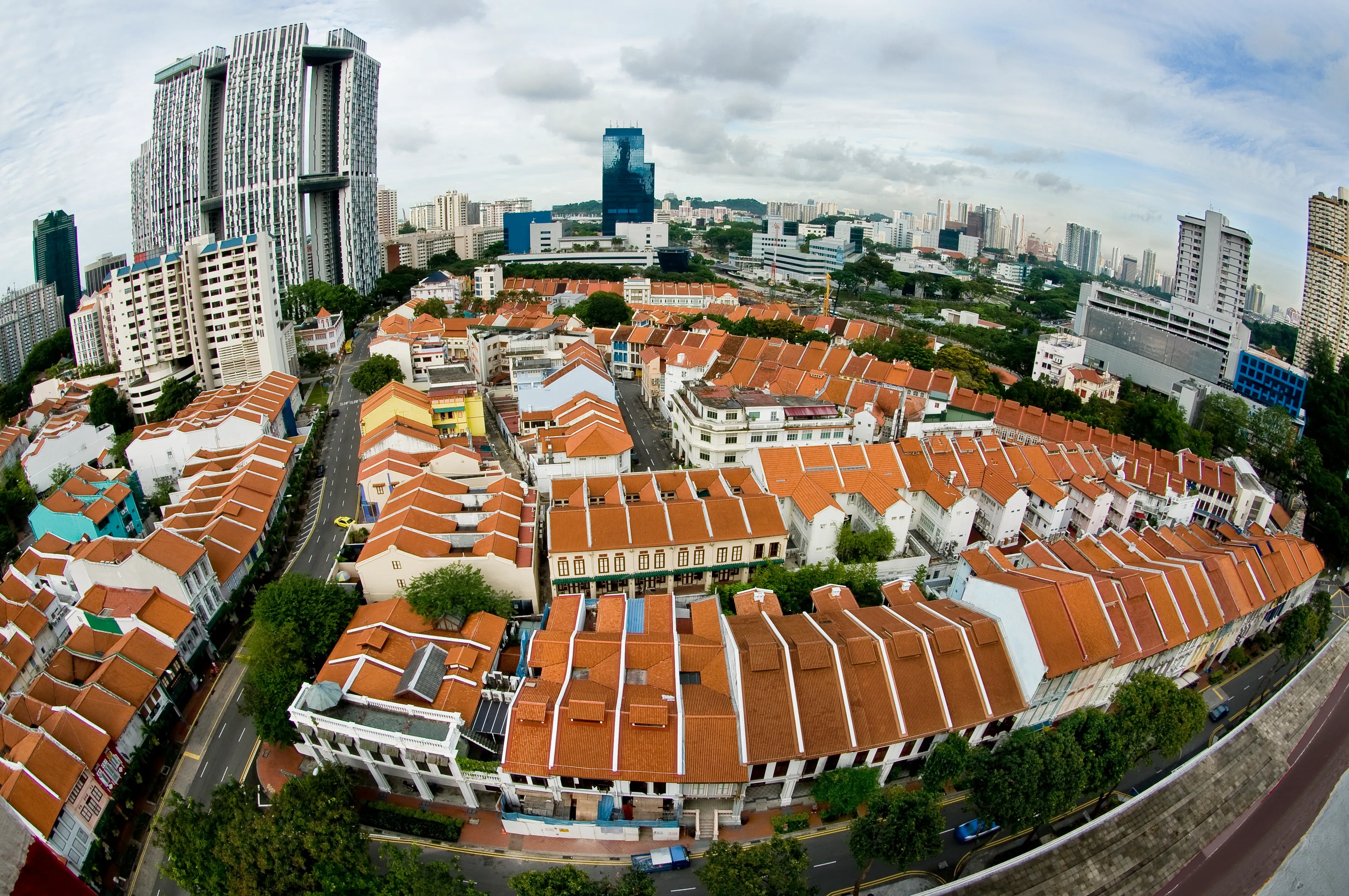
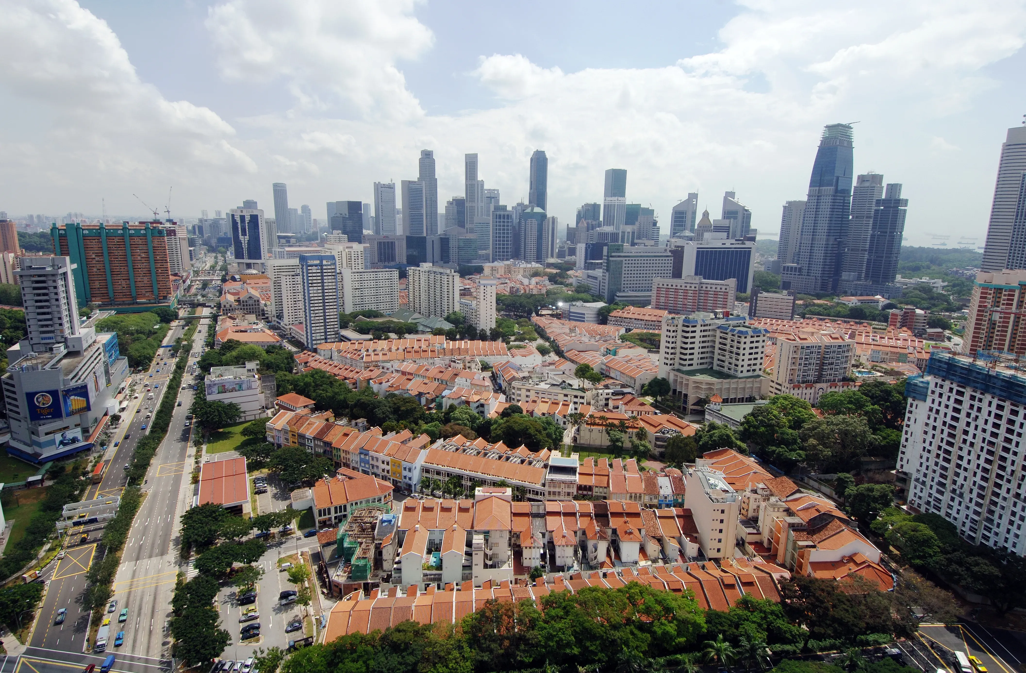
There was a small Chinese community living in this area long before the British colonial administration designated it as the living quarters for Chinese immigrants. It is part of the largest conserved historic district in Singapore – ‘Chinatown’, comprising distinct precincts that were developed at different times, of which four precincts are now under conservation: Telok Ayer (developed from the 1820s), Kreta Ayer (1830s), Tanjong Pagar (late 1880s) and Bukit Pasoh (early 1920s). These 4 districts are in-between other precincts that make up the ‘Greater Town’ south of Singapore River, the local Chinese term for the urban district that stretched from Boat Quay to the Tanjong Pagar docks
The History
In 1821, it was recorded that there were about 1,000 Chinese living in the area south of the Singapore River, where Boat Quay is today. The area consisted largely of hillocks and a pair of roads: the current Telok Ayer Road (that ran along the original shoreline) and what was known to the locals as South Bridge. A proper road was only constructed in 1833.
In 1823, Sir Stamford Raffles designated the area southwest of the Singapore River as the “Chinese Campong” and the “Chuliah Campong”. Thus in addition to the Chinese, many South Indian migrants, both Hindu and Muslim also moved to the area and so the Sri Mariamman Temple and Jamae Mosque were eventually built on South Bridge Road, while the Nagore Durgha Shrine and the Al-Abrar Mosque were built along Telok Ayer, on either side of the Chinese Hokkien temple complex of Chung Wen Ge, Thian Hock Keng and Keng Teck Hway.
The commercial heart of the Chinatown area is known as Gu Chia Chwi (in Hokkien), Ngau-che-shui (in Cantonese), and Niu Che Shui (in Mandarin), which mean "bullock water-cart". These names are in reference to the Malay name of the area, and actually refer to the district around Kreta Ayer Road. In Malay, the then lingua franca of the island and the region, Kreta Ayer means "Water cart".
These carts were used to fetch water from wells before the advent of tap water. By the 1860s the Chinese population had grown to about 50,000. Urban terraces that we now call ‘Shophouses’ were built around the Sri Mariamman Temple and Jamae Mosque as the enclave expanded into the Kreta Ayer area. Trade increased after the opening of the Suez Canal in 1869 and the Telok Ayer Basin was reclaimed to construct new shophouses and docks.
By 1900, the original ‘Chinese Campong’ had expanded to include the Bukit Pasoh and Tanjong Pagar areas, increasing the population to about 164,000. Clans, mutual help associations and recreational organisations were set up and schools built. However, the noise and congestion drove wealthier families away.
As the population continued to grow, overcrowding, congestion and pollution became major problems. The area’s residents had to share small cubicles with little sanitation, sagging walls, damp floors and rat infestations. Secret societies, gang crimes and prostitution and opium dens thrived.
Living conditions deteriorated further after World War Two as parts of the town were badly bombed. The town also swelled with refugees who fled town the Malay Peninsula ahead of the Japanese invasion. This and the rent control imposed after 1945 to protect rental tenants exacerbated the housing shortage on the island. After independence in 1965, the Singapore government committed itself to providing better public housing and improving the population’s living conditions through a plan of large scale urban renewal of the old city. With the housing famine largely solved by the mid-1980s, the URA was able to implement the first large scale urban conservation programme in Singapore, and the Chinatown area, together with three other historic districts, were formally gazetted for conservation on 7 July 1989.
The Architecture
This hilly area is bounded by New Bridge Road, Keong Siak Road, Kreta Ayer Road, Neil Road and Cantonment Road. It contains two- and three-storey shophouses, mostly of the Transitional, Late and Art Deco styles. Bukit Pasoh received conservation status on 7 July 1989. Additional shophouses along Keong Saik Road received conservation status on 12 April 1990, while those along Teck Lim Road and Keong Siak Road were given conservation status on 25 October 1991.
Guidelines and Procedures
Gallery
Resources
[1] The conservation guidelines for shophouses and bungalows will generally be applied by URA in the consideration of a development application. However, if the circumstances or planning considerations relevant to a case warrant it, URA may in its discretion decide to depart from these general guidelines. The guidelines, principles and illustrations found in the guidelines are not exhaustive in covering all possible site conditions and variations in building type. Persons intending to carry out a development are advised to take this into consideration and check with URA through enquiries or development applications to confirm if their proposals can be allowed.