Stewardship of Natural Capital
Our green and blue spaces will be better integrated within our urban fabric.
Last updated 26 May 2026
This will be guided by a science-based approach that seeks to strengthen ecological connectivity between our core biodiversity areas, as well as balance conservation and development.
Understanding our natural habitats
Over the decades, we have safeguarded and enhanced our natural capital even as we developed our city.
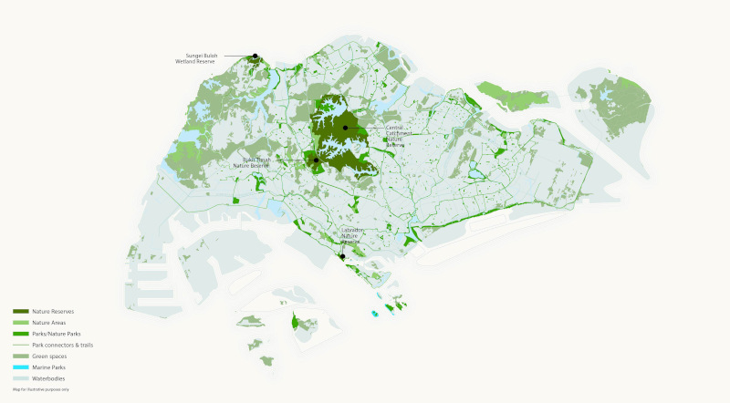
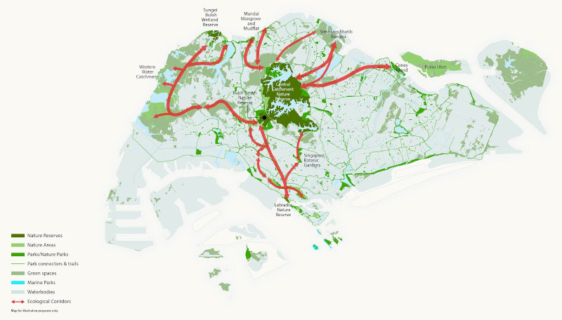
We have set aside 7,800 ha of green spaces, including four gazetted Nature Reserves, 450 ha of Nature Parks, identified Nature Areas to be kept for as long as possible, and more than 370 km of park connectors. These green spaces protect natural habitats while providing opportunities for recreation.
According to the 2017 Green View Index by MIT’s Senseable City Lab and the World Economic Forum, Singapore has the highest density of greenery based on a comparison of tree canopy cover among 17 other cities.
De-fragmenting our habitats
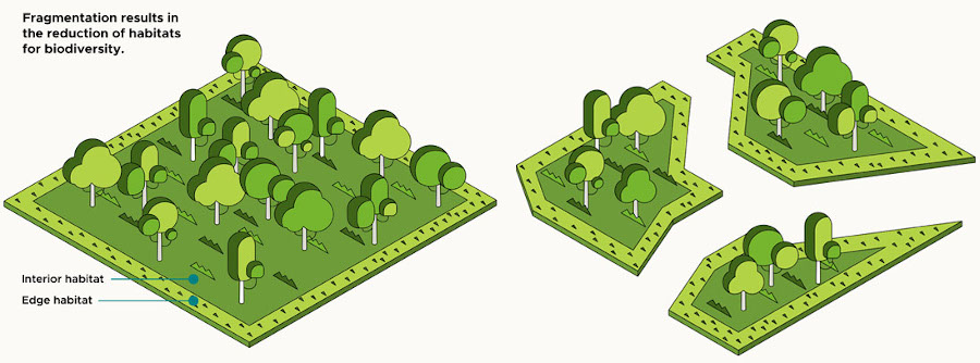
Singapore’s remaining terrestrial habitats are fragmented due to urbanisation over the decades. Finding ways to connect them even as we develop can strengthen the resilience of these ecosystems.
Habitat fragmentation
The fragmentation of large continuous habitats into smaller isolated habitat patches makes it more challenging for native biodiversity to find food, shelter and reproduce.
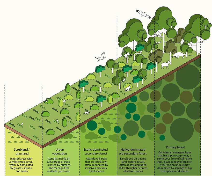
Different shades of green
An understanding of our different green spaces and their varied ecological functions will better inform decisions to balance biodiversity considerations and development.
Strengthen resilience of native ecosystems
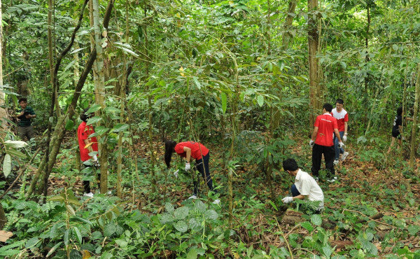
We have embarked on the Forest Restoration Action Plan, which involves planting tree species that are nitrogen-fixing to improve soil conditions.
Forest restoration at Rifle Range Nature Park © NParks
The Species Recovery Programme will also help the populations of threatened native species, such as the endemic Singapore Freshwater Crab, survive adverse environmental changes through efforts such as reintroduction and habitat enhancement.
Our natural capital
Unlike other countries with large hinterlands, we have limited land. It is thus vital for our urban fabric to support and foster ecological connections between core (source) habitats.
This requires a deeper understanding of how greenfield and brownfield sites contribute to ecological connectivity across the island.
Planning sensitively with ecological profiling tools
To allow urban planners to sensitively plan and integrate nature within long-term plans, NParks has developed ecological profiling tools and embarked on an Ecological Profiling Exercise (EPE) to formulate conservation strategies that support our natural ecosystems.
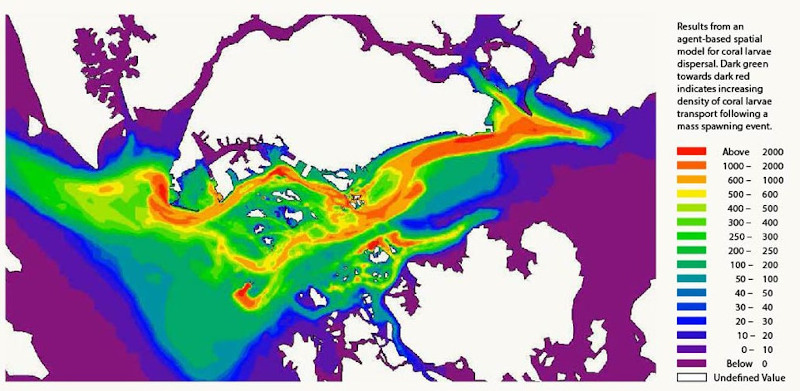
Agent-based spatial model for coastal and marine habitats
This computational model simulates the movement of large numbers of individual organisms to understand their dispersal pattern.
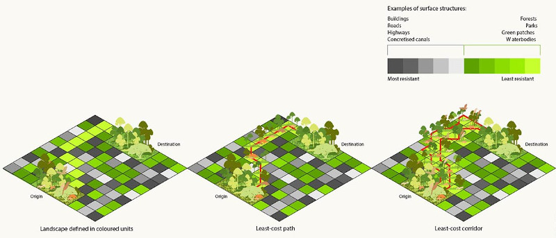
Least-resistance pathway model for terrestrial Habitats
This model identifies the surface structures (e.g. roads, forests, buildings) between core (source) habitats and assigns a numerical value to each one. A lower value indicates a surface structure that is conducive for an animal.
The movement pathway is then plotted out by selecting a route comprising pixels of the lowest value.
Stewarding our coastal and marine spaces
Our marine spaces today are used for a range of activities, including maritime, aquaculture, industry, utility and recreation.
Based on the findings from the coastal and marine EPE, we will explore ways to enhance the resilience of our coastal and marine habitats and study how to develop sensitively. More research will also be undertaken to understand our marine ecosystem.
Stewarding our terrestrial spaces
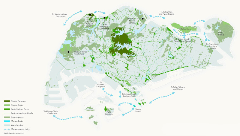
The islandwide terrestrial EPE has been completed in tandem with the Long-Term Plan Review. Based on the findings from the terrestrial EPE, we have identified key ecological corridors between core (source) habitats.
Further studies will help us gain an even better understanding of these habitats and their value to guide our land use and development plans.
Extending natural capital
Based on the findings from the terrestrial EPE, we have identified key ecological corridors that connect our core (source) habitats.
We are studying the feasibility of creating Nature Corridors along these identified ecological corridors. Together, these Nature Corridors and Nature Park Networks help to extend and strengthen our natural capital islandwide.
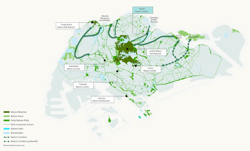
Creating Nature Corridors and Nature Park Networks
Nature Park Networks buffer the Nature Reserves while Nature Corridors strengthen connectivity between core (source) habitats and provide new nature-based recreational opportunities for the public.
Find out more about Nature Park Networks and Nature Corridors.
Enhancing connectivity along ecological corridors
A new Nature Corridor, Khatib Nature Corridor, will be added. Three other Nature Corridors identified around Lim Chu Kang, Kranji and Seletar are currently under study. As part of the future planning for the redevelopment of Paya Lebar Air Base, another Nature Corridor in the east could also be identified.
Ecological and recreational connectivity can be established in these corridors through a variety of ways (e.g. parks, park connectors, nature trails, Nature Ways and greenery on urban infrastructure).
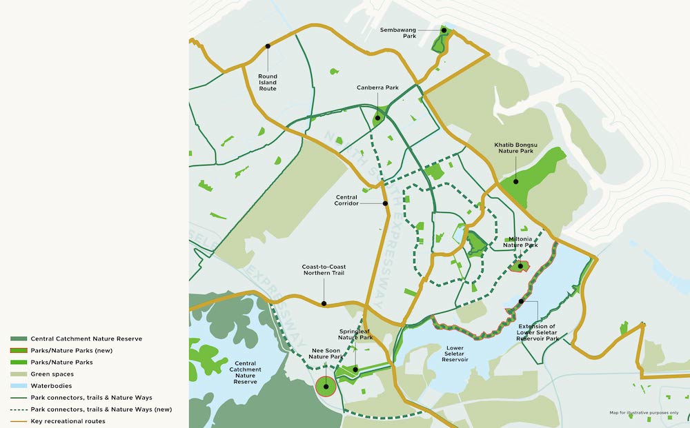
Khatib Nature Corridor: ecological and recreational connectivity in the North
The EPE has identified important core (source) habitats of native biodiversity in the Central Catchment Nature Reserve and Khatib Bongsu Nature Park, with ecological corridors between these two core (source) habitats running along Lower Seletar Reservoir.
This new Nature Corridor comprises a series of upcoming parks and Nature Parks that will serve as stepping stone habitats, including Khatib Bongsu Nature Park, Nee Soon Nature Park, Miltonia Nature Park, and extension of Lower Seletar Reservoir Park. There will be more than 90 ha of new green spaces in total.
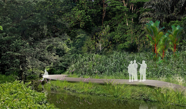
Nee Soon Nature Park © NParks
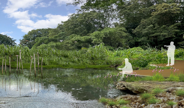
Miltonia Nature Park © NParks
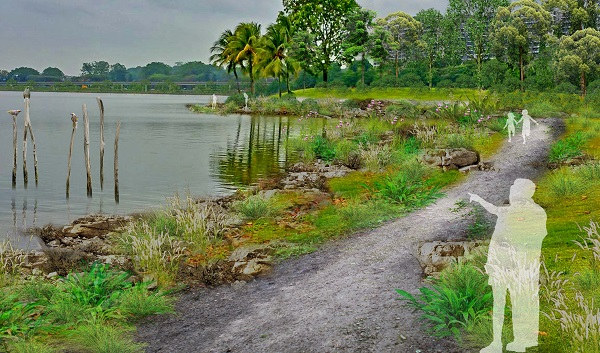
Extension of Lower Seletar Reservoir Park © NParks
To strengthen ecological and recreational connectivity, a network of park connectors, Nature Ways and trails through Lower Seletar Reservoir and the surrounding Khatib areas will be curated to connect the various green spaces. A total of 150 ha of Nature Parks and parks and 80 km of walking and cycling routes will be established.