Developments Involving Waterbodies
Check the guidelines relating to civic and community institutions involving waterbodies.
Last updated 12 June 2026
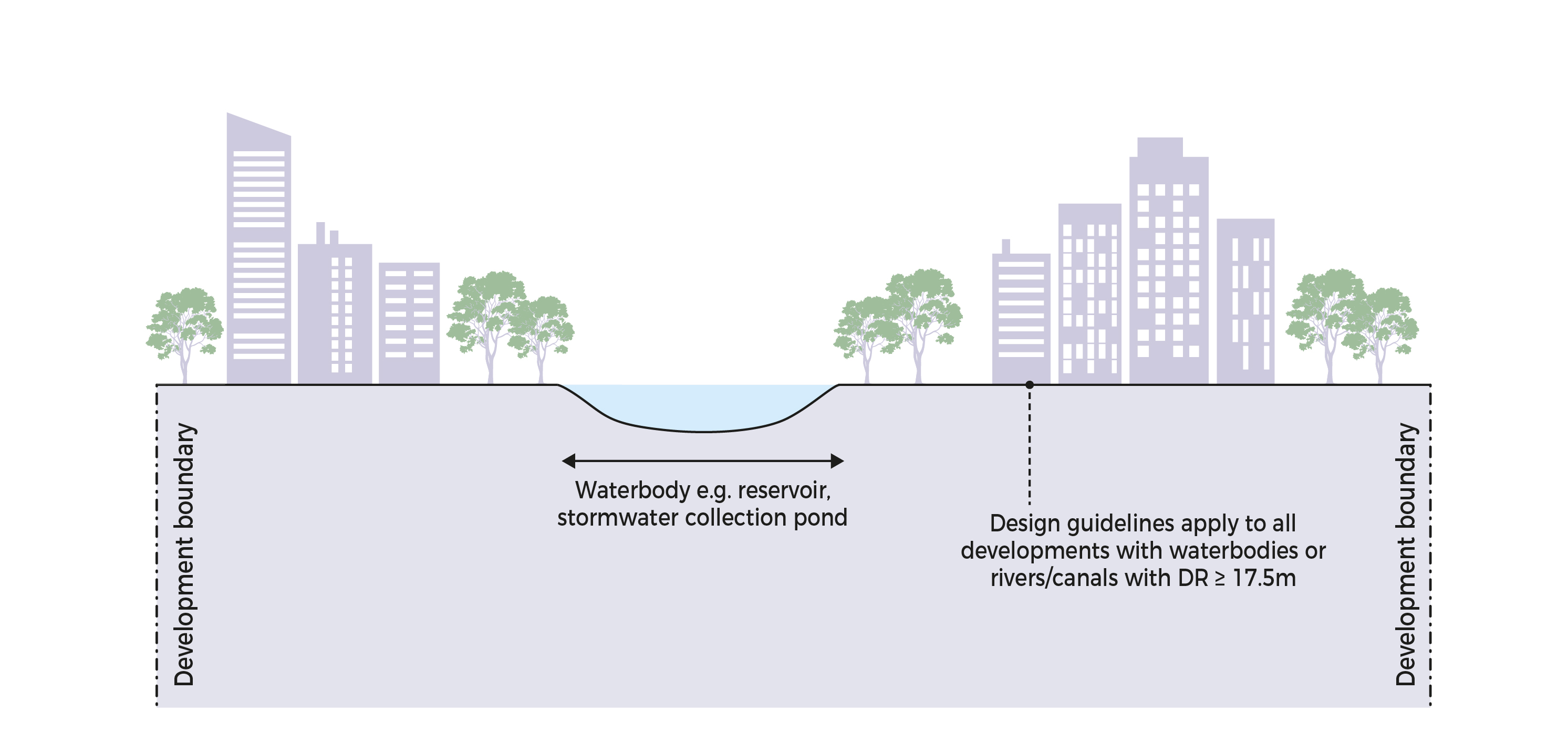
To maintain the integrity and aesthetics of the waterfront areas so that the public can have free and unrestricted access to enjoy these spaces, developments at major waterbodies1 shall observe the design and development application submission guidelines below.
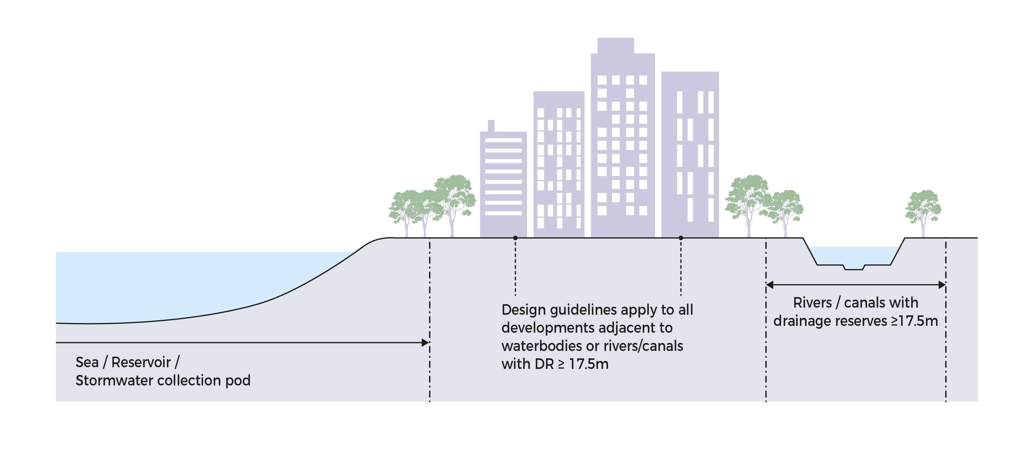
1 Major waterbodies: rivers, canals of at least 17.5m width, reservoirs, and seas.
Developments at Major Waterbodies
Design Guidelines
Retaining Walls
Retaining walls along the waterbodies may be allowed subject to the following criteria:Retaining walls are less than 1.5m in height;
Retaining walls are set back at least 300mm from the boundary;
Retaining walls are covered with creepers.
Boundary Walls/Fences
For non-industrial developments, proposed boundary fences shall be porous (eg chained-link, metal-grille, or timber fence).
For industrial developments, the following may be allowed:Solid boundary walls not exceeding 1.8m in height. The walls shall be aesthetically treated.
Chain-linked fences not exceeding 1.8m in height with close planting of shrubs/vegetation as screenings. A planting strip of 0.5m width (minimum) shall be provided within the development.
Slope
There shall be no abrupt change in slope gradient at the boundary between the development and the waterbody. The slope gradient shall not exceed 1:2.Conservation of Vegetation
Mature vegetation along the waterbodies are to be saved and conserved, wherever possible.
Development Application Submission Guidelines
In all waterbodies-related development application submissions to URA, the following shall be provided, where applicable:
Site/Location Plan showing the width and alignment of Drainage Reserve2/Waterbody/Coastal Profile;
Layout plans and cross-sections showing the area between the site and the Drainage Reserve/Waterbody/Coastal Area including existing and proposed ground levels;
Design details of integration with waterbody including slope, retaining wall, and boundary wall/fencing (Height, Type, Screening);
Contour lines extending to 1m beyond the side of development fronting the Drainage Reserve/Waterbody/Sea;
Checklist [DOC, 37 KB] for Waterbodies-related proposals.
2 Drainage Reserve (DR): An area safeguarded for purposes of building or widening a public drain.
Application of Guidelines
The design guidelines listed above shall apply to all developments adjacent to or with waterbodies except developments adjacent to or with Drainage Reserves less than 17.5m.
All proposals involving waterbodies shall comply with the development application submission guidelines listed above.
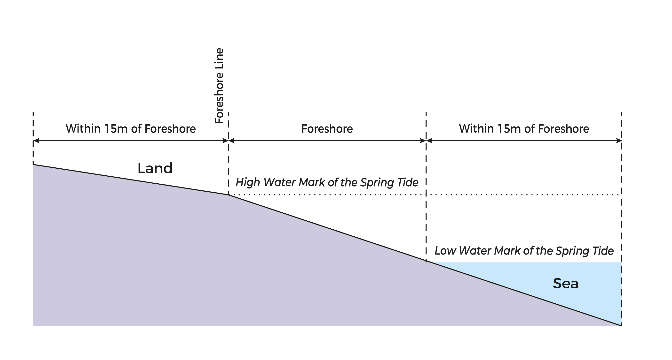
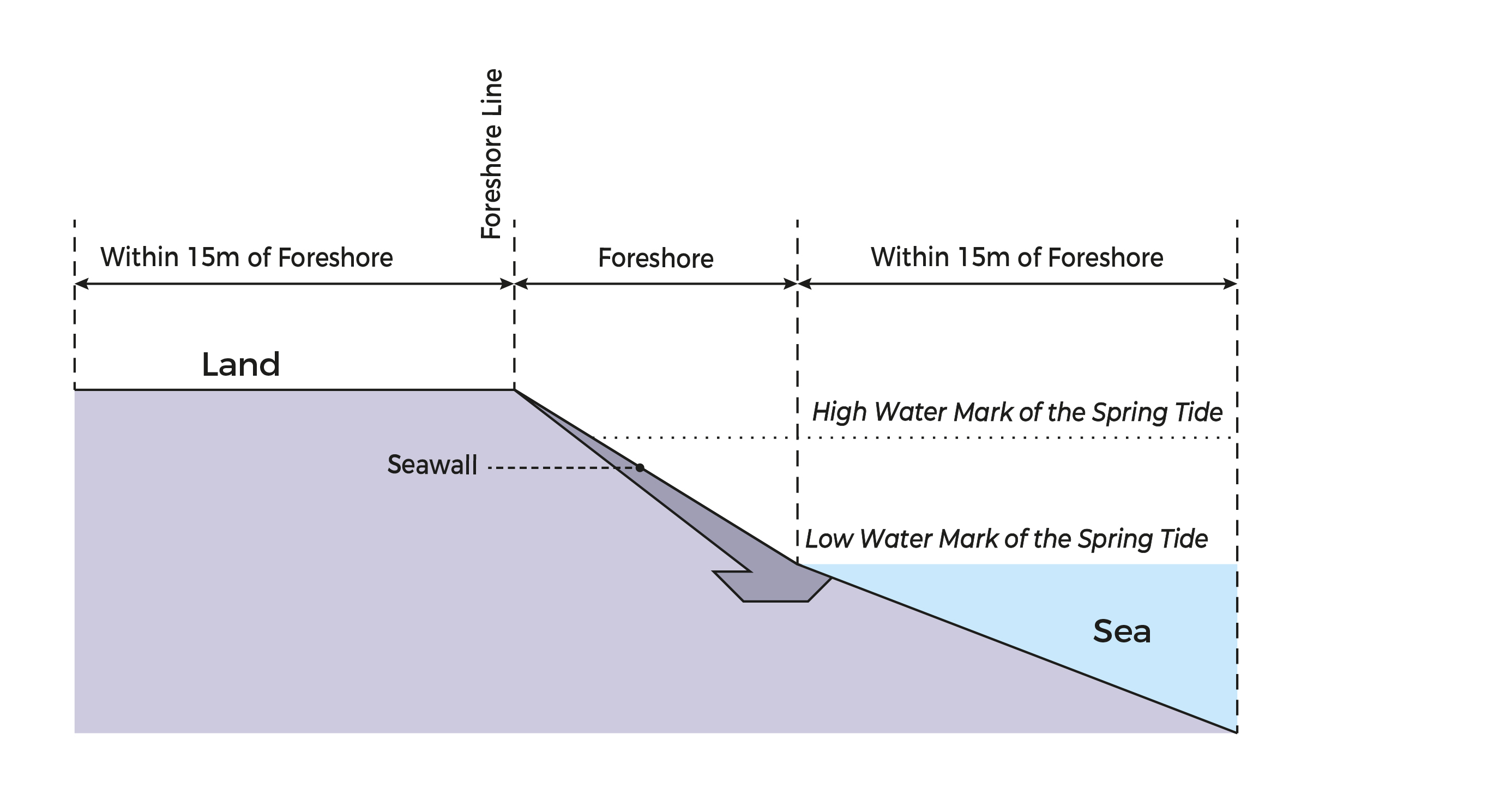
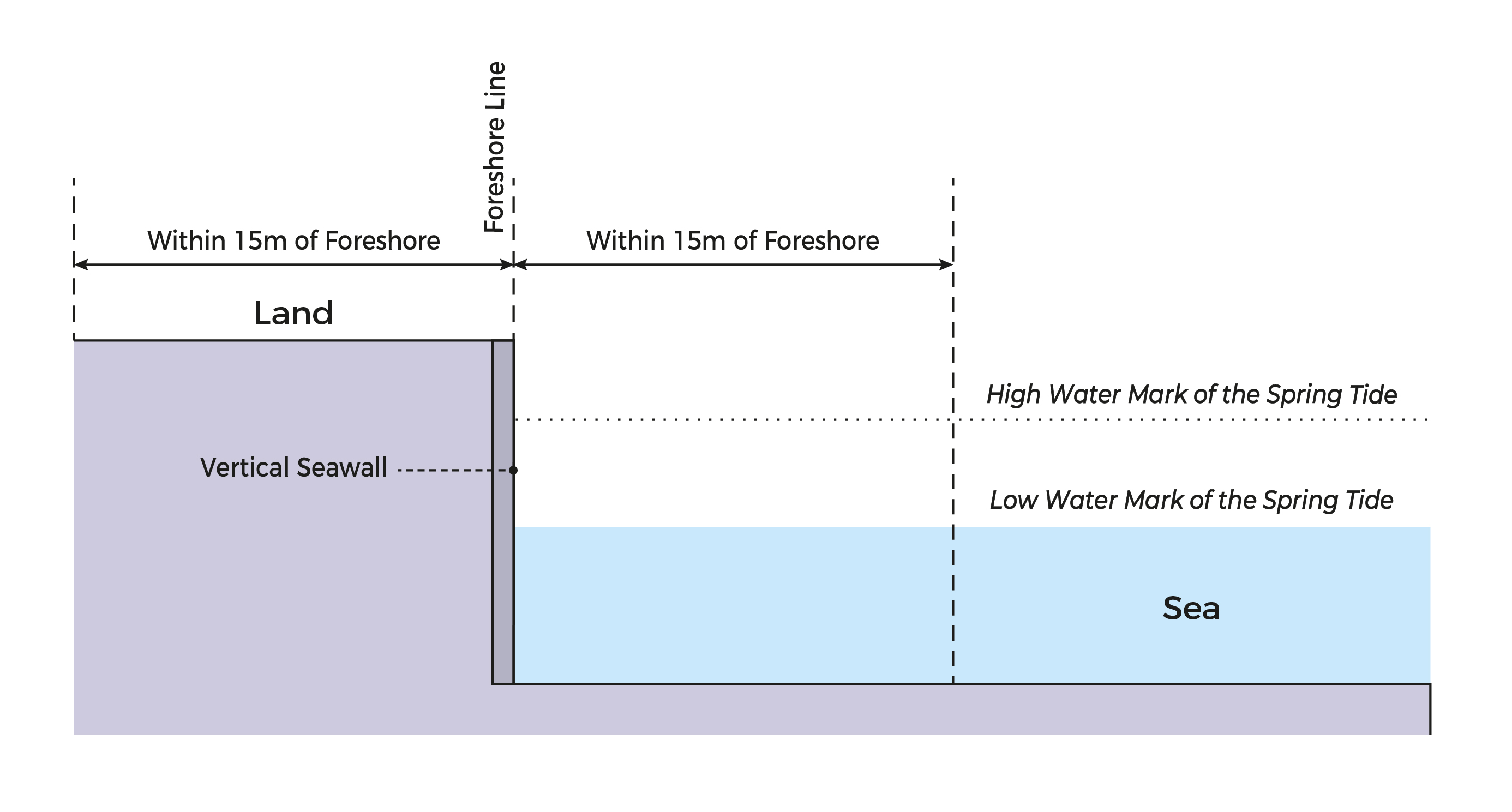
Additional Guidelines for Use of Foreshore by Developments with a Frontage to the Sea
For land use planning and development control purposes, the foreshore3 and the area within 15m on both the landward and seaward side of the foreshore line4 shall be kept free of structures. Some structures such as ramps may be permitted if they are constructed in connection with an approved development (eg marine industries, refineries, and pleasure-boat storage complex). These structures are subject to planning evaluation depending on merits.
3 The area between the high water mark of the Spring Tide or the top of the seawall and the low water mark of the Spring Tide.
4 The high water mark of the Spring Tide; the top of the existing seawall or revertment or river wall (where appropriate) for controlling landward development.